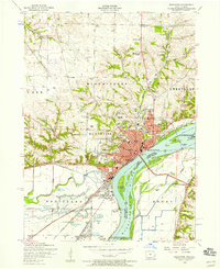
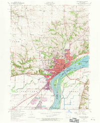
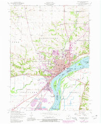
1953 Map of Muscatine
USGS Topo · Published 1958About this map
Muscatine sits at a sharp bend in the Mississippi River, serving as a critical mid-century industrial and transport hub where the Chicago Rock Island and Pacific and Chicago Milwaukee St Paul and Pacific railroads converge. The riverfront is dominated by civil engineering and utility works, including Lock and Dam No 16 and the Muscatine Municipal Electric Plant. Further south, the town of Fruitland marks a transition into the lowlands of the Muscatine Slough.
Find a feature on this map
53 named features on this map. Tap any name to fly to it.
Don’t see what you’re looking for? This feature index may not catch every label — zoom into the map to look around manually.
Map Details
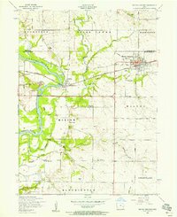
Editions of this 1953 Muscatine Map
Other maps of this area

1890 · Durant
USGS Topo · 1:62,500

1891 · Wilton Junction
USGS Topo · 1:62,500

1894 · Durant
USGS Topo · 1:62,500

1901 · Rock Island
USGS Topo · 1:125,000

1901 · Stanwood
USGS Topo · 1:125,000

1910 · Rock Island
USGS Topo · 1:125,000

1916 · Edgington
USGS Topo · 1:62,500

1938 · Edgington
USGS Topo · 1:62,500

1948 · Muscatine
USGS Topo · 1:62,500
1953 · Wilton Junction
USGS Topo · 1:24,000