Old Maps of Rock Island County, Illinois
Explore 190 old maps of Rock Island County, spanning from 1891 to today. These high-resolution historic maps reveal how streets, neighborhoods, landmarks, and natural features evolved over time — perfect for genealogy, metal detecting, research, and local history exploration.
What you can do with these maps:
- See how Rock Island County changed over time: Compare historical maps to modern-day views to trace roads, homesites, rail lines & more.
- View detailed metadata: Each map includes creators, publishers, year, scale, and archive source.
- Overlay maps with satellite & LiDAR: Visualize the past alongside modern tools to explore terrain & human change.
- Trusted historical sources: Maps sourced from the USGS, Library of Congress, and other archives.
- Access maps your way: View online, download high-res files, or order prints for personal or research use.
Start exploring old maps of Rock Island County to uncover forgotten places, hidden landmarks, and the deep history beneath your feet.
Rock Island County, IL maps
(190)- 1891 Map of Davenport
 1891 Davenport1891 Print · USGSIowa's riverfront and rolling prairie townships are captured here during a period of rapid railroad expansion in the late nineteenth century. Trace early land tracts and rail junctions like Eldridge Junction or locate landmarks such as Green Tree Tavern and Maysville.
 - 1891 Map of Clinton
 1891 Clinton1891 Print · USGSThe Mississippi River corridor thrived as a dual-state rail hub in the 1890s, anchored by the riverfront centers of Clinton and Fulton. Researchers can trace the early tracks of the Chicago and Northwestern RR and locate vanished stops like Almont and Argo.
 - 1892 Map of Goose Lake
 1892 Goose Lake1892 Print · USGSClinton County thrived at the end of the nineteenth century as a hub of river commerce and expanding rail lines. Genealogists and local historians can trace the early development of Camanche on the Mississippi River or the inland rail stops of Charlotte and Low Moor.
 - 1892 Map of Leclaire
 1892 Leclaire1892 Print · USGSThe Mississippi River border between Iowa and Illinois comes alive in the 1890s, before modern locks reshaped the shoreline. Genealogists and historians can trace riverside settlements like Leclaire, Port Byron, and the railroad junction at Watertown.
 - 1893 Map of Leclaire
 1893 Leclaire1893 Print · USGSThe riverfronts of Scott County and Rock Island County thrived in the late nineteenth century as vital hubs for steamboats and steam rail. Researchers can trace the early grids of Leclaire, Port Byron, and Valley City alongside the sprawling banks of the Mississippi River.4 unique versions available
 - 1894 Map of Goose Lake
 1894 Goose Lake1894 Print · USGSClinton County and the banks of the Mississippi are shown here in the 1890s as the railroad and river trade defined local growth. Researchers can trace the original footprints of settlements like Charlotte, Low Moor, and the river landing at Camanche.3 unique versions available
 - 1894 Map of Clinton
 1894 Clinton1894 Print · USGSThe riverfront communities of eastern Iowa and western Illinois are captured here in the late nineteenth century as rail expansion reached its peak. Researchers can trace early street grids in Clinton and Lyons or locate old rail junctions near Garden Plain and Almont.3 unique versions available
 - 1894 Map of Davenport
 1894 Davenport1894 Print · USGSDavenport and the surrounding Scott County prairies come alive in this late nineteenth-century survey of the Mississippi River front. Researchers can trace the early rail networks through Eldridge Junction and locate vanished landmarks like Green Tree Tavern and Gilbertown.4 unique versions available
 - 1899 Map of Clinton
 1899 Clinton1899 Print · USGSThe Mississippi River valley comes alive in the late 1890s, capturing the river-and-rail economy of Iowa and Illinois before modern channelization. Genealogists and historians can trace early townships and river landings, finding precise locations for Low Moor, Folletts, and Pink Prairie.5 unique versions available
 - 1901 Map of Rock Island
 1901 Rock Island1901 Print · USGSThe eastern Iowa borderlands and the Mississippi River confluence thrive during the rail boom of the late nineteenth century. Genealogists and historians can trace family roots through numerous small settlements like Lost Nation, Grand Mound, and the vital U. S. Arsenal grounds.2 unique versions available
 - 1910 Map of Rock Island, 1949 Print
 1910 Rock Island1949 Print · USGSEastern Iowa and the Illinois borderlands come alive in this late nineteenth-century survey of the river valleys and rail hubs. Genealogists and historians can trace old homesteads near Lost Nation, the early streets of Dewitt, and the sprawling U.S. Arsenal.
 - 1912 Map of Milan
 1912 Milan1912 Print · USGSThe river confluence and burgeoning rail networks of Rock Island County are captured here just before the First World War. Researchers can trace the legacy of early industry and education through sites like the Coal Valley Mine, Blackhawk Watchtower, and Excelsior School.7 unique versions available
 - 1916 Map of Edgington
 1916 Edgington1916 Print · USGSThe river-and-rail corridor along the Mississippi border emerges in high detail during the early twentieth century. Genealogists and local historians can trace the rural landscape through a dense network of country schools like Whiteoak School and New Era, alongside river features like Geneva Island.3 unique versions available
 - 1937 Map of Orion
 1937 Orion1937 Print · USGSHenry County and Mercer County are captured here in the late 1930s, showing a landscape of small agricultural hubs connected by a dense rail network. Genealogists can trace family footprints through dozens of rural schools like Washington Sch and landmarks like the Valhalla Cemetery.2 unique versions available
 - 1938 Map of Edgington, 1955 Print
 1938 Edgington1955 Print · USGSThe Mississippi River corridor in the late thirties shows a landscape of active rail lines and riverfront industry. Genealogists can trace rural family roots through numerous local landmarks like Jimtown, White Eagle School, and Buffalo Center School.
 - 1944 Map of Milan, 1958 Print
 1944 Milan1958 Print · USGSThe Illinois-Iowa border comes alive in the 1940s, highlighting the industrial riverfronts and the rural interior of Rock Island and Mercer Counties. Trace family roots and local industry at the Coal Valley Mine, the US Arsenal, or the vanished schoolhouses like Doxie School.
 - 1948 Map of Muscatine
 1948 Muscatine1948 Print · USGSThe Mississippi River bottomlands along the Iowa-Illinois border are captured here in the late 1940s, showing a transition from river commerce to intensive drainage agriculture. Researchers can trace rural school districts like Lillibridge Sch and local landmarks such as the Muscatine Bridge and Glancey Lake.2 unique versions available
 - 1948 Map of Milan, 1955 Print
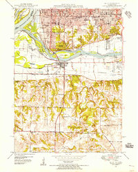 1948 Milan1955 Print · USGSThe Quad Cities area in the late 1940s reveals a landscape defined by the convergence of the Rock River and Mississippi River. Genealogists and local historians can trace legacy sites like Chippiannock Cem, the County Sanitarium, and numerous country schools such as Tindall Sch.
 - 1949 Map of Coal Valley
 1949 Coal Valley1949 Print · USGSThe Rock River valley was a hub of coal mining and transit in the late 1940s as the Moline area expanded eastward. Local researchers can trace family landmarks and industry at Black Hawk Mine, the Illinois and Mississippi Canal, and Kingdom Sch.2 unique versions available
 - 1949 Map of Silvis
 1949 Silvis1949 Print · USGSThe Illinois riverfront along the Mississippi at the close of the 1940s reveals a powerful hub of rail and industry. Genealogists and historians can trace institutional grounds like the East Moline State Hospital or find the early Miller Landing Field.
 - 1949 Map of Davenport
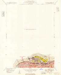 1949 Davenport1949 Print · USGSThe Quad Cities area emerged from the war years as a vital rail and river hub along the Mississippi River. Researchers can trace the complex industrial layout of Rock Island, find local landmarks like Augustana College, and locate the National Cem on the arsenal island.
 - 1949 Map of Port Byron, 1954 Print
 1949 Port Byron1954 Print · USGSThe confluence of the Mississippi and Rock Rivers defined the mid-century economy of these Illinois and Iowa river towns. Genealogists and local historians can trace rural school districts and family burial grounds including Leafy Bower Sch, Edwards Cem, and Zion Ch.2 unique versions available
 - 1950 Map of Milan
 1950 Milan1950 Print · USGSThe Tri-Cities area comes alive in the mid-century as industrial centers like Rock Island and Moline expand across the river islands. Researchers can locate dozens of local landmarks, from Chippiannock Cem to rural outposts like Tindall School No 1.2 unique versions available
 - 1950 Map of Port Byron
 1950 Port Byron1950 Print · USGSThe Illinois-Iowa border along the Mississippi River thrives as a rail and river hub at the middle of the twentieth century. Local historians can trace family roots through numerous rural landmarks like Shake-Rag Sch, St Johns Cem, and Rapids City.
 - 1952 Map of Erie, 1953 Print
 1952 Erie1953 Print · USGSWhiteside and Henry counties are mapped here in the early fifties, showing a rural river-bound landscape along the Rock River. Local historians can trace family roots at Pink Prairie Cem or locate the site of the Old Stage Line Monument and Kingsbury Sch.2 unique versions available
Showing maps 1-25 of 190
Top cities of Rock Island County
- Moline historical maps
- Rock Island historical maps
- East Moline historical maps
- Silvis historical maps
- Milan historical maps
- Hampton historical maps
See more
Frequently asked questions
- What are the different types of historical maps available for Rock Island County?
- What is the oldest map of Rock Island County?
- Where can I purchase historical maps of Rock Island County for my home or office?
- Where can I download high-res historical maps of Rock Island County?
- Are there historical topographic maps available for Rock Island County?
- Is there historical aerial imagery available for Rock Island County?
- Where are historical maps of Rock Island County sourced from?