1990s Maps of Rock Island County, Illinois
Explore 20 historic maps of Rock Island County from the 1990s. These maps offer a rare glimpse into what life looked like during the 1990s — showing old roads, neighborhoods, homes, and landmarks that have changed or disappeared over time.
Whether you're researching your family's past, planning a metal detecting trip, or studying how Rock Island County's landscape evolved across the 1990s, these high-resolution maps are a powerful tool for exploring the history of this region.
- Focus on a specific era: All maps on this page are from the 1990s, giving you a focused view of this time period.
- See what’s changed: Compare century-old streets, trails, and buildings to today's modern landscape using overlays and satellite layers.
- Research with precision: Use these maps for genealogy, historical research, land use analysis, or educational projects.
- View, download, or print: Maps are fully viewable online in high resolution, and can be downloaded or printed for your own records.
Start exploring Rock Island County's history through authentic maps from the 1990s. This is your window into the past.
Rock Island County, IL maps
(20)- 1991 Map of Muscatine, 1992 Print
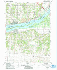
 1991 Muscatine1992 Print · USGSMuscatine and the fertile riverfront of the early 1990s are captured here during a period of steady industrial and residential development. Genealogists and historians can trace neighborhood landmarks like Spangler Chapel, St Marys Cem, and the massive Greenwood Cemetery near the city center.
 - 1991 Map of Coal Valley, 1992 Print
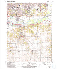 1991 Coal Valley1992 Print · USGSThe confluence of the Rock and Green Rivers defines the landscape of southeastern Rock Island County in the early 1990s. Genealogists and local historians can trace family-named sites like Bowlesburg Cem, Arrowhead Ranch, and Good Shepherd Sch.
 - 1991 Map of Buffalo Prairie, 1992 Print
 1991 Buffalo Prairie1992 Print · USGSBuffalo Prairie and the rural borderlands of Rock Island and Mercer counties are captured in detail as they appeared in the late twentieth century. Genealogists and local historians can trace family ties at the Buffalo Prairie Cem, Duncan Cem, or Antioch Ch.
 - 1991 Map of Matherville, 1992 Print
 1991 Matherville1992 Print · USGSMercer and Rock Island Counties are captured in the early nineties, showing a landscape defined by small mining settlements and rural townships. Genealogists can locate family sites at Farlows Grove Cem or trace the development of Matherville.
 - 1991 Map of Clinton, 1992 Print
 1991 Clinton1992 Print · USGSThe Mississippi River corridor comes alive in the early nineties, showcasing the riverfront growth of Iowa and Illinois. Genealogists can trace local roots through Clinton Mem Cem, St Patrick Ch, and school sites like Unity Christian High Sch.
 - 1991 Map of Silvis, 1992 Print
 1991 Silvis1992 Print · USGSThe riverfront communities of the Quad Cities thrive along both banks of the Mississippi in the early nineties. Genealogists and local historians can locate family landmarks like Fairview Cem, Forest Grove Sch, and the Quad City Downs racetrack.
 - 1991 Map of Camanche, 1992 Print
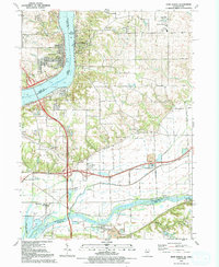
 1991 Camanche1992 Print · USGSCamanche and the Clinton County riverfront are captured here in the early nineties, showcasing a region defined by the Mississippi and its surrounding townships. Genealogists can trace family sites at Pleasant Hill Cem or the settlement of Low Moor near the Chicago and North Western rail line.
 - 1991 Map of Illinois City, 1992 Print
 1991 Illinois City1992 Print · USGSThe Mississippi River islands and Iowa-Illinois borderlands are captured here in the early nineties. Genealogists can locate family sites like Ziegler Memorial Ch, Fairport Cem, and the rural community of Illinois City.2 unique versions available
 - 1991 Map of Orion, 1992 Print
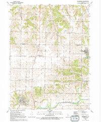
 1991 Orion1992 Print · USGSThe intersection of Rock Island, Henry, and Mercer counties comes to life in this early 1990s portrait of Illinois farm country. Local historians can trace the foundations of Orion and Sherrard or find family roots at Beulah Ch and Brush Hill Cem.
 - 1991 Map of Andalusia, 1992 Print
 1991 Andalusia1992 Print · USGSThe Mississippi River valley comes into focus during the early nineties, showing the industrial and residential growth of the Quad Cities periphery. Trace the evolution of transport and burials via the Old RR GB, Asbury Cem, and the riverside town of Andalusia.
 - 1991 Map of Reynolds, 1992 Print
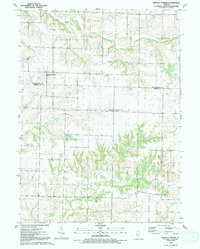
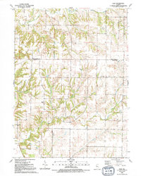
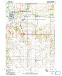
 1991 Reynolds1992 Print · USGSNorthwestern Illinois farmland at the start of the 1990s reveals a quiet landscape of township roads and scattered hamlets. Genealogists can trace family footprints at Hamlet Cemetery, St Johns Church, and the rural crossroads of Gingle Corners.
 - 1991 Map of Cordova, 1992 Print
 1991 Cordova1992 Print · USGSThe riverfront communities of Rock Island and Scott counties are captured here in the late twentieth century as industry and recreation converge. Researchers can trace local heritage through sites like Virgil Grissom Sch, Our Lady of the River Ch, and Jacks Cem.
 - 1991 Map of Blanchard Island, 1992 Print
 1991 Blanchard Island1992 Print · USGSThe Mississippi River valley at the start of the nineties reveals a landscape of massive flood control projects and wildlife conservation. Genealogists and historians can trace local landmarks like Reynolds Cem or the remote Carl Ritter Landing Strip among the river chutes and islands.
 - 1991 Map of Eliza, 1992 Print
 1991 Eliza1992 Print · USGSThe borderlands of Rock Island and Mercer counties come into focus in the early 1990s, showing a landscape defined by prairie farming and winding creek beds. Genealogists can locate family landmarks like Union Ch, Heath Cem, and the small community of Petersville.
 - 1991 Map of Port Byron, 1992 Print
 1991 Port Byron1992 Print · USGSThe riverfront communities of Port Byron and Le Claire are captured here in the early nineties as they expanded along the Mississippi. Genealogists and historians can trace numerous family landmarks like Yost Cem, Edwards Cem, and the Cody Sch.
 - 1991 Map of Davenport East, 1992 Print
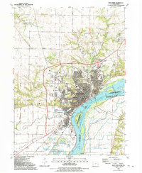
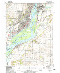
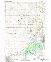
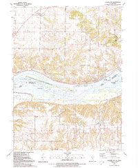
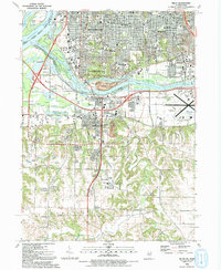
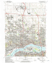 1991 Davenport East1992 Print · USGSThe Quad Cities region thrives along the river in the early nineties, showing the dense urban centers of Davenport and Rock Island. Researchers can trace the massive Rock Island Arsenal, historical burial sites like Confederate Cem, and local institutions like Augustana College.
 - 1991 Map of Montpelier, 1992 Print
 1991 Montpelier1992 Print · USGSThe Mississippi River corridor near the Iowa-Illinois border is documented here in the early nineties, showing a landscape defined by island channels and bluff-top settlements. Researchers can locate Edgington and Montpelier, or trace the grounds of Loud Thunder Camp and St Patricks Ch.
 - 1992 Map of Green Rock
 1992 Green Rock1992 Print · USGSHenry County is captured in the early 1990s as a landscape of historic waterways and quiet rural crossroads. Genealogists and local historians can trace family-named sites like Dayton Cem and Warner or follow the path of the Hennepin Canal.
 - 1992 Map of Milan
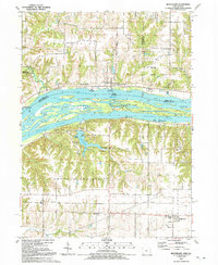
 1992 Milan1992 Print · USGSThe Quad Cities area at the start of the 1990s showcases the meeting of the Mississippi and Rock Rivers amidst a landscape of established urban centers and riverine islands. Genealogists and local researchers can trace numerous family sites at Chippiannock Cem or locate community landmarks like Wharton Field House and Camden Park.
 - 1993 Map of Davenport East, 1999 Print
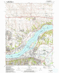
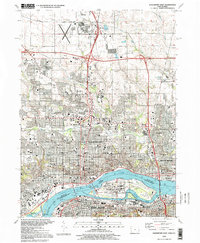 1993 Davenport East1999 Print · USGSThe Quad Cities are captured here in the 1990s, showcasing the complex urban and industrial landscape where the Iowa and Illinois borders meet. Genealogists and local historians can trace legacy sites like Oakdale Cemetery, the Rock Island Arsenal, and institutions such as Palmer College of Chiropractic.
End of results
Showing maps 1-20 of 20
Top cities of Rock Island County
- Moline historical maps
- Rock Island historical maps
- East Moline historical maps
- Silvis historical maps
- Milan historical maps
- Hampton historical maps
See more
Frequently asked questions
- What are the different types of historical maps available for Rock Island County?
- What is the oldest map of Rock Island County?
- Where can I purchase historical maps of Rock Island County for my home or office?
- Where can I download high-res historical maps of Rock Island County?
- Are there historical topographic maps available for Rock Island County?
- Is there historical aerial imagery available for Rock Island County?
- Where are historical maps of Rock Island County sourced from?