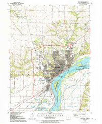
1991 Map of Muscatine
USGS Topo · Published 1992About this map
The Mississippi River defines the industrial and geographic character of this riverfront community, where the commercial hub of Muscatine meets the agricultural expanse of Muscatine Island. By the early 1990s, the landscape shows a developed urban core featuring the General Hospital and Community College, set against a backdrop of deep-seated local history represented by Greenwood Cemetery and St Marys Cem. The river's influence is seen in the engineering of Lock and Dam No 16 and the complex waterways of Hog Island and Towhead Island. To the south, the settlement of Fruitland is surrounded by active extraction sites like several Gravel Pits, while traces of earlier transit remain visible through the Old RR Grade and the Soo Line tracks. Numerous neighborhood institutions, from Washington Sch to Spangler Chapel, provide a high level of detail for local genealogy and land-use studies.
Find a feature on this map
103 named features on this map. Tap any name to fly to it.
Don’t see what you’re looking for? This feature index may not catch every label — zoom into the map to look around manually.
Map Details
Editions of this 1991 Muscatine Map
This is the sole edition of this map. No revisions or reprints were ever made.
Other maps of this area

1890 · Durant
USGS Topo · 1:62,500

1891 · Wilton Junction
USGS Topo · 1:62,500

1894 · Durant
USGS Topo · 1:62,500

1901 · Rock Island
USGS Topo · 1:125,000

1901 · Stanwood
USGS Topo · 1:125,000

1910 · Rock Island
USGS Topo · 1:125,000

1916 · Edgington
USGS Topo · 1:62,500

1938 · Edgington
USGS Topo · 1:62,500

1948 · Muscatine
USGS Topo · 1:62,500

1953 · Wilton Junction
USGS Topo · 1:24,000