1950s Maps of Rock Island County, Illinois
Explore 27 historic maps of Rock Island County from the 1950s. These maps offer a rare glimpse into what life looked like during the 1950s — showing old roads, neighborhoods, homes, and landmarks that have changed or disappeared over time.
Whether you're researching your family's past, planning a metal detecting trip, or studying how Rock Island County's landscape evolved across the 1950s, these high-resolution maps are a powerful tool for exploring the history of this region.
- Focus on a specific era: All maps on this page are from the 1950s, giving you a focused view of this time period.
- See what’s changed: Compare century-old streets, trails, and buildings to today's modern landscape using overlays and satellite layers.
- Research with precision: Use these maps for genealogy, historical research, land use analysis, or educational projects.
- View, download, or print: Maps are fully viewable online in high resolution, and can be downloaded or printed for your own records.
Start exploring Rock Island County's history through authentic maps from the 1950s. This is your window into the past.
Rock Island County, IL maps
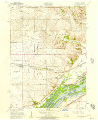
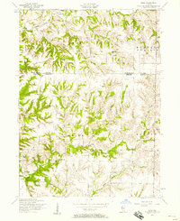
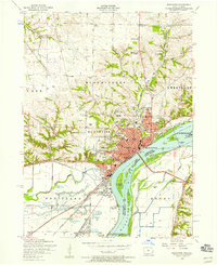
(27)- 1950 Map of Milan
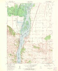
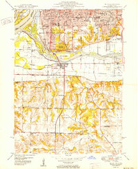 1950 Milan1950 Print · USGSThe Tri-Cities area comes alive in the mid-century as industrial centers like Rock Island and Moline expand across the river islands. Researchers can locate dozens of local landmarks, from Chippiannock Cem to rural outposts like Tindall School No 1.2 unique versions available
 - 1950 Map of Port Byron
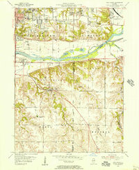
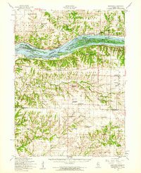
 1950 Port Byron1950 Print · USGSThe Illinois-Iowa border along the Mississippi River thrives as a rail and river hub at the middle of the twentieth century. Local historians can trace family roots through numerous rural landmarks like Shake-Rag Sch, St Johns Cem, and Rapids City.
 - 1952 Map of Erie, 1953 Print
 1952 Erie1953 Print · USGSWhiteside and Henry counties are mapped here in the early fifties, showing a rural river-bound landscape along the Rock River. Local historians can trace family roots at Pink Prairie Cem or locate the site of the Old Stage Line Monument and Kingsbury Sch.2 unique versions available
 - 1952 Map of Clinton, 1953 Print
 1952 Clinton1953 Print · USGSThe Illinois-Iowa border along the Mississippi River is captured here in the early fifties, showing a landscape defined by industrial rail lines and wildlife refuges. Trace family roots through specific rural landmarks like York Ch, Cottonwood Sch, and Calvary Cem.2 unique versions available
 - 1952 Map of Cordova, 1953 Print
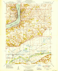
 1952 Cordova1953 Print · USGSRock Island County shoreline life is captured here in the early fifties, following the river as it winds past developing river towns. Genealogists can locate family landmarks like Williams Sch, Fairfield Ch, and the Baker Cem.
 - 1953 Map of Silvis, 1956 Print
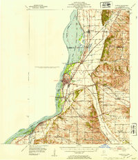
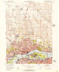
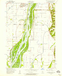
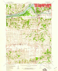
 1953 Silvis1956 Print · USGSThe Quad Cities area flourished in the early fifties as an industrial powerhouse along the Mississippi River. Genealogists and historians can trace the footprint of the East Moline State Hospital, several rural schools like Barr School, and the grounds of Fairview Cemetery.3 unique versions available
 - 1953 Map of Coal Valley, 1956 Print
 1953 Coal Valley1956 Print · USGSThe Illinois-Iowa border region in the early fifties shows a landscape of river-side industry and emerging suburbs. Genealogists and historians can trace family locations near the Black Hawk Mine, rural Kingdom School, or the small settlements of Crampton and Warner.3 unique versions available
 - 1953 Map of Davenport East, 1956 Print
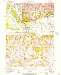
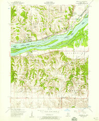
 1953 Davenport East1956 Print · USGSThe Quad Cities are captured at a peak of mid-century growth, following the path of the Mississippi River and the bustling Rock Island Arsenal. Local historians can trace family roots at St Ambrose College or locate the former aviation hub at Cram Field.3 unique versions available
 - 1953 Map of Milan, 1956 Print
 1953 Milan1956 Print · USGSThe Quad Cities area in the early fifties shows a landscape of river-driven industry and rapid post-war growth. Genealogists can trace family roots through numerous named schools and cemeteries like Chippiannock Cemetery and the rural Pleasant Hill Cem.3 unique versions available
 - 1953 Map of Port Byron, 1957 Print
 1953 Port Byron1957 Print · USGSThe Mississippi and Rock Rivers converge in the 1950s, defining a landscape of active rail lines and riverfront towns. Researchers can trace historic family burial sites and rural schoolhouses like Yost Cemetery, Friedens Church, and Sycamore School.3 unique versions available
 - 1953 Map of Cordova, 1957 Print
 1953 Cordova1957 Print · USGSThe Mississippi River forms the heart of this mid-century borderland between Illinois and Iowa, where riverfront towns like Cordova and Princeton thrived. Researchers can pinpoint family-named landmarks such as Nowlin Cemetery, Scharff School, and Camp Hauberg.3 unique versions available
 - 1953 Map of Matherville, 1957 Print
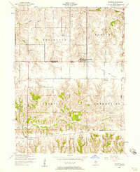
 1953 Matherville1957 Print · USGSThe border of Rock Island and Mercer Counties is shown in the early 1950s as the local coal mining era was fading. Researchers can trace historic industrial sites like the Gilhrist Mine and several rural burial grounds including Farlows Grove Cemetery and Soderberg Cemetery.2 unique versions available
 - 1953 Map of Orion, 1957 Print
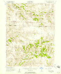
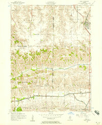 1953 Orion1957 Print · USGSThe tri-county border of Henry, Rock Island, and Mercer counties appears in the early fifties as a landscape of rural schools and coal works. Researchers can trace family sites at Beulah Church, the Long View Mine, and the Rural Town Hall School.3 unique versions available
 - 1953 Map of Green Rock, 1957 Print
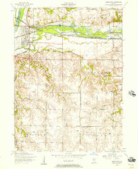 1953 Green Rock1957 Print · USGSHenry County is captured here at a mid-century crossroads where the legacy of the Illinois-Mississippi Canal meets active rail corridors. Local historians can trace the foundations of Green Rock or locate vanished rural landmarks like the Bozize Mine and Stewart School.3 unique versions available
 - 1953 Map of Camanche, 1957 Print
 1953 Camanche1957 Print · USGSThe riverfront and rail corridors of Clinton County are captured here in the early fifties, showing the transition from rural farming to mid-century industry. Researchers can trace family roots through several landmarks like Shafton Cemetery, Low Moor, and the Clinton Speedway.3 unique versions available
 - 1953 Map of Blanchard Island, 1958 Print
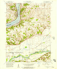
 1953 Blanchard Island1958 Print · USGSThe Mississippi River bottomlands between Illinois and Iowa are captured here in the early fifties, showing a landscape of complex chutes and islands. Genealogists can locate rural landmarks like Island Church, Reynolds Cemetery, and several local schools such as Excelsior School.2 unique versions available
 - 1953 Map of Buffalo Prairie, 1958 Print
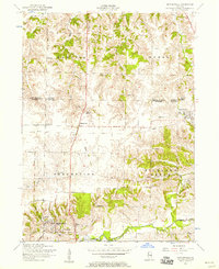
 1953 Buffalo Prairie1958 Print · USGSIllinois prairie life in the early fifties comes into focus along the Rock Island and Mercer County line. Researchers can trace the heritage of rural communities through several country schoolhouses and church sites like Buffalo Prairie Church and the Duncan Town Hall.2 unique versions available
 - 1953 Map of Illinois City, 1958 Print
 1953 Illinois City1958 Print · USGSThe Mississippi River forms a maze of sloughs and islands between Illinois and Iowa in the early fifties. Genealogists and historians can locate Illinois City, the dismantled Rock Island and Pacific railroad, and Harker Cemetery.2 unique versions available
 - 1953 Map of Eliza, 1958 Print
 1953 Eliza1958 Print · USGSWestern Illinois farm country in the early fifties is mapped here in detail, spanning the boundary of Rock Island and Mercer Counties. Researchers can locate local landmarks like the White Eagle School, Miller Cemetery, and the rural community center of Eliza.2 unique versions available
 - 1953 Map of Reynolds, 1958 Print
 1953 Reynolds1958 Print · USGSThe borderlands of Rock Island and Mercer counties are captured here in the early 1950s, showing a landscape shaped by small farmsteads and rural schools. Researchers can trace family sites at Hamlet Cemetery, locate vanished schoolhouses like McAfee School, and follow the path of a dismantled railroad.2 unique versions available
 - 1953 Map of Andalusia, 1958 Print
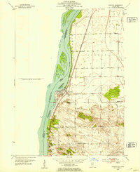
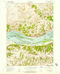
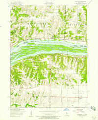
 1953 Andalusia1958 Print · USGSThe Mississippi River corridor south of Davenport is captured here in the early fifties, showing a landscape defined by rail lines and river islands. Researchers can locate rural landmarks like Asbury Cemetery, Buffalo Heights, and the Coon Hunters Club along the bluffs.3 unique versions available
 - 1953 Map of Montpelier, 1958 Print
 1953 Montpelier1958 Print · USGSThe Mississippi River corridor near the Iowa-Illinois border is captured here during the 1950s, showing a landscape of riverfront recreation and rural industry. Researchers can find the Old Pine Creek Mill, early schools like White Lake School, and the community at Edgington.3 unique versions available
 - 1953 Map of Muscatine, 1958 Print
 1953 Muscatine1958 Print · USGSMuscatine and the Mississippi River bottomlands are captured here in the early 1950s, showing a bustling rail and river economy. Genealogists can locate family landmarks like Spangler Church, Mittman School, and the old County Home.3 unique versions available
 - 1953 Map of Milan, 1959 Print
 1953 Milan1959 Print · USGSRock Island County and the Mississippi riverfront are captured here in the mid-fifties, showing the region's transition from river-town industry to suburban growth. Genealogists and historians can locate numerous rural landmarks like St Josephs Ch, Colony Cem, and the old Edgington Sch.
 - 1953 Map of Edgington, 1960 Print
 1953 Edgington1960 Print · USGSThe Mississippi River valley comes alive in the early fifties, showing a landscape of sloughs and islands between Iowa and Illinois. Researchers can trace rural lineages through the Buffalo Prairie Cem, Sweetland Center, and dozens of named schoolhouses.
Showing maps 1-25 of 27
Top cities of Rock Island County
- Moline historical maps
- Rock Island historical maps
- East Moline historical maps
- Silvis historical maps
- Milan historical maps
- Hampton historical maps
See more
Frequently asked questions
- What are the different types of historical maps available for Rock Island County?
- What is the oldest map of Rock Island County?
- Where can I purchase historical maps of Rock Island County for my home or office?
- Where can I download high-res historical maps of Rock Island County?
- Are there historical topographic maps available for Rock Island County?
- Is there historical aerial imagery available for Rock Island County?
- Where are historical maps of Rock Island County sourced from?