1950s Maps of Muscatine, Iowa
Explore 5 historic maps of Muscatine from the 1950s. These maps offer a rare glimpse into what life looked like during the 1950s — showing old roads, neighborhoods, homes, and landmarks that have changed or disappeared over time.
Whether you're researching your family's past, planning a metal detecting trip, or studying how Muscatine's landscape evolved across the 1950s, these high-resolution maps are a powerful tool for exploring the history of this region.
- Focus on a specific era: All maps on this page are from the 1950s, giving you a focused view of this time period.
- See what’s changed: Compare century-old streets, trails, and buildings to today's modern landscape using overlays and satellite layers.
- Research with precision: Use these maps for genealogy, historical research, land use analysis, or educational projects.
- View, download, or print: Maps are fully viewable online in high resolution, and can be downloaded or printed for your own records.
Start exploring Muscatine's history through authentic maps from the 1950s. This is your window into the past.
Muscatine, IA maps
(5)- 1953 Map of Blanchard Island, 1958 Print
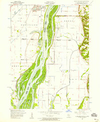 1953 Blanchard Island1958 Print · USGSThe Mississippi River bottomlands between Illinois and Iowa are captured here in the early fifties, showing a landscape of complex chutes and islands. Genealogists can locate rural landmarks like Island Church, Reynolds Cemetery, and several local schools such as Excelsior School.2 unique versions available
 - 1953 Map of Illinois City, 1958 Print
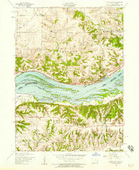 1953 Illinois City1958 Print · USGSThe Mississippi River forms a maze of sloughs and islands between Illinois and Iowa in the early fifties. Genealogists and historians can locate Illinois City, the dismantled Rock Island and Pacific railroad, and Harker Cemetery.2 unique versions available
 - 1953 Map of Muscatine, 1958 Print
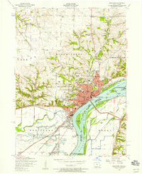 1953 Muscatine1958 Print · USGSMuscatine and the Mississippi River bottomlands are captured here in the early 1950s, showing a bustling rail and river economy. Genealogists can locate family landmarks like Spangler Church, Mittman School, and the old County Home.3 unique versions available
 - 1953 Map of Edgington, 1960 Print
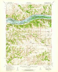 1953 Edgington1960 Print · USGSThe Mississippi River valley comes alive in the early fifties, showing a landscape of sloughs and islands between Iowa and Illinois. Researchers can trace rural lineages through the Buffalo Prairie Cem, Sweetland Center, and dozens of named schoolhouses.
 - 1958 Map of Davenport, 1968 Print
 1958 Davenport1968 Print · USGSEastern Iowa and western Illinois thrive along the river during the late fifties, defined by the industrial Quad Cities and a robust rail network. Genealogists can trace family roots through settlements like Oasis and Stanwood or along the Cedar River.2 unique versions available
End of results
Showing maps 1-5 of 5
Top cities near Muscatine
- West Liberty historical maps
- Wilton historical maps
- Durant historical maps
- Buffalo Prairie historical maps
- Fruitland historical maps
- Grandview historical maps
See more
Frequently asked questions
- What are the different types of historical maps available for Muscatine?
- What is the oldest map of Muscatine?
- Where can I purchase historical maps of Muscatine for my home or office?
- Where can I download high-res historical maps of Muscatine?
- Are there historical topographic maps available for Muscatine?
- Is there historical aerial imagery available for Muscatine?
- Where are historical maps of Muscatine sourced from?