Old Maps of Muscatine, Iowa for Academic Research
Study the evolution of Muscatine with 45 high-resolution historic maps. Whether you're teaching, researching, or modeling changes in land use, these maps provide essential visual documentation of urban, environmental, and geographic change.
- Analyze long-term change: Track patterns in development, transportation, and natural features.
- Ideal for environmental or urban studies: Support academic projects with primary historical map data.
- Use in the classroom or lab: Educators and researchers rely on these maps to bring historical context to life.
These maps are a powerful tool for teaching, research, and visualizing how Muscatine has changed over the decades.
Muscatine, IA maps
(45)- 1916 Map of Edgington
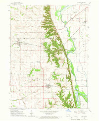
 1916 Edgington1916 Print · USGSThe river-and-rail corridor along the Mississippi border emerges in high detail during the early twentieth century. Genealogists and local historians can trace the rural landscape through a dense network of country schools like Whiteoak School and New Era, alongside river features like Geneva Island.3 unique versions available
 - 1938 Map of Edgington, 1955 Print
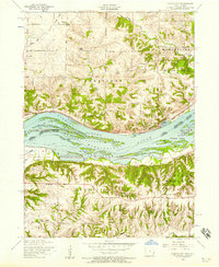
 1938 Edgington1955 Print · USGSThe Mississippi River corridor in the late thirties shows a landscape of active rail lines and riverfront industry. Genealogists can trace rural family roots through numerous local landmarks like Jimtown, White Eagle School, and Buffalo Center School.
 - 1948 Map of Muscatine
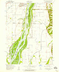
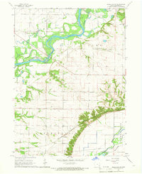
 1948 Muscatine1948 Print · USGSThe Mississippi River bottomlands along the Iowa-Illinois border are captured here in the late 1940s, showing a transition from river commerce to intensive drainage agriculture. Researchers can trace rural school districts like Lillibridge Sch and local landmarks such as the Muscatine Bridge and Glancey Lake.2 unique versions available
 - 1953 Map of Blanchard Island, 1958 Print
 1953 Blanchard Island1958 Print · USGSThe Mississippi River bottomlands between Illinois and Iowa are captured here in the early fifties, showing a landscape of complex chutes and islands. Genealogists can locate rural landmarks like Island Church, Reynolds Cemetery, and several local schools such as Excelsior School.2 unique versions available
 - 1953 Map of Illinois City, 1958 Print
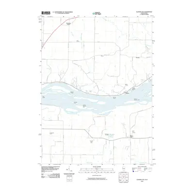
 1953 Illinois City1958 Print · USGSThe Mississippi River forms a maze of sloughs and islands between Illinois and Iowa in the early fifties. Genealogists and historians can locate Illinois City, the dismantled Rock Island and Pacific railroad, and Harker Cemetery.2 unique versions available
 - 1953 Map of Muscatine, 1958 Print
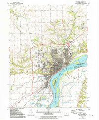
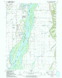
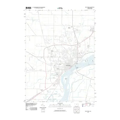
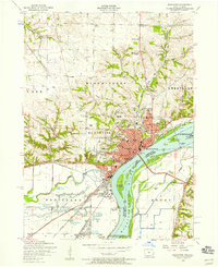 1953 Muscatine1958 Print · USGSMuscatine and the Mississippi River bottomlands are captured here in the early 1950s, showing a bustling rail and river economy. Genealogists can locate family landmarks like Spangler Church, Mittman School, and the old County Home.3 unique versions available
 - 1953 Map of Edgington, 1960 Print
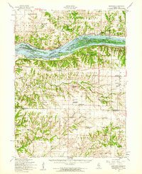 1953 Edgington1960 Print · USGSThe Mississippi River valley comes alive in the early fifties, showing a landscape of sloughs and islands between Iowa and Illinois. Researchers can trace rural lineages through the Buffalo Prairie Cem, Sweetland Center, and dozens of named schoolhouses.
 - 1958 Map of Davenport, 1968 Print
 1958 Davenport1968 Print · USGSEastern Iowa and western Illinois thrive along the river during the late fifties, defined by the industrial Quad Cities and a robust rail network. Genealogists can trace family roots through settlements like Oasis and Stanwood or along the Cedar River.2 unique versions available
 - 1961 Map of Davenport
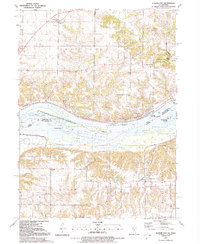
 1961 Davenport1961 Print · USGSThe Quad Cities and the eastern Iowa riverlands are captured here in the early sixties, showing the region's transition into a modern industrial and transit hub. Genealogists and historians can trace the paths of major railroads and find river landmarks like Rock Island Arsenal, Huron Island, and the Coralville Reservoir.
 - 1962 Map of Davenport
 1962 Davenport1962 Print · USGSThe Quad Cities and the Mississippi River corridor are shown at their industrial peak just before the interstate era fully transformed the region. Researchers can trace the sprawling rail networks of the Chicago Rock Island and Pacific and find landmarks like the Rock Island Arsenal and Wild Cat Den State Park.
 - 1965 Map of Letts, 1966 Print
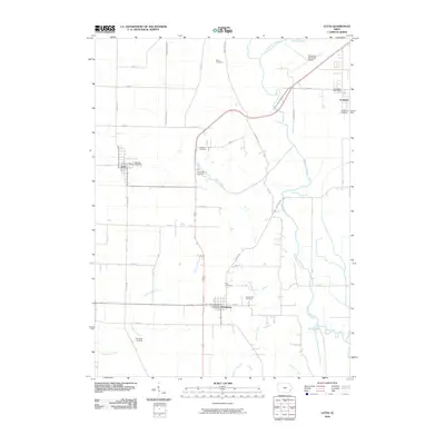
 1965 Letts1966 Print · USGSEastern Iowa's riverine border comes into focus in the mid-sixties, where the Muscatine Slough meets the developed farmsteads of the interior. Genealogists and local historians can trace family plots at Lettsville Cem or Thompson Cem and locate landmarks like Gospel Hall Ch.
 - 1965 Map of Muscatine NW, 1966 Print
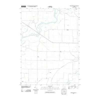
 1965 Muscatine NW1966 Print · USGSMuscatine County during the mid-sixties reveals a landscape defined by the winding Cedar River and the active Chicago Milwaukee St Paul and Pacific rail line. Researchers can locate community anchors like Ardon, St Malachys Ch, and various family burial sites like Houtz Cem.
 - 1984 Map of Muscatine, 1985 Print
 1984 Muscatine1985 Print · USGSThe Mississippi River corridor and Iowa prairie meet in the 1980s, showcasing a landscape of river navigation and agricultural heartland. Genealogists and researchers can locate old schools and landmarks like Maharishi International University, Elm Grove Cem, and Lock & Dam No 16.2 unique versions available
 - 1984 Map of Aledo, 1985 Print
 1984 Aledo1985 Print · USGSThe Mississippi River borderlands and Illinois heartland are captured here in the mid-eighties as industry and agriculture overlap. Trace the Hennepin Canal, the historic Swedish colony at Bishop Hill, and the rail corridors of the Burlington Northern.
 - 1989 Map of Aledo
 1989 Aledo1989 Print · USGSWestern Illinois and eastern Iowa are shown here during the late twentieth century, when the river-and-rail economy still defined the Quad Cities and the surrounding prairie. Researchers can trace historic settlements like Bishop Hill and Millersburg alongside active routes like the Chicago Rock Island & Pacific RR.
 - 1991 Map of Muscatine, 1992 Print
 1991 Muscatine1992 Print · USGSMuscatine and the fertile riverfront of the early 1990s are captured here during a period of steady industrial and residential development. Genealogists and historians can trace neighborhood landmarks like Spangler Chapel, St Marys Cem, and the massive Greenwood Cemetery near the city center.
 - 1991 Map of Illinois City, 1992 Print
 1991 Illinois City1992 Print · USGSThe Mississippi River islands and Iowa-Illinois borderlands are captured here in the early nineties. Genealogists can locate family sites like Ziegler Memorial Ch, Fairport Cem, and the rural community of Illinois City.2 unique versions available
 - 1991 Map of Blanchard Island, 1992 Print
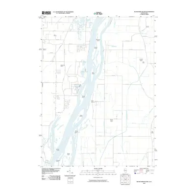
 1991 Blanchard Island1992 Print · USGSThe Mississippi River valley at the start of the nineties reveals a landscape of massive flood control projects and wildlife conservation. Genealogists and historians can trace local landmarks like Reynolds Cem or the remote Carl Ritter Landing Strip among the river chutes and islands.
 - 2010 Map of Muscatine NW, 2010 Print
 2010 Muscatine NW2010 Print · USGSCovers Muscatine, including Ardon, Dayfield, and other nearby areas
 - 2010 Map of Letts, 2010 Print
 2010 Letts2010 Print · USGSCovers Muscatine, including Fruitland, Grandview, and other nearby areas
 - 2010 Map of Illinois City, 2010 Print
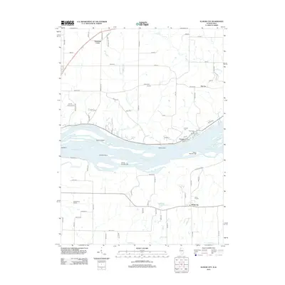
 2010 Illinois City2010 Print · USGSCovers Muscatine, including Sweetland Center, Illinois City, and other nearby areas
 - 2010 Map of Muscatine, 2010 Print
 2010 Muscatine2010 Print · USGSCovers Muscatine, including Rock Island County, Muscatine County, and other nearby areas
 - 2010 Map of Blanchard Island, 2010 Print
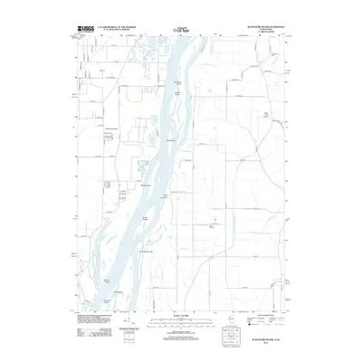
 2010 Blanchard Island2010 Print · USGSCovers Muscatine, including Fruitland, Kammerer Trailer Court, and other nearby areas
 - 2012 Map of Blanchard Island, 2012 Print
 2012 Blanchard Island2012 Print · USGSCovers Muscatine, including Fruitland, Kammerer Trailer Court, and other nearby areas
 - 2012 Map of Illinois City, 2012 Print
 2012 Illinois City2012 Print · USGSCovers Muscatine, including Sweetland Center, Illinois City, and other nearby areas
Showing maps 1-25 of 45
Top cities near Muscatine
- West Liberty historical maps
- Wilton historical maps
- Durant historical maps
- Buffalo Prairie historical maps
- Fruitland historical maps
- Grandview historical maps
See more
Frequently asked questions
- What are the different types of historical maps available for Muscatine?
- What is the oldest map of Muscatine?
- Where can I purchase historical maps of Muscatine for my home or office?
- Where can I download high-res historical maps of Muscatine?
- Are there historical topographic maps available for Muscatine?
- Is there historical aerial imagery available for Muscatine?
- Where are historical maps of Muscatine sourced from?