1960s Maps of Sioux County, Iowa
Explore 21 historic maps of Sioux County from the 1960s. These maps offer a rare glimpse into what life looked like during the 1960s — showing old roads, neighborhoods, homes, and landmarks that have changed or disappeared over time.
Whether you're researching your family's past, planning a metal detecting trip, or studying how Sioux County's landscape evolved across the 1960s, these high-resolution maps are a powerful tool for exploring the history of this region.
- Focus on a specific era: All maps on this page are from the 1960s, giving you a focused view of this time period.
- See what’s changed: Compare century-old streets, trails, and buildings to today's modern landscape using overlays and satellite layers.
- Research with precision: Use these maps for genealogy, historical research, land use analysis, or educational projects.
- View, download, or print: Maps are fully viewable online in high resolution, and can be downloaded or printed for your own records.
Start exploring Sioux County's history through authentic maps from the 1960s. This is your window into the past.
Sioux County, IA maps
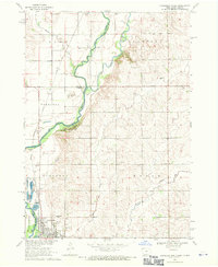
(21)- 1962 Map of Le Mars, 1964 Print
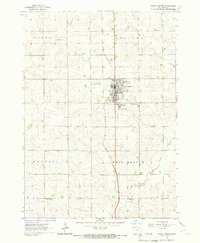
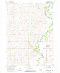
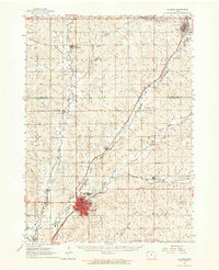 1962 Le Mars1964 Print · USGSNorthwestern Iowa's agricultural heartland is documented here in the early sixties, centered on the growing community of Le Mars. Researchers can trace old rail corridors like the ILLINOIS CENTRAL, locate family plots at Resthaven Cemetery, or find historical landmarks like Westmar College.
 - 1962 Map of Canton, 1964 Print
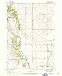
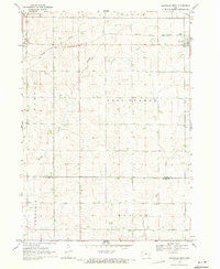
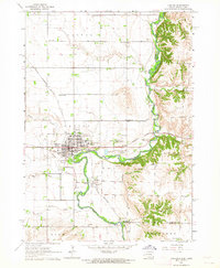 1962 Canton1964 Print · USGSThe South Dakota and Iowa border comes alive in the early sixties as the Big Sioux River winds past bustling prairie towns. Genealogists can locate several rural schools and cemeteries, including Augustana Academy, Beloit Cem, and York Sch.2 unique versions available
 - 1964 Map of Hospers, 1965 Print
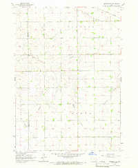
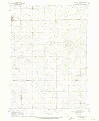
 1964 Hospers1965 Print · USGSNorthwest Iowa’s agricultural heartland is documented here in the mid-1960s, showing the intersection of rail and river commerce. Genealogists and historians can trace the town sites of Hospers and Newkirk, or locate ancestors at St Anthonys Cem.
 - 1964 Map of Matlock, 1965 Print
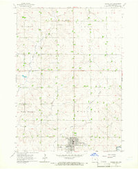
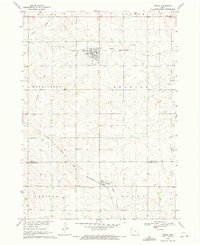
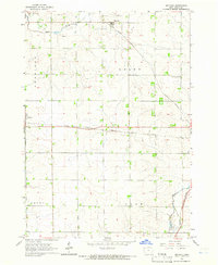 1964 Matlock1965 Print · USGSThe rural landscape of Sioux County is captured in the mid-1960s, a period when three distinct railroads still defined local commerce. Genealogists and historians can locate family landmarks such as Greenwood Cem and the Church of the Brethren near the settlement of Matlock.
 - 1964 Map of Sheldon SE, 1965 Print
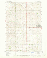
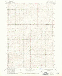
 1964 Sheldon SE1965 Print · USGSO'Brien and Sioux Counties appear in the mid-1960s as a structured landscape of established farmsteads and rural townships. Researchers can trace local landmarks like Philby, the Baker Ch, and the corridor of the Illinois Central railroad.
 - 1964 Map of Orange City, 1965 Print
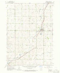
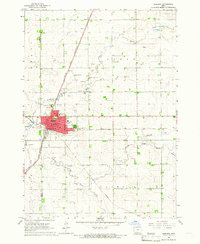
 1964 Orange City1965 Print · USGSSioux County's agricultural heartland is captured in the mid-1960s, centered on the growing town of Orange City. Genealogists and researchers can trace local landmarks like the County Home, Middleburg Cem, and the small settlement of Middleburg.
 - 1964 Map of Sheldon, 1965 Print
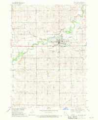
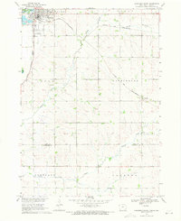
 1964 Sheldon1965 Print · USGSSheldon was a bustling rail hub in the mid-1960s where three major lines converged amidst the fertile farmland of the Sioux and O'Brien county line. Researchers can trace the city's growth through landmarks like the Municipal Airport, St Patricks Sch, and the Illinois Central tracks.
 - 1964 Map of Boyden, 1965 Print
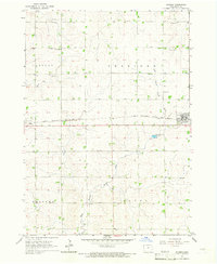 1964 Boyden1965 Print · USGSSioux County farming life is captured here in the mid-1960s, centered on the railroad towns of Boyden and Hull. Researchers can trace genealogy and land use through landmarks like St John Sch, St Paul Ch, and the winding West Branch Floyd River.
 - 1964 Map of Sioux Center, 1966 Print
 1964 Sioux Center1966 Print · USGSSioux Center stood as a bustling agricultural and educational hub in the mid-sixties. Genealogists and local historians can trace the town's development around Dordt College, locate the Community Cemetery, and follow the GREAT NORTHERN rail line.2 unique versions available
 - 1964 Map of Hull, 1966 Print
 1964 Hull1966 Print · USGSMid-century Sioux County farm country is centered here around the busy railroad junction at Perkins and the town of Hull. Genealogists and local historians can trace family-named sites, rural cemeteries like Pioneer Cem, and the path of Sixmile Cr.
 - 1968 Map of Alcester NE, 1970 Print
 1968 Alcester NE1970 Print · USGSThe Big Sioux River valley comes to life in the late sixties as it winds through Lincoln County. Genealogists can trace early rural life through family-named landmarks like Moe Sch, Bethany Cem, and the tracks of the Chicago Milwaukee St Paul and Pacific railroad.2 unique versions available
 - 1968 Map of Alcester SE, 1970 Print
 1968 Alcester SE1970 Print · USGSThe borderlands of Union County, South Dakota, are captured in the late sixties as the Big Sioux River snakes past the township of Alcester. Researchers can trace rural landmarks from the Nathanael Cem to the Chicago and North Western rail line.
 - 1968 Map of Hawarden North, 1971 Print
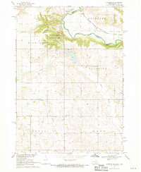
 1968 Hawarden North1971 Print · USGSThe river valley at the Iowa-South Dakota border was a vital rail and agricultural corridor in the late sixties. Genealogists and local historians can trace the foundations of Hawarden and find specific landmarks like Calvary Cem and the old Townhall.
 - 1968 Map of Fairview, 1971 Print
 1968 Fairview1971 Print · USGSThe Big Sioux River valley straddles the South Dakota and Iowa border in the late sixties, a landscape of river-bend farms and rail-line towns. Local historians can trace the Milwaukee Road tracks past Fairview and the Blanchard Sch.
 - 1968 Map of Labanon, 1971 Print
 1968 Labanon1971 Print · USGSThe rural heart of Sioux County is captured in the late sixties, showing the agricultural patterns of the Garfield Plateau. Researchers can trace old family sites near Lebanon or locate community landmarks like Highland Cem and Peace Ch.2 unique versions available
 - 1968 Map of Rock Valley, 1971 Print
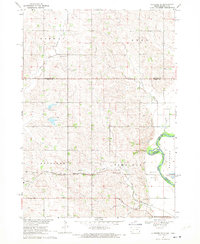
 1968 Rock Valley1971 Print · USGSRock Valley, Iowa, is captured in the late sixties as the local rail and river hub for Sioux County. Genealogists and historians can locate Valley View Cem, the Chicago Milwaukee St Paul and Pacific tracks, and the High Sch.
 - 1969 Map of Chatsworth, 1971 Print
 1969 Chatsworth1971 Print · USGSThe Big Sioux River valley comes alive in the late sixties as it winds along the South Dakota and Iowa border. Trace the old Milwaukee Road rail line through Chatsworth and locate local landmarks like Union Creek Ch or Old Big Springs Cem.
 - 1969 Map of Granville West, 1971 Print
 1969 Granville West1971 Print · USGSNorthwest Iowa's agricultural landscape is captured here in the late sixties as the township system matured. Researchers can trace the path of the Chicago and North Western railroad near Granville or follow the banks of Willow Creek and Deep Creek.
 - 1969 Map of Granville East, 1971 Print
 1969 Granville East1971 Print · USGSNorthwest Iowa's farm country comes into focus in the late sixties, where rail lines and section roads define the prairie. Genealogists and local historians can trace family ties at St Josephs Cem or locate the village of Germantown near Whiskey Creek.
 - 1969 Map of Ireton, 1971 Print
 1969 Ireton1971 Print · USGSNorthwest Iowa's farm country comes into focus in this late 1960s study of Sioux and Plymouth counties. Genealogists and local historians can locate rural landmarks such as Pleasant Hill Cem, St Johns Ch, and the rail lines of the Chicago and North Western.
 - 1969 Map of Hawarden South, 1971 Print
 1969 Hawarden South1971 Print · USGSSioux County farming and rail transit are captured here in the late sixties as the region supported the Missouri River Basin development. Researchers can trace the dual rail lines of the Chicago and North Western and the Chicago Milwaukee St Paul and Pacific near Hawarden and McNally.
End of results
Showing maps 1-21 of 21
Top cities of Sioux County
- Sioux Center historical maps
- Orange City historical maps
- Rock Valley historical maps
- Hawarden historical maps
- Hull historical maps
- Alton historical maps
See more
Frequently asked questions
- What are the different types of historical maps available for Sioux County?
- What is the oldest map of Sioux County?
- Where can I purchase historical maps of Sioux County for my home or office?
- Where can I download high-res historical maps of Sioux County?
- Are there historical topographic maps available for Sioux County?
- Is there historical aerial imagery available for Sioux County?
- Where are historical maps of Sioux County sourced from?