Old Maps of Sioux County, Iowa for Academic Research
Study the evolution of Sioux County with 172 high-resolution historic maps. Whether you're teaching, researching, or modeling changes in land use, these maps provide essential visual documentation of urban, environmental, and geographic change.
- Analyze long-term change: Track patterns in development, transportation, and natural features.
- Ideal for environmental or urban studies: Support academic projects with primary historical map data.
- Use in the classroom or lab: Educators and researchers rely on these maps to bring historical context to life.
These maps are a powerful tool for teaching, research, and visualizing how Sioux County has changed over the decades.
Sioux County, IA maps
(172)- 1897 Map of Canton, 1954 Print
 1897 Canton1954 Print · USGSSoutheastern South Dakota and the Iowa borderlands were undergoing a railway-driven expansion during the 1890s. Genealogists and historians can trace early settlements like Beloit, Centerville, and Lennox as they grew along the Big Sioux River.
 - 1898 Map of Elk Point, 1960 Print
 1898 Elk Point1960 Print · USGSThe tri-state borderlands of South Dakota, Nebraska, and Iowa are captured here in the late nineteenth century as a landscape of ferries and river-fed commerce. Researchers can trace the early foundations of Elk Point and Vermillion or locate vanished crossings like Ionia Ferry and the Ponca Ferry.2 unique versions available
 - 1900 Map of Canton
 1900 Canton1900 Print · USGSSoutheastern South Dakota and the Iowa borderlands are captured here at a peak of late-nineteenth-century rail expansion. Genealogists can trace the early foundations of towns like Canton, Centerville, and Beresford along the Big Sioux River.2 unique versions available
 - 1901 Map of Elk Point
 1901 Elk Point1901 Print · USGSThe tri-state borderlands of South Dakota, Nebraska, and Iowa are captured here at the turn of the century during the peak of the steam rail era. Researchers can trace the original paths of the Chicago Milwaukee and St. Paul Ry. and locate early settlements like Spirit Mound, Newcastle, and Burbank.
 - 1907 Map of Elk Point
 1907 Elk Point1907 Print · USGSThe tri-state borderlands of South Dakota, Nebraska, and Iowa are shown here at the start of the century, centered on the Missouri and Big Sioux river valleys. Researchers can trace the river's old path through oxbows like Mc Cook Lake and locate early river crossings including Vermilion Ferry and Ponca Ferry.6 unique versions available
 - 1954 Map of Fairmont, 1967 Print
 1954 Fairmont1967 Print · USGSThe prairie landscape of southern Minnesota and northern Iowa comes alive in this mid-century survey of the Coteau des Prairies. Genealogists and historians can trace the rail-connected growth of Fairmont and Blue Earth or locate family roots near St Kilian Ch and Union Slough National Wildlife Refuge.3 unique versions available
 - 1954 Map of Fort Dodge, 1968 Print
 1954 Fort Dodge1968 Print · USGSNorthwest Iowa is shown here during a period of steady industrial and rail activity in the mid-fifties. Researchers can trace the extensive rail lines connecting Fort Dodge to mining and manufacturing sites like Gypsum and Industry Station.3 unique versions available
 - 1955 Map of Sioux City, 1959 Print
 1955 Sioux City1959 Print · USGSThe Missouri River valley in the mid-fifties is captured here during a time of major engineering and social transition. Genealogists and historians can trace the foundations of Gavins Point Dam, tribal boundaries on the Santee Sioux Indian Reservation, and local landmarks like the Norfolk State Hospital.4 unique versions available
 - 1955 Map of Sioux Falls, 1967 Print
 1955 Sioux Falls1967 Print · USGSThe eastern South Dakota and western Minnesota borderlands come alive in the mid-fifties, showing the vital rail-to-river connections of the era. Genealogists can trace family footprints across townships like Madison and Pipestone, while following the paths of the Big Sioux River and the Chicago and North Western line.3 unique versions available
 - 1957 Map of Fort Dodge
 1957 Fort Dodge1957 Print · USGSWest-central Iowa thrived as a network of rail-linked agricultural hubs and river towns during the mid-fifties. Researchers can trace the development of the Des Moines River valley and locate historic landmarks in Fort Dodge, Storm Lake, and Lehigh.
 - 1958 Map of Sioux City
 1958 Sioux City1958 Print · USGSThe Missouri River valley in the late fifties was a bustling intersection of tribal lands, rail corridors, and river towns. Genealogists can trace family roots through specific rural sites like Daisy Valley School, St Johns Church and School, and Yankton State Hospital.
 - 1958 Map of Sioux Falls
 1958 Sioux Falls1958 Print · USGSThe tri-state borderlands of South Dakota, Minnesota, and Iowa are captured here during the mid-century peak of the regional rail network. Genealogists and historians can trace local landmarks like Augustana Academy, the St Marys Cem, and the path of the Illinois Central through Rock Rapids.
 - 1958 Map of Fort Dodge
 1958 Fort Dodge1958 Print · USGSWestern Iowa in the mid-1950s reveals a productive landscape of river-valley industry and prairie agricultural hubs. Researchers can trace the development of the Des Moines River corridor through Fort Dodge and locate vanished local landmarks near Coalville or Storm Lake.
 - 1958 Map of Fairmont
 1958 Fairmont1958 Print · USGSThe borderlands of southern Minnesota and northern Iowa come alive in the mid-1950s, showing a landscape defined by glacial lakes and rail-line commerce. Researchers can trace historic landmarks like Lakeside Laboratory, Gridley Station, and the Bancroft Wildlife Refuge across the prairie.
 - 1959 Map of Sioux City
 1959 Sioux City1959 Print · USGSThe tri-state region surrounding the Missouri River is captured here in the late fifties, showing the convergence of Nebraska, South Dakota, and Iowa. Researchers can trace rural lineages through numerous country schoolhouses like Cemetery School and the many numbered Washington School districts.
 - 1962 Map of Le Mars, 1964 Print
 1962 Le Mars1964 Print · USGSNorthwestern Iowa's agricultural heartland is documented here in the early sixties, centered on the growing community of Le Mars. Researchers can trace old rail corridors like the ILLINOIS CENTRAL, locate family plots at Resthaven Cemetery, or find historical landmarks like Westmar College.
 - 1962 Map of Canton, 1964 Print
 1962 Canton1964 Print · USGSThe South Dakota and Iowa border comes alive in the early sixties as the Big Sioux River winds past bustling prairie towns. Genealogists can locate several rural schools and cemeteries, including Augustana Academy, Beloit Cem, and York Sch.2 unique versions available
 - 1964 Map of Hospers, 1965 Print
 1964 Hospers1965 Print · USGSNorthwest Iowa’s agricultural heartland is documented here in the mid-1960s, showing the intersection of rail and river commerce. Genealogists and historians can trace the town sites of Hospers and Newkirk, or locate ancestors at St Anthonys Cem.
 - 1964 Map of Matlock, 1965 Print
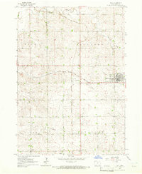
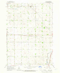 1964 Matlock1965 Print · USGSThe rural landscape of Sioux County is captured in the mid-1960s, a period when three distinct railroads still defined local commerce. Genealogists and historians can locate family landmarks such as Greenwood Cem and the Church of the Brethren near the settlement of Matlock.
 - 1964 Map of Sheldon SE, 1965 Print
 1964 Sheldon SE1965 Print · USGSO'Brien and Sioux Counties appear in the mid-1960s as a structured landscape of established farmsteads and rural townships. Researchers can trace local landmarks like Philby, the Baker Ch, and the corridor of the Illinois Central railroad.
 - 1964 Map of Orange City, 1965 Print
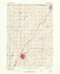
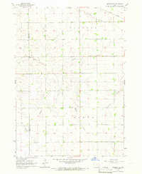
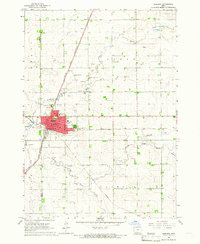
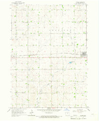
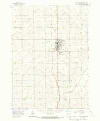
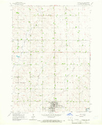 1964 Orange City1965 Print · USGSSioux County's agricultural heartland is captured in the mid-1960s, centered on the growing town of Orange City. Genealogists and researchers can trace local landmarks like the County Home, Middleburg Cem, and the small settlement of Middleburg.
 - 1964 Map of Sheldon, 1965 Print
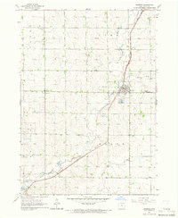
 1964 Sheldon1965 Print · USGSSheldon was a bustling rail hub in the mid-1960s where three major lines converged amidst the fertile farmland of the Sioux and O'Brien county line. Researchers can trace the city's growth through landmarks like the Municipal Airport, St Patricks Sch, and the Illinois Central tracks.
 - 1964 Map of Boyden, 1965 Print
 1964 Boyden1965 Print · USGSSioux County farming life is captured here in the mid-1960s, centered on the railroad towns of Boyden and Hull. Researchers can trace genealogy and land use through landmarks like St John Sch, St Paul Ch, and the winding West Branch Floyd River.
 - 1964 Map of Sioux Center, 1966 Print
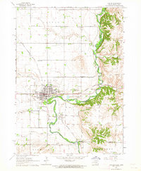
 1964 Sioux Center1966 Print · USGSSioux Center stood as a bustling agricultural and educational hub in the mid-sixties. Genealogists and local historians can trace the town's development around Dordt College, locate the Community Cemetery, and follow the GREAT NORTHERN rail line.2 unique versions available
 - 1964 Map of Hull, 1966 Print
 1964 Hull1966 Print · USGSMid-century Sioux County farm country is centered here around the busy railroad junction at Perkins and the town of Hull. Genealogists and local historians can trace family-named sites, rural cemeteries like Pioneer Cem, and the path of Sixmile Cr.
Showing maps 1-25 of 172
Top cities of Sioux County
- Sioux Center historical maps
- Orange City historical maps
- Rock Valley historical maps
- Hawarden historical maps
- Hull historical maps
- Alton historical maps
See more
Frequently asked questions
- What are the different types of historical maps available for Sioux County?
- What is the oldest map of Sioux County?
- Where can I purchase historical maps of Sioux County for my home or office?
- Where can I download high-res historical maps of Sioux County?
- Are there historical topographic maps available for Sioux County?
- Is there historical aerial imagery available for Sioux County?
- Where are historical maps of Sioux County sourced from?