1980s Maps of Ridgeway, Iowa
Explore 4 historic maps of Ridgeway from the 1980s. These maps offer a rare glimpse into what life looked like during the 1980s — showing old roads, neighborhoods, homes, and landmarks that have changed or disappeared over time.
Whether you're researching your family's past, planning a metal detecting trip, or studying how Ridgeway's landscape evolved across the 1980s, these high-resolution maps are a powerful tool for exploring the history of this region.
- Focus on a specific era: All maps on this page are from the 1980s, giving you a focused view of this time period.
- See what’s changed: Compare century-old streets, trails, and buildings to today's modern landscape using overlays and satellite layers.
- Research with precision: Use these maps for genealogy, historical research, land use analysis, or educational projects.
- View, download, or print: Maps are fully viewable online in high resolution, and can be downloaded or printed for your own records.
Start exploring Ridgeway's history through authentic maps from the 1980s. This is your window into the past.
Ridgeway, IA maps
(4)- 1981 Map of Ridgeway, 1982 Print
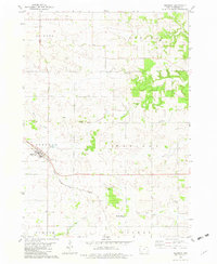 1981 Ridgeway1982 Print · USGSRidgeway and the surrounding townships are captured in the early eighties as a well-ordered landscape of prairie farms and railroad corridors. Genealogists and local historians can locate rural landmarks like Madison Settlement, the Lincoln Cem, and the Orleans Ch.
 - 1981 Map of Cresco SE, 1982 Print
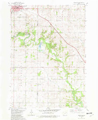 1981 Cresco SE1982 Print · USGSNortheast Iowa farmland and conservation areas are captured here in the early eighties as the Turkey River winds through the border of Howard and Winneshiek counties. You can trace the Milwaukee Road rail line or locate rural landmarks like Community Chapel and United Cem.
 - 1985 Map of Charles City
 1985 Charles City1985 Print · USGSNorthern Iowa and the Minnesota borderlands are mapped here in the mid-1980s as a thriving network of rail-side towns and river valleys. Trace local history through the Reilly Settlement, Stacyville Junction, and aviation sites like Ellen Church Field.2 unique versions available
 - 1985 Map of Decorah
 1985 Decorah1985 Print · USGSNortheast Iowa and western Wisconsin in the mid-eighties show a landscape of high bluffs and river valleys shaped by the Upper Iowa and Mississippi Rivers. Genealogists and historians can trace the paths of the Chicago Milwaukee St Paul and Pacific railroad or locate the National Cemetery and the ancient earthworks at Effigy Mounds National Monument.2 unique versions available
End of results
Showing maps 1-4 of 4
Top cities near Ridgeway
- Decorah historical maps
- Cresco historical maps
- Calmar historical maps
- Ossian historical maps
- Mabel historical maps
- Lawler historical maps
See more
Frequently asked questions
- What are the different types of historical maps available for Ridgeway?
- What is the oldest map of Ridgeway?
- Where can I purchase historical maps of Ridgeway for my home or office?
- Where can I download high-res historical maps of Ridgeway?
- Are there historical topographic maps available for Ridgeway?
- Is there historical aerial imagery available for Ridgeway?
- Where are historical maps of Ridgeway sourced from?