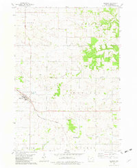
1981 Map of Ridgeway
USGS Topo · Published 1982About this map
Ridgeway serves as the primary hub in this corner of Winneshiek County, situated along the Chicago Milwaukee St Paul and Pacific railroad line. The landscape is defined by the intersection of several townships, including Lincoln, Madison, Orleans, and Bluffton, each reflecting the organized agricultural grid of the late twentieth century. Small community centers like the Madison Settlement and its associated Madison Settlement Cem illustrate the persistence of local ancestry in this rural Iowa prairie.
Find a feature on this map
26 named features on this map. Tap any name to fly to it.
Don’t see what you’re looking for? This feature index may not catch every label — zoom into the map to look around manually.
Map Details
Editions of this 1981 Ridgeway Map
This is the sole edition of this map. No revisions or reprints were ever made.
Other maps of this area

1906 · Decorah
USGS Topo · 1:125,000

1954 · Mason City
USGS Topo · 1:250,000

1957 · Mason City
USGS Topo · 1:250,000

1958 · Mason City
USGS Topo · 1:250,000

1958 · La Crosse
USGS Topo · 1:250,000

1961 · La Crosse
USGS Topo · 1:250,000

1965 · La Crosse
USGS Topo · 1:250,000

1975 · Decorah 2 NW
USGS Topo · 1:24,000

1975 · Decorah 3 NW
USGS Topo · 1:24,000
1975 · Decorah 2 NE
USGS Topo · 1:24,000