2020s Maps of Hanlontown, Iowa
Explore 2 historic maps of Hanlontown from the 2020s. These maps offer a rare glimpse into what life looked like during the 2020s — showing old roads, neighborhoods, homes, and landmarks that have changed or disappeared over time.
Whether you're researching your family's past, planning a metal detecting trip, or studying how Hanlontown's landscape evolved across the 2020s, these high-resolution maps are a powerful tool for exploring the history of this region.
- Focus on a specific era: All maps on this page are from the 2020s, giving you a focused view of this time period.
- See what’s changed: Compare century-old streets, trails, and buildings to today's modern landscape using overlays and satellite layers.
- Research with precision: Use these maps for genealogy, historical research, land use analysis, or educational projects.
- View, download, or print: Maps are fully viewable online in high resolution, and can be downloaded or printed for your own records.
Start exploring Hanlontown's history through authentic maps from the 2020s. This is your window into the past.
Hanlontown, IA maps
(2)- 2022 Map of Fertile, 2022 Print
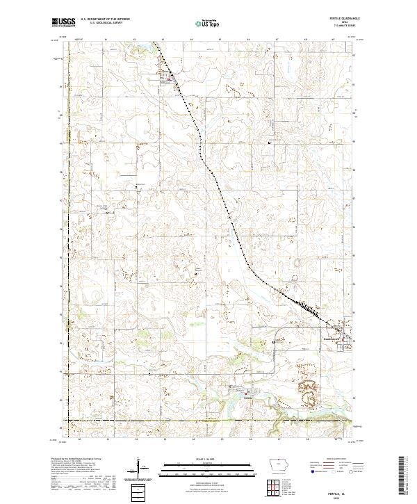 2022 Fertile2022 Print · USGSNorthern Iowa's agricultural heartland is documented here in the early twenty-first century, centered on the communities of Fertile and Hanlontown. Genealogists can locate family landmarks at Beaver Creek Lutheran Cem, Elim Cem, and Brush Point Cem along the Winnebago River.
 - 2022 Map of Fertile SE, 2022 Print
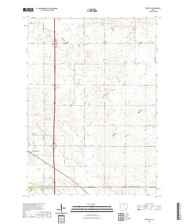 2022 Fertile SE2022 Print · USGSNorthern Iowa's farm country and the Winnebago River valley are captured here in the early 2020s. Genealogists can trace local history through several small burial sites, including the Benjegerdes Family Plot, Elk Grove Cem, and Grandview Cem.
End of results
Showing maps 1-2 of 2
Top cities near Hanlontown
- Mason City historical maps
- Clear Lake historical maps
- Garner historical maps
- Lake Mills historical maps
- Northwood historical maps
- Manly historical maps
See more
Frequently asked questions
- What are the different types of historical maps available for Hanlontown?
- What is the oldest map of Hanlontown?
- Where can I purchase historical maps of Hanlontown for my home or office?
- Where can I download high-res historical maps of Hanlontown?
- Are there historical topographic maps available for Hanlontown?
- Is there historical aerial imagery available for Hanlontown?
- Where are historical maps of Hanlontown sourced from?