Old Maps of Dickinson County, Kansas for Academic Research
Study the evolution of Dickinson County with 175 high-resolution historic maps. Whether you're teaching, researching, or modeling changes in land use, these maps provide essential visual documentation of urban, environmental, and geographic change.
- Analyze long-term change: Track patterns in development, transportation, and natural features.
- Ideal for environmental or urban studies: Support academic projects with primary historical map data.
- Use in the classroom or lab: Educators and researchers rely on these maps to bring historical context to life.
These maps are a powerful tool for teaching, research, and visualizing how Dickinson County has changed over the decades.
Dickinson County, KS maps
(175)- 1886 Map of Junction City, 1960 Print
 1886 Junction City1960 Print · USGSNortheastern Kansas in the late nineteenth century centers on the strategic military and rail hubs of the Flint Hills. Genealogists can trace the early foundations of Junction City, the sprawling Fort Riley Military Reservation, and rail-stop towns like Garrison and Stockdale.
 - 1889 Map of Junction City
 1889 Junction City1889 Print · USGSThe confluence of the Republican and Smoky Hill rivers defines this central Kansas landscape in the late nineteenth century. Genealogists and historians can trace the early footprints of Fort Riley, the rail hubs of Junction City and Manhattan, and vanished stops like Garrison and Bala.
 - 1889 Map of Abilene
 1889 Abilene1889 Print · USGSAbilene and Dickinson County appear here in the late 1880s during the height of the Kansas railroad expansion. Genealogists and historians can trace the early development of Enterprise, Gypsum City, and Navarre along the complex network of the Union Pacific Railroad and competing lines.
 - 1889 Map of Parkerville
 1889 Parkerville1889 Print · USGSMorris and Marion County townships appear here during the great western rail boom. Genealogists and historians can trace the early layouts of Parkerville, White City, and Herrington along the Chicago Kansas and Nebraska Railroad.
 - 1891 Map of Clay Center
 1891 Clay Center1891 Print · USGSClay County and northern Dickinson County were defined by competing rail lines in the early 1890s as the river valleys were first being settled. Genealogists and historians can trace the early foundations of towns like Clay Center, Wakefield, and Manchester alongside the Republican River.5 unique versions available
 - 1894 Map of Junction City
 1894 Junction City1894 Print · USGSThe Kansas frontier of the late nineteenth century comes alive as the rail-and-river network expands around Junction City. Genealogists and historians can trace early townships and rural outposts like Riley Center, Bala, and the Fort Riley Military Reservation.7 unique versions available
 - 1894 Map of Abilene
 1894 Abilene1894 Print · USGSCentral Kansas at the peak of the railroad era shows a landscape transformed by competing iron rails and river commerce. Genealogists and historians can trace family roots through early settlements like Abilene, Enterprise, and Hope, or locate old stops along the Missouri Pacific Railroad.6 unique versions available
 - 1894 Map of Parkerville
 1894 Parkerville1894 Print · USGSEastern Kansas at the height of the steam era shows a landscape transformed by competing rail lines and growing prairie towns. Genealogists and historians can trace early settlements like White City, Parkerville, and the riverside hub of Council Grove.6 unique versions available
 - 1947 Map of Fort Riley, 1954 Print
 1947 Fort Riley1954 Print · USGSPost-war Kansas comes to life where the Smoky Hill and Republican rivers meet to form the Kansas River. Genealogists and historians can trace the foundations of Fort Riley, early settlements like Milford, and dozens of rural schools including Walla Walla Sch and Acme Sch.2 unique versions available
 - 1950 Map of Alida
 1950 Alida1950 Print · USGSMid-century Kansas life along the Republican River is preserved here just as the post-war era reshaped the plains. Genealogists and local historians can locate early schools like Walla Walla School and burial grounds including Bethel Cemetery.2 unique versions available
 - 1951 Map of Milford
 1951 Milford1951 Print · USGSThe Republican River valley remains unchanged in this mid-century portrait of Milford before modern developments altered the local drainage. Genealogists and historians can locate rural landmarks like Acme School District 92 and the Milford Cemetery.
 - 1955 Map of Niles, 1956 Print
 1955 Niles1956 Print · USGSMid-century Kansas life unfolds along the winding Solomon River and the critical Union Pacific railroad line. Researchers can locate early schools and cemeteries like the Red Brick Sch (Abandoned) and Greenville Cem within the townships of Buckeye and Dayton.2 unique versions available
 - 1955 Map of Milford, 1958 Print
 1955 Milford1958 Print · USGSThe Republican River valley in the mid-1950s was a landscape of small schools and prairie churches before major reservoir projects altered the terrain. Genealogists can trace family footprints at Timber Creek Cem, Zoar School, and the Indian Grave Monument.3 unique versions available
 - 1955 Map of Alida, 1958 Print
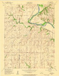 1955 Alida1958 Print · USGSThe Republican River valley of Geary and Dickinson counties is captured here in the mid-fifties, just before the landscape was reshaped. Researchers can trace the original locations of rural landmarks like Alida, the Walla Walla School, and St Johns Cem.3 unique versions available
 - 1955 Map of Manhattan, 1964 Print
 1955 Manhattan1964 Print · USGSNorth Central Kansas is captured here in the mid-fifties, just as major flood control projects began reshaping the river valleys. Genealogists can locate family sites near St. Joseph Church, Sunset Cemetery, or along the busy tracks of the Rock Island RR.4 unique versions available
 - 1955 Map of Hutchinson, 1967 Print
 1955 Hutchinson1967 Print · USGSCentral Kansas in the mid-sixties reveals a landscape of growing reservoirs and evolving transportation corridors. Trace the development of towns like Hutchinson and Abilene alongside the Union Pacific Railroad and the expanding Interstate 70.3 unique versions available
 - 1956 Map of Manhattan
 1956 Manhattan1956 Print · USGSNorth-central Kansas in the mid-fifties reveals a landscape defined by the convergence of the Republican River and Smoky Hill River. Historians can trace the rail corridors of the Union Pacific RR and Missouri Pacific RR through towns like Manhattan and Clay Center.
 - 1957 Map of Manhattan
 1957 Manhattan1957 Print · USGSNortheast Kansas in the mid-1950s reveals a landscape of expanding military installations and new water projects. Genealogists and historians can trace the rail-to-river economy through the Union Pacific RR and old settlements like Clay Center or Marysville.
 - 1959 Map of Hutchinson
 1959 Hutchinson1959 Print · USGSCentral Kansas thrives at the intersection of rail and river in the mid-1950s, as post-war aviation infrastructure reshapes the prairie. Genealogists and historians can trace the paths of the AT&SF RR through Newton and Hutchinson, or locate military sites like Smoky Hill Air Force Base.2 unique versions available
 - 1963 Map of Upland, 1964 Print
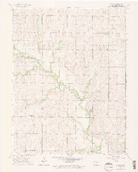 1963 Upland1964 Print · USGSThe Dickinson County prairie of the early sixties is captured here as a network of small townships and family farms. Researchers can trace rural life through the locations of Blue Ridge Sch No 130, Liberty Cem, and the settlement of Upland.2 unique versions available
 - 1963 Map of Abilene SW, 1965 Print
 1963 Abilene SW1965 Print · USGSDickinson County in the early sixties remains a landscape of traditional townships and creek-bottom agriculture. Researchers can locate family roots at New Basel Ch, Farmington Cem, or the Rural Center Sch along the winding Turkey Creek.2 unique versions available
 - 1963 Map of Holland, 1965 Print
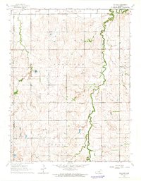 1963 Holland1965 Print · USGSDickinson County farming communities are documented here in the early sixties, showing the rural townships of Lincoln and Garfield. Genealogists can locate Green Lawn Cem, while local historians can trace the sites of Acme and the Grace & Truth Gospel Chapel.
 - 1963 Map of Solomon, 1965 Print
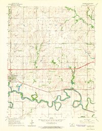 1963 Solomon1965 Print · USGSThe confluence of the Smoky Hill River and two major railroads defined life in central Kansas during the early sixties. Researchers can trace family landmarks like Willowdale Ch, Prairie Mound Cem, and the King Solomon Camp as the interstate era began.3 unique versions available
 - 1964 Map of Industry
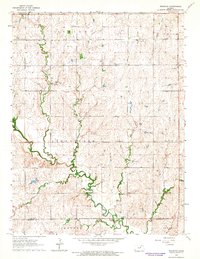 1964 Industry1964 Print · USGSAgricultural life in central Kansas during the early sixties is centered on the winding path of Chapman Creek and the settlement of Industry. Genealogists can trace local roots through numerous rural landmarks like Athelstane Cem, Bethany Chapel, and Vinzant Sch.2 unique versions available
 - 1964 Map of Elmo, 1965 Print
 1964 Elmo1965 Print · USGSAgricultural Dickinson County comes alive in the mid-1960s, showing the intersection of rail history and rural settlement. Genealogists and historians can trace the Missouri Pacific through Elmo or locate Mt Calvary Cem and Ashton Cem.3 unique versions available
Showing maps 1-25 of 175
Top cities of Dickinson County
- Abilene historical maps
- Herington historical maps
- Chapman historical maps
- Chapman historical maps
- Enterprise historical maps
- Buckeye historical maps
See more
Frequently asked questions
- What are the different types of historical maps available for Dickinson County?
- What is the oldest map of Dickinson County?
- Where can I purchase historical maps of Dickinson County for my home or office?
- Where can I download high-res historical maps of Dickinson County?
- Are there historical topographic maps available for Dickinson County?
- Is there historical aerial imagery available for Dickinson County?
- Where are historical maps of Dickinson County sourced from?