1900s (20th Century) Maps of Ellis County, Kansas
Explore 32 historic maps of Ellis County from the 1900s (20th Century). These maps offer a rare glimpse into what life looked like during the 1900s — showing old roads, neighborhoods, homes, and landmarks that have changed or disappeared over time.
Whether you're researching your family's past, planning a metal detecting trip, or studying how Ellis County's landscape evolved across the 1900s, these high-resolution maps are a powerful tool for exploring the history of this region.
- Focus on a specific era: All maps on this page are from the 1900s, giving you a focused view of this time period.
- See what’s changed: Compare century-old streets, trails, and buildings to today's modern landscape using overlays and satellite layers.
- Research with precision: Use these maps for genealogy, historical research, land use analysis, or educational projects.
- View, download, or print: Maps are fully viewable online in high resolution, and can be downloaded or printed for your own records.
Start exploring Ellis County's history through authentic maps from the 1900s. This is your window into the past.
Ellis County, KS maps
(32)- 1955 Map of Great Bend, 1966 Print
 1955 Great Bend1966 Print · USGSCentral Kansas during the mid-sixties transition reveals a landscape defined by new reservoirs and enduring rail corridors. Researchers can trace the development of towns like Hays and Great Bend or locate natural landmarks such as Round Mound and the wetlands of the Quivira National Wildlife Refuge.3 unique versions available
 - 1955 Map of Beloit, 1971 Print
 1955 Beloit1971 Print · USGSNorth Central Kansas in the mid-fifties shows a landscape of river-valley agriculture and expanding water infrastructure. Genealogists can trace the rail lines of the Union Pacific through towns like Nicodemus, Cawker City, and the State Sanatorium.3 unique versions available
 - 1957 Map of Great Bend
 1957 Great Bend1957 Print · USGSCentral Kansas at the peak of the postwar era shows a landscape of growing rail hubs and massive new water projects. Trace the routes of the Union Pacific through Hays or locate the newly formed shorelines of Cedar Bluff Reservoir and Kanopolis Reservoir.
 - 1958 Map of Great Bend
 1958 Great Bend1958 Print · USGSCentral Kansas in the late fifties reveals a landscape of high-plains agriculture and vital river crossings. Researchers can trace the development of regional hubs like Hays and Russell, or locate historic sites such as Fort Larned and the Cheyenne Bottoms wildlife area.2 unique versions available
 - 1959 Map of Beloit
 1959 Beloit1959 Print · USGSNorth Central Kansas at mid-century reveals a landscape shaped by river valleys and the expansion of massive water reservoirs. Genealogists and historians can trace the rail-town connections of Beloit and Norton or locate the site of the new Webster Dam.3 unique versions available
 - 1961 Map of Yocemento, 1962 Print
 1961 Yocemento1962 Print · USGSThe rural prairie of western Kansas in the early sixties is dominated by the rail-and-river corridor of the Union Pacific and Big Creek. Researchers can trace the layout of Yocemento and locate specific industrial sites like the Oil Field and Fort Hays Memorial Gardens.2 unique versions available
 - 1961 Map of Hays South, 1962 Print
 1961 Hays South1962 Print · USGSThe southern outskirts of Hays and the village of Munjor are captured here during the early sixties. Researchers can trace the development of Fort Hays State College or locate numerous Oil Wells and landmarks like the Old Fort Hays Museum.3 unique versions available
 - 1961 Map of Catharine, 1962 Print
 1961 Catharine1962 Print · USGSThe high plains of Ellis County come into focus during the early sixties, showing a landscape defined by ranching and resource extraction. Genealogists can trace family footprints at St Catharine Cem or Emmeram and locate numerous wells across the local Oil Field.2 unique versions available
 - 1961 Map of Hays North, 1962 Print
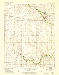
 1961 Hays North1962 Print · USGSHays was a bustling hub of education and industry in the early sixties, centered on the Union Pacific rail line. Researchers can trace the mid-century footprints of Fort Hays State College, find family plots at St Joseph Cem, or locate dozens of local quarries.3 unique versions available
 - 1961 Map of Antonino, 1962 Print
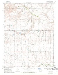
 1961 Antonino1962 Print · USGSThe rural landscape of Ellis County in the early sixties showcases a growing petroleum industry alongside traditional prairie schools. Researchers can locate Antonino and trace local landmarks like Good Hope Sch, Pleasant Hill Sch, and the extensive Oil Field development.
 - 1961 Map of Walker, 1962 Print
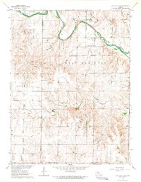
 1961 Walker1962 Print · USGSThe rural prairie along the Ellis and Russell County line is shown here in the early sixties, centered on the railroad community of Walker. Researchers can locate several country cemeteries and schools, including St Boniface Cem and Vincent Sch.2 unique versions available
 - 1961 Map of Ellis, 1962 Print
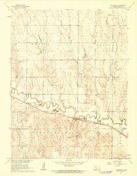
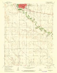
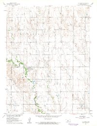
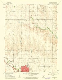
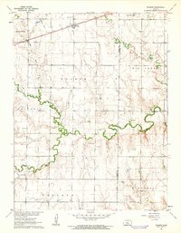
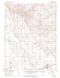
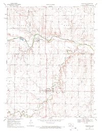
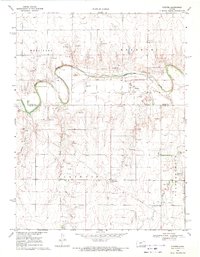
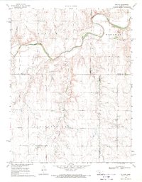
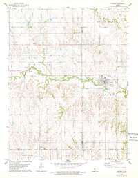
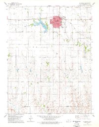
 1961 Ellis1962 Print · USGSThe town of Ellis sits at a vital rail and river junction in the early sixties, surrounded by the growing oil fields of Western Kansas. Genealogists and historians can locate St Marys Cem, trace the Union Pacific line, or find local landmarks like the Fairground.2 unique versions available
 - 1961 Map of Victoria, 1962 Print
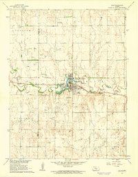
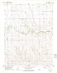
 1961 Victoria1962 Print · USGSVictoria and the surrounding Kansas plains appear here at the start of the sixties, caught between the old railroad era and the growing oil economy. Researchers can trace local heritage at St Fidelis Cem, locate the old High Sch, or follow the Union Pacific line past Toulon.
 - 1963 Map of Hill City 4 SE, 1964 Print
 1963 Hill City 4 SE1964 Print · USGSWestern Kansas at the start of the sixties shows a landscape defined by prairie watercourses and a burgeoning petroleum industry. Genealogists and local historians can trace the rural community through St John Ch, Cottonwood Grove Sch, and the extensive Oil Field north of Spring Creek.2 unique versions available
 - 1967 Map of Gorham, 1968 Print
 1967 Gorham1968 Print · USGSWestern Russell County was dominated by petroleum production and rail transit during the late sixties. Genealogists and historians can trace local families at St Marys Cem and explore industrial sites like the Gorham Oil Field and the Victoria-Pratt Airport (Abandoned).
 - 1968 Map of Liebenthal, 1971 Print
 1968 Liebenthal1971 Print · USGSThe Rush and Ellis County border comes alive in the late sixties as the river-and-rail landscape shifts between agriculture and industry. Genealogists and local historians can locate Liebenthal and Schoenchen, tracing family roots at St Joseph Cem and St Anthony Cem.
 - 1968 Map of La Crosse NW, 1971 Print
 1968 La Crosse NW1971 Print · USGSIn the late 1960s, the plains of western Kansas were a landscape of cattle, oil, and river-valley farming. Genealogists and researchers can locate family burial sites at Cordia Cem and Nickel Cem or trace the early energy economy through several Oil Wells.
 - 1969 Map of Pfeifer, 1971 Print
 1969 Pfeifer1971 Print · USGSThe Smoky Hill River valley and the rural townships of Ellis and Rush Counties are captured here in the late sixties. Genealogists and local historians can trace family sites near Pfeifer, Loretta, Holy Cross Cem, and the many Oil Wells dotting the plains.
 - 1969 Map of Otis NE, 1971 Print
 1969 Otis NE1971 Print · USGSFour rural townships in central Kansas come into focus during the late 1960s as oil extraction begins to mark the agricultural landscape. Genealogists and historians can locate family landmarks like Pleasantdale Cem or trace the winding course of the Smoky Hill River and Duck Creek.
 - 1974 Map of Ellis SE, 1977 Print
 1974 Ellis SE1977 Print · USGSWestern Kansas at the height of the 1970s oil boom reveals a landscape where historic wagon routes meet modern energy extraction. You can trace the Butterfield Trail across the plains or locate numerous oil sites like the Solburn Oil Field and West Ellis Oil Field.
 - 1978 Map of Natoma, 1979 Print
 1978 Natoma1979 Print · USGSThe Kansas plains of the late seventies come alive on this sheet centered on the rail-side community of Natoma. Researchers can trace the legacy of local industry and genealogy through the Oil Field and landmarks like Conger Cem.
 - 1978 Map of Plainville, 1979 Print
 1978 Plainville1979 Print · USGSIn the late seventies, this Rooks County landscape centered on the intersection of prairie agriculture and the booming energy industry. Trace the town's layout through landmarks like the Drive-in Theater, the Union Pacific rail line, and Plainville Twp Lake.
 - 1978 Map of Plainville SW, 1979 Print
 1978 Plainville SW1979 Print · USGSNorth of Hays in the late 1970s, the Saline River valley reveals a landscape shaped by petroleum and faith. Researchers can trace family-named sites like Kroeger and locate rural landmarks such as St Andrew Ch and Hyacinth Cem.
 - 1978 Map of Codell, 1979 Print
 1978 Codell1979 Print · USGSRooks and Ellis counties in the late 1970s reveal a landscape shaped by petroleum and rail. Researchers can trace the Union Pacific corridor through Codell and locate family burial sites at Shiloh Cem and Center Cem.
 - 1978 Map of Turkville, 1979 Print
 1978 Turkville1979 Print · USGSThe Saline River valley in Ellis County is captured here in the late 1970s, showcasing a landscape defined by petroleum production. Researchers can locate the Bemis Shutts Oil Field and trace the rural community at Turkville or the Norman Cem.
Showing maps 1-25 of 32
Top cities of Ellis County
Frequently asked questions
- What are the different types of historical maps available for Ellis County?
- What is the oldest map of Ellis County?
- Where can I purchase historical maps of Ellis County for my home or office?
- Where can I download high-res historical maps of Ellis County?
- Are there historical topographic maps available for Ellis County?
- Is there historical aerial imagery available for Ellis County?
- Where are historical maps of Ellis County sourced from?