1900s (20th Century) Maps of Junction City, Kansas
Explore 16 historic maps of Junction City from the 1900s (20th Century). These maps offer a rare glimpse into what life looked like during the 1900s — showing old roads, neighborhoods, homes, and landmarks that have changed or disappeared over time.
Whether you're researching your family's past, planning a metal detecting trip, or studying how Junction City's landscape evolved across the 1900s, these high-resolution maps are a powerful tool for exploring the history of this region.
- Focus on a specific era: All maps on this page are from the 1900s, giving you a focused view of this time period.
- See what’s changed: Compare century-old streets, trails, and buildings to today's modern landscape using overlays and satellite layers.
- Research with precision: Use these maps for genealogy, historical research, land use analysis, or educational projects.
- View, download, or print: Maps are fully viewable online in high resolution, and can be downloaded or printed for your own records.
Start exploring Junction City's history through authentic maps from the 1900s. This is your window into the past.
Junction City, KS maps
(16)- 1947 Map of Fort Riley, 1954 Print
 1947 Fort Riley1954 Print · USGSPost-war Kansas comes to life where the Smoky Hill and Republican rivers meet to form the Kansas River. Genealogists and historians can trace the foundations of Fort Riley, early settlements like Milford, and dozens of rural schools including Walla Walla Sch and Acme Sch.2 unique versions available
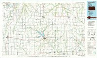
 - 1950 Map of Junction City
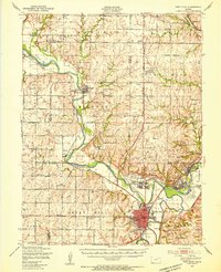
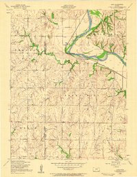
 1950 Junction City1950 Print · USGSThe Kansas river forks and the vast Fort Riley complex dominate this mid-century landscape. Researchers can trace local roots through the Highland Cemetery, Grand View School, and the early layout of Camp Forsyth.2 unique versions available
 - 1950 Map of Alida
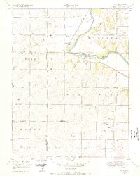 1950 Alida1950 Print · USGSMid-century Kansas life along the Republican River is preserved here just as the post-war era reshaped the plains. Genealogists and local historians can locate early schools like Walla Walla School and burial grounds including Bethel Cemetery.2 unique versions available
 - 1955 Map of Junction City, 1958 Print
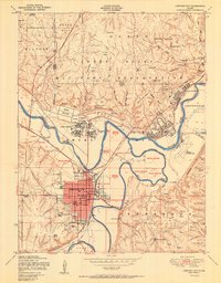
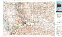
 1955 Junction City1958 Print · USGSJunction City and the Fort Riley Military Reservation are captured here in the mid-fifties at the historic meeting of the Republican and Smoky Hill rivers. Researchers can locate civic landmarks like the Courthouse, local schools, and the Kansas First Territorial Capitol.2 unique versions available
 - 1955 Map of Alida, 1958 Print
 1955 Alida1958 Print · USGSThe Republican River valley of Geary and Dickinson counties is captured here in the mid-fifties, just before the landscape was reshaped. Researchers can trace the original locations of rural landmarks like Alida, the Walla Walla School, and St Johns Cem.3 unique versions available
 - 1955 Map of Manhattan, 1964 Print
 1955 Manhattan1964 Print · USGSNorth Central Kansas is captured here in the mid-fifties, just as major flood control projects began reshaping the river valleys. Genealogists can locate family sites near St. Joseph Church, Sunset Cemetery, or along the busy tracks of the Rock Island RR.4 unique versions available
 - 1955 Map of Hutchinson, 1967 Print
 1955 Hutchinson1967 Print · USGSCentral Kansas in the mid-sixties reveals a landscape of growing reservoirs and evolving transportation corridors. Trace the development of towns like Hutchinson and Abilene alongside the Union Pacific Railroad and the expanding Interstate 70.3 unique versions available
 - 1956 Map of Manhattan
 1956 Manhattan1956 Print · USGSNorth-central Kansas in the mid-fifties reveals a landscape defined by the convergence of the Republican River and Smoky Hill River. Historians can trace the rail corridors of the Union Pacific RR and Missouri Pacific RR through towns like Manhattan and Clay Center.
 - 1957 Map of Manhattan
 1957 Manhattan1957 Print · USGSNortheast Kansas in the mid-1950s reveals a landscape of expanding military installations and new water projects. Genealogists and historians can trace the rail-to-river economy through the Union Pacific RR and old settlements like Clay Center or Marysville.
 - 1959 Map of Hutchinson
 1959 Hutchinson1959 Print · USGSCentral Kansas thrives at the intersection of rail and river in the mid-1950s, as post-war aviation infrastructure reshapes the prairie. Genealogists and historians can trace the paths of the AT&SF RR through Newton and Hutchinson, or locate military sites like Smoky Hill Air Force Base.2 unique versions available
 - 1964 Map of Wreford, 1965 Print
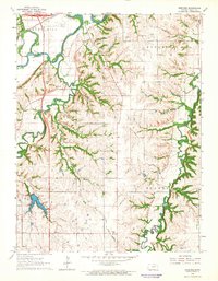 1964 Wreford1965 Print · USGSGeary County in the mid-1960s features a landscape shaped by the Smoky Hill River and established rail corridors. Genealogists and local historians can trace family roots through the Skiddy Cem, Salchow Cem, and the rural community at Wreford.
 - 1982 Map of Junction City
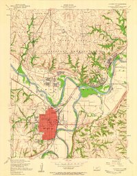
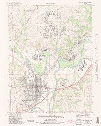 1982 Junction City1982 Print · USGSJunction City and the surrounding river forks appear in the early 1980s as a vital military and transport hub. Genealogists and historians can trace neighborhood growth alongside Fort Riley and locate landmarks like St Marys Cem and the Union Pacific line.2 unique versions available
 - 1982 Map of Milford Dam
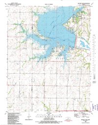 1982 Milford Dam1982 Print · USGSThe Republican River valley and the settlement of Alida were forever changed by the mid-century reservoir project shown here. Researchers can trace the submerged history of the region through Milford Lake contours and sites like Alida Cem and Good Hope Cem.
 - 1985 Map of Council Grove
 1985 Council Grove1985 Print · USGSThe Flint Hills region of Kansas thrives in the mid-1980s as a vital crossroads for major rail lines and prairie water systems. Researchers can trace the path of the Atchison Topeka and Santa Fe through small towns like Hope and Burdick or locate landmarks like Lake Kahola.2 unique versions available
 - 1985 Map of Manhattan, 1986 Print
 1985 Manhattan1986 Print · USGSThe Flint Hills and Kansas River valley are captured in the mid-eighties, showing the growth of Manhattan alongside major military and ecological preserves. Trace local history through the Union Pacific rail lines, the Treaty Boundary, and the infrastructure of Fort Riley.
 - 1990 Map of Manhattan
 1990 Manhattan1990 Print · USGSThe Kansas river valley and the Flint Hills uplands are captured here in the late twentieth century as the region balanced military expansion and water management. Trace the historic Union Pacific rail line through river towns like Wamego and St Marys, or explore the sprawling Fort Riley Military Reservation.
End of results
Showing maps 1-16 of 16
Top cities near Junction City
- Manhattan historical maps
- Chapman historical maps
- Chapman historical maps
- Ogden historical maps
- Grandview Plaza historical maps
- Wakefield historical maps
See more
Frequently asked questions
- What are the different types of historical maps available for Junction City?
- What is the oldest map of Junction City?
- Where can I purchase historical maps of Junction City for my home or office?
- Where can I download high-res historical maps of Junction City?
- Are there historical topographic maps available for Junction City?
- Is there historical aerial imagery available for Junction City?
- Where are historical maps of Junction City sourced from?