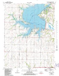
1982 Map of Milford Dam
USGS Topo · Published 1982About this map
Milford Lake dominates the landscape in this early 1980s topography, illustrating the significant hydrological engineering that transformed the Republican River valley. The map is particularly valuable for genealogists and local historians as it documents the remnants of the settlement of Alida, which was largely displaced by the reservoir's waters. Submerged contours and several relocated or preserved landmarks, such as Alida Cem, St Johns Cem, and Alida-Upland Cem, provide a critical spatial record of the area's pre-dam history.
Find a feature on this map
23 named features on this map. Tap any name to fly to it.
Don’t see what you’re looking for? This feature index may not catch every label — zoom into the map to look around manually.
Map Details
Editions of this 1982 Milford Dam Map
This is the sole edition of this map. No revisions or reprints were ever made.
Other maps of this area

1886 · Junction City
USGS Topo · 1:125,000

1889 · Junction City
USGS Topo · 1:125,000

1889 · Abilene
USGS Topo · 1:125,000

1889 · Parkerville
USGS Topo · 1:125,000

1891 · Clay Center
USGS Topo · 1:125,000

1894 · Junction City
USGS Topo · 1:125,000

1894 · Abilene
USGS Topo · 1:125,000

1894 · Parkerville
USGS Topo · 1:125,000

1947 · Fort Riley
USGS Topo · 1:62,500

1950 · Junction City
USGS Topo · 1:24,000