1900s (20th Century) Maps of Harper County, Kansas
Explore 38 historic maps of Harper County from the 1900s (20th Century). These maps offer a rare glimpse into what life looked like during the 1900s — showing old roads, neighborhoods, homes, and landmarks that have changed or disappeared over time.
Whether you're researching your family's past, planning a metal detecting trip, or studying how Harper County's landscape evolved across the 1900s, these high-resolution maps are a powerful tool for exploring the history of this region.
- Focus on a specific era: All maps on this page are from the 1900s, giving you a focused view of this time period.
- See what’s changed: Compare century-old streets, trails, and buildings to today's modern landscape using overlays and satellite layers.
- Research with precision: Use these maps for genealogy, historical research, land use analysis, or educational projects.
- View, download, or print: Maps are fully viewable online in high resolution, and can be downloaded or printed for your own records.
Start exploring Harper County's history through authentic maps from the 1900s. This is your window into the past.
Harper County, KS maps
(38)- 1955 Map of Wichita, 1959 Print
 1955 Wichita1959 Print · USGSSouth-central Kansas comes alive in the mid-1950s as Wichita grows into its role as a regional industrial and military powerhouse. Trace the rail-and-river network connecting El Dorado and Arkansas City through the Atchison Topeka and Santa Fe lines.3 unique versions available
 - 1955 Map of Enid, 1966 Print
 1955 Enid1966 Print · USGSNorth-central Oklahoma's transition from open plains to the blackjack hills of the Osage Indian Reservation is captured in the mid-1950s. Researchers can trace the development of the Naval Reserve Oil Field, the grounds of Vance AFB, and the early footprints of Tulsa and Stillwater.4 unique versions available
 - 1955 Map of Woodward, 1967 Print
 1955 Woodward1967 Print · USGSNorthwest Oklahoma and the bordering plains are captured during the mid-sixties, showing a landscape defined by river valleys and massive water projects. Researchers can trace family roots in towns like Woodward and Alva or locate landmarks such as the Western Oklahoma State Hospital and Kegelman AF.3 unique versions available
 - 1955 Map of Pratt, 1968 Print
 1955 Pratt1968 Print · USGSSouth-central Kansas during the mid-fifties presents a landscape of sprawling oil fields and critical rail junctions. Researchers can trace the paths of the Atchison Topeka and Santa Fe railroad or locate local landmarks like the Blue Ridge Community House and Camp Carlisle.3 unique versions available
 - 1958 Map of Enid
 1958 Enid1958 Print · USGSNorthern Oklahoma is mapped here in the late fifties, showcasing a dense network of petroleum production and historic tribal lands. Researchers can trace the legacy of the Osage Indian Reservation, early energy hubs like the Cushing Oil Field, and the Chilocco Indian Agricultural School.2 unique versions available
 - 1958 Map of Wichita
 1958 Wichita1958 Print · USGSSouth Central Kansas in the late fifties was a landscape of aviation industry, oil exploration, and expanding turnpikes. Researchers can trace mid-century growth through McConnell Air Force Base, major facilities for Cessna Aircraft Company, and the active El Dorado Oil Field.
 - 1958 Map of Woodward
 1958 Woodward1958 Print · USGSNorthwest Oklahoma and the neighboring panhandle borders are shown here during a period of steady mid-century growth. Researchers can trace the rail networks of the Atchison Topeka and Santa Fe and locate landmarks like the Western Oklahoma State Hospital and Port Supply Reservoir.2 unique versions available
 - 1959 Map of Pratt
 1959 Pratt1959 Print · USGSSouth-central Kansas thrived as a rail and agricultural hub in the late fifties, where the Arkansas River meets a vast grid of section roads. Researchers can trace the path of the Missouri Pacific railroad through settlements like Turon and Stafford, or locate family landmarks like the Prairie Oak School.2 unique versions available
 - 1968 Map of Wakita, 1970 Print
 1968 Wakita1970 Print · USGSGrant County, Oklahoma, was a thriving center for the energy industry and rail transport during the late sixties. Researchers can trace the Atchison Topeka and Santa Fe rail line through Wakita or locate the Gibbon Cem and Gibbon settlement.
 - 1968 Map of Wakita NE, 1970 Print
 1968 Wakita NE1970 Print · USGSThe Oklahoma-Kansas borderlands in the late sixties reveal a landscape of rural townships and active energy exploration. Genealogists and local historians can trace the Wakita Trend Gas Field and family sites near Springdale Cem or Pond Creek.
 - 1969 Map of Amorita, 1971 Print
 1969 Amorita1971 Print · USGSAlfalfa County's borderlands are captured here in the late sixties, where the Medicine Lodge River winds through a landscape of farming and oil extraction. Local historians can trace the Old Railroad Grade and find family sites at the Byron-Amorita Cem or near the small town of Byron.
 - 1969 Map of Manchester, 1971 Print
 1969 Manchester1971 Print · USGSThe Oklahoma-Kansas state line meets at the town of Manchester in the late sixties, where the local economy follows the tracks of the Atchison Topeka and Santa Fe. Genealogists can locate family sites like the IOOF Cem or the SS Peter and Paul Cem and its nearby church.2 unique versions available
 - 1969 Map of Manchester NW, 1971 Print
 1969 Manchester NW1971 Print · USGSAlfalfa County farmsteads and the Kansas borderlands are captured here in the late sixties as the rural landscape evolved. Researchers can trace the path of the Old Railroad Grade and locate local centers like the Mennonite Cem or Willow Glen Ch.2 unique versions available
 - 1971 Map of Norwich, 1972 Print
 1971 Norwich1972 Print · USGSThe rural landscape around Norwich and Milton is shown here in the early 1970s, where two major rail lines intersect among the Kansas townships. Genealogists and historians can trace the Old Indian Treaty Boundary and locate family markers at Upchurch Cem or Stitch Cem.
 - 1971 Map of Bluff City West, 1972 Print
 1971 Bluff City West1972 Print · USGSNear the southern Kansas border in the early seventies, this region reveals a landscape of prairie agriculture and winding creek beds. Genealogists and historians can trace the Old Indian Treaty Boundary and locate landmarks like Wilcox Landing Field or the Atchison Topeka and Santa Fe rail line.
 - 1971 Map of Adams, 1972 Print
 1971 Adams1972 Print · USGSKingman County and the surrounding townships are captured in the early 1970s, showing a landscape defined by prairie rivers and energy infrastructure. Researchers can trace the Old Indian Treaty Boundary and locate specific sites like the Adams settlement and the Oil Field wells.
 - 1971 Map of Argonia, 1972 Print
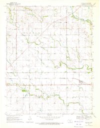
 1971 Argonia1972 Print · USGSSumner and Harper Counties come together in the early 1970s at this bustling prairie rail junction. Researchers can trace the dual lines of the Atchison Topeka and Santa Fe and Missouri Pacific near Argonia and the Argonia Cem.
 - 1971 Map of Danville, 1972 Print
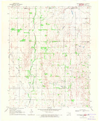
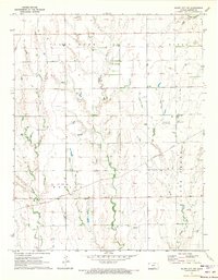
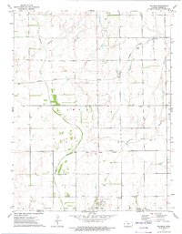
 1971 Danville1972 Print · USGSDanville and the surrounding Harper County prairies are shown here in the early 1970s. Researchers can locate specific family sites such as Chicaskia Ch, local cemeteries like Pleasant Valley Cem, and the path of the Atchison Topeka and Santa Fe.
 - 1971 Map of Bluff City East, 1973 Print
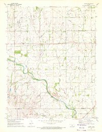
 1971 Bluff City East1973 Print · USGSThe Kansas borderlands south of Bluff City come to life in this early 1970s survey of Harper and Sumner counties. Researchers can trace the Old Indian Treaty Boundary and locate family history at Pleasant Hill Cem or Devore Cem.
 - 1971 Map of Freeport, 1973 Print
 1971 Freeport1973 Print · USGSThe rural landscape of southern Kansas is captured here in the early seventies, centered on the small community of Freeport. Genealogists and local historians can trace the Missouri Pacific rail line and locate landmarks like H & S Cem or the Tracy Landing Field.
 - 1971 Map of Bluff City NW, 1973 Print
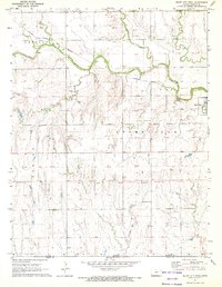
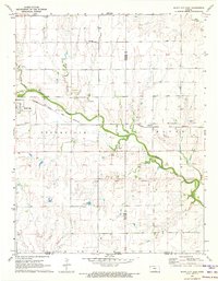
 1971 Bluff City NW1973 Print · USGSHarper County's rural landscape is captured here in the early seventies, where the energy industry and rail transport intersect. Trace the path of the Missouri Pacific or locate local landmarks like Pilot Knob and the Stohrville Oil Field.
 - 1972 Map of Attica, 1975 Print
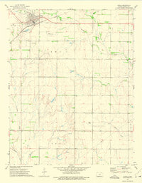 1972 Attica1975 Print · USGSThe rail-and-road network of Attica and Midway is captured here during the early 1970s. Researchers can trace the Atchison Topeka and Santa Fe line, locate the Attica Cem, and find regional landmarks like the Goemann Landing Strip.
 - 1972 Map of Anthony, 1975 Print
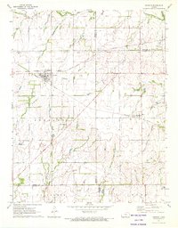
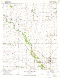
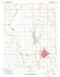 1972 Anthony1975 Print · USGSThe Harper County seat of Anthony is captured here during the early 1970s, showing a well-established plains community and its vital rail connections. Genealogists and researchers can locate Spring Grove Cemetery, trace the path of the Missouri Pacific railroad, or find the site of the old Drive-in Theater.2 unique versions available
 - 1972 Map of Spring, 1975 Print
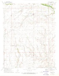
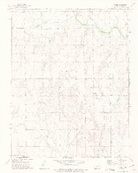 1972 Spring1975 Print · USGSIn the early seventies, the borderlands of Harper County were defined by rural rail lines and the straight path of the Old Indian Treaty Boundary. Researchers can trace the legacy of the Spring settlement and locate rural landmarks like Hopewell Ch and Burchfiel Ch.
 - 1972 Map of Waldron, 1975 Print
 1972 Waldron1975 Print · USGSThe Kansas-Oklahoma border comes to life in the 1970s, showing a prairie landscape still oriented around the railroad and historic treaty lines. Genealogists can locate family burial sites at Goss Cem and Waldron Cem while tracing the Old Indian Treaty Boundary.
Showing maps 1-25 of 38
Top cities of Harper County
- Anthony historical maps
- Harper historical maps
- Attica historical maps
- Bluff City historical maps
- Danville historical maps
- Waldron historical maps
See more
Frequently asked questions
- What are the different types of historical maps available for Harper County?
- What is the oldest map of Harper County?
- Where can I purchase historical maps of Harper County for my home or office?
- Where can I download high-res historical maps of Harper County?
- Are there historical topographic maps available for Harper County?
- Is there historical aerial imagery available for Harper County?
- Where are historical maps of Harper County sourced from?