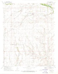
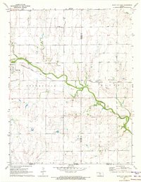
1971 Map of Freeport
USGS Topo · Published 1973About this map
Freeport serves as the central settlement on this southern Kansas landscape, where the Missouri Pacific railroad cuts a diagonal path through the prairie. The terrain is defined by the winding course of the Chikaskia River in the northeast and the drainage patterns of Silver Creek and Spring Branch further south. For those tracing family history in the area, the map specifically locates the H & S Cem and the Freeport Cem, providing exact spatial context for these local landmarks. A notable aviation feature, the Tracy Landing Field, sits near the border of Dixon and Morris townships, indicating the rural infrastructure of the early 1970s. The survey also captures the boundary between Harper and Sumner Counties, illustrating how the township system of Odell and its neighbors organized the agricultural land.
Find a feature on this map
14 named features on this map. Tap any name to fly to it.
Don’t see what you’re looking for? This feature index may not catch every label — zoom into the map to look around manually.
Map Details
Editions of this 1971 Freeport Map
This is the sole edition of this map. No revisions or reprints were ever made.
Other maps of this area

1889 · Caldwell
USGS Topo · 1:125,000

1893 · Caldwell
USGS Topo · 1:125,000

1897 · Caldwell
USGS Topo · 1:125,000

1955 · Wichita
USGS Topo · 1:250,000

1958 · Wichita
USGS Topo · 1:250,000

1971 · Caldwell NW
USGS Topo · 1:24,000
1971 · Bluff City West
USGS Topo · 1:24,000
1971 · Argonia
USGS Topo · 1:24,000
1971 · Danville
USGS Topo · 1:24,000
1971 · Bluff City East
USGS Topo · 1:24,000