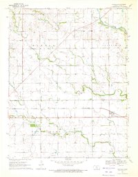
1971 Map of Danville
USGS Topo · Published 1972About this map
Danville and Runnymede anchor this agricultural landscape in eastern Harper County, where the plains are defined by the winding course of the Chikaskia River and several smaller tributaries like Spring Creek and Sand Creek. The map documents a period of active land use, featuring three separate aviation sites including Latta Landing Strip, Park Airport, and Kaypod Airport. In the southern portion of the quadrangle, Pilot Knob provides a distinct topographic high point above the surrounding farmsteads.
Find a feature on this map
19 named features on this map. Tap any name to fly to it.
Don’t see what you’re looking for? This feature index may not catch every label — zoom into the map to look around manually.
Map Details
Editions of this 1971 Danville Map
This is the sole edition of this map. No revisions or reprints were ever made.
Other maps of this area

1889 · Anthony
USGS Topo · 1:125,000

1889 · Caldwell
USGS Topo · 1:125,000

1891 · Anthony
USGS Topo · 1:125,000

1893 · Caldwell
USGS Topo · 1:125,000

1897 · Caldwell
USGS Topo · 1:125,000

1955 · Wichita
USGS Topo · 1:250,000

1955 · Pratt
USGS Topo · 1:250,000

1958 · Wichita
USGS Topo · 1:250,000

1959 · Pratt
USGS Topo · 1:250,000
1971 · Norwich
USGS Topo · 1:24,000