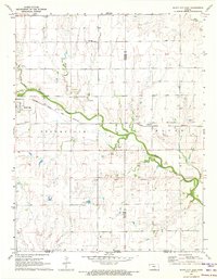
1971 Map of Bluff City East
USGS Topo · Published 1973About this map
Bluff City anchors this 1971 survey, situated along the Atchison Topeka and Santa Fe railroad in south-central Kansas. The landscape is defined by the winding course of Bluff Creek, which cuts through the townships of Stohrville and Bluff. A significant historical landmark, the Old Indian Treaty Boundary, runs east-west across the southern portion of the map, marking a line of former territorial division.
Find a feature on this map
20 named features on this map. Tap any name to fly to it.
Don’t see what you’re looking for? This feature index may not catch every label — zoom into the map to look around manually.
Map Details
Editions of this 1971 Bluff City East Map
This is the sole edition of this map. No revisions or reprints were ever made.
Other maps of this area

1889 · Caldwell
USGS Topo · 1:125,000

1893 · Caldwell
USGS Topo · 1:125,000

1897 · Caldwell
USGS Topo · 1:125,000

1955 · Wichita
USGS Topo · 1:250,000

1955 · Enid
USGS Topo · 1:250,000

1958 · Enid
USGS Topo · 1:250,000

1958 · Wichita
USGS Topo · 1:250,000

1968 · Wakita
USGS Topo · 1:24,000

1968 · Renfrow
USGS Topo · 1:24,000
1968 · Wakita NE
USGS Topo · 1:24,000