1900s (20th Century) Maps of Hesston, Kansas
Explore 8 historic maps of Hesston from the 1900s (20th Century). These maps offer a rare glimpse into what life looked like during the 1900s — showing old roads, neighborhoods, homes, and landmarks that have changed or disappeared over time.
Whether you're researching your family's past, planning a metal detecting trip, or studying how Hesston's landscape evolved across the 1900s, these high-resolution maps are a powerful tool for exploring the history of this region.
- Focus on a specific era: All maps on this page are from the 1900s, giving you a focused view of this time period.
- See what’s changed: Compare century-old streets, trails, and buildings to today's modern landscape using overlays and satellite layers.
- Research with precision: Use these maps for genealogy, historical research, land use analysis, or educational projects.
- View, download, or print: Maps are fully viewable online in high resolution, and can be downloaded or printed for your own records.
Start exploring Hesston's history through authentic maps from the 1900s. This is your window into the past.
Hesston, KS maps
(8)- 1955 Map of Hutchinson, 1967 Print
 1955 Hutchinson1967 Print · USGSCentral Kansas in the mid-sixties reveals a landscape of growing reservoirs and evolving transportation corridors. Trace the development of towns like Hutchinson and Abilene alongside the Union Pacific Railroad and the expanding Interstate 70.3 unique versions available
 - 1959 Map of Hutchinson
 1959 Hutchinson1959 Print · USGSCentral Kansas thrives at the intersection of rail and river in the mid-1950s, as post-war aviation infrastructure reshapes the prairie. Genealogists and historians can trace the paths of the AT&SF RR through Newton and Hutchinson, or locate military sites like Smoky Hill Air Force Base.2 unique versions available
 - 1959 Map of Zimmerdale, 1960 Print
 1959 Zimmerdale1960 Print · USGSHarvey County agricultural lands are captured here in the late fifties, showing the rural grid between Newton and Halstead. Researchers can locate the Pennsylvania Mennonite Ch, the Prouty School, and rail lines including the Missouri Pacific.4 unique versions available
 - 1965 Map of Goessel, 1966 Print
 1965 Goessel1966 Print · USGSMarion and Harvey counties appear in the mid-1960s as a structured agricultural landscape centered on the town of Goessel. Genealogists and local historians can trace rural roots through landmarks like Highland Ch, Grange Hall, and Greenfield Cem.
 - 1965 Map of Hesston, 1966 Print
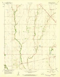
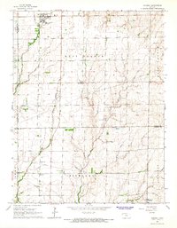
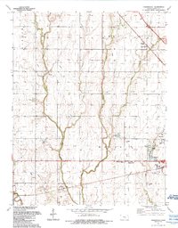
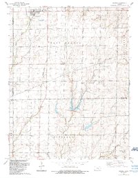
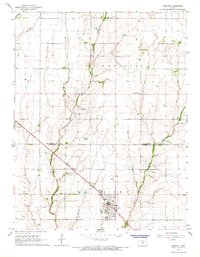 1965 Hesston1966 Print · USGSHesston and its surrounding Kansas farmland are shown in the mid-sixties, capturing the intersection of academic life and the railroad economy. Researchers can locate family roots at Hesston College, Meridian Ch, or the Freedom Cem while tracing the Missouri Pacific rail corridor.2 unique versions available
 - 1985 Map of Hutchinson
 1985 Hutchinson1985 Print · USGSCentral Kansas in the mid-1980s is revealed here as a landscape of productive plains, rail corridors, and growing college towns. Genealogists and historians can trace family plots at McPherson Cemetery and follow the routes of the Missouri Pacific through settlements like Moundridge and Hesston.2 unique versions available
 - 1989 Map of Zimmerdale, 1990 Print
 1989 Zimmerdale1990 Print · USGSHarvey County’s agricultural heartland is documented here in the late eighties, showing the convergence of the Emma Creek system. Researchers can locate numerous local burial sites including Royer Cem and Church of God Cem, or trace the outskirts of Newton.
 - 1989 Map of Goessel, 1990 Print
 1989 Goessel1990 Print · USGSMarion and McPherson counties come together in this late-century survey of a landscape shaped by the Sixth Principal Meridian. Researchers can trace community roots through the Goessel townsite and several rural landmarks like Tabor Ch, Highland Ch, and Schoenthal Cem.
End of results
Showing maps 1-8 of 8
Top cities near Hesston
- Newton historical maps
- McPherson historical maps
- Hillsboro historical maps
- Halstead historical maps
- Sedgwick historical maps
- Moundridge historical maps
See more
Frequently asked questions
- What are the different types of historical maps available for Hesston?
- What is the oldest map of Hesston?
- Where can I purchase historical maps of Hesston for my home or office?
- Where can I download high-res historical maps of Hesston?
- Are there historical topographic maps available for Hesston?
- Is there historical aerial imagery available for Hesston?
- Where are historical maps of Hesston sourced from?