1900s (20th Century) Maps of Hodgeman County, Kansas
Explore 38 historic maps of Hodgeman County from the 1900s (20th Century). These maps offer a rare glimpse into what life looked like during the 1900s — showing old roads, neighborhoods, homes, and landmarks that have changed or disappeared over time.
Whether you're researching your family's past, planning a metal detecting trip, or studying how Hodgeman County's landscape evolved across the 1900s, these high-resolution maps are a powerful tool for exploring the history of this region.
- Focus on a specific era: All maps on this page are from the 1900s, giving you a focused view of this time period.
- See what’s changed: Compare century-old streets, trails, and buildings to today's modern landscape using overlays and satellite layers.
- Research with precision: Use these maps for genealogy, historical research, land use analysis, or educational projects.
- View, download, or print: Maps are fully viewable online in high resolution, and can be downloaded or printed for your own records.
Start exploring Hodgeman County's history through authentic maps from the 1900s. This is your window into the past.
Hodgeman County, KS maps
(38)- 1955 Map of Great Bend, 1966 Print
 1955 Great Bend1966 Print · USGSCentral Kansas during the mid-sixties transition reveals a landscape defined by new reservoirs and enduring rail corridors. Researchers can trace the development of towns like Hays and Great Bend or locate natural landmarks such as Round Mound and the wetlands of the Quivira National Wildlife Refuge.3 unique versions available
 - 1955 Map of Pratt, 1968 Print
 1955 Pratt1968 Print · USGSSouth-central Kansas during the mid-fifties presents a landscape of sprawling oil fields and critical rail junctions. Researchers can trace the paths of the Atchison Topeka and Santa Fe railroad or locate local landmarks like the Blue Ridge Community House and Camp Carlisle.3 unique versions available
 - 1955 Map of Dodge City, 1968 Print
 1955 Dodge City1968 Print · USGSSouthwest Kansas in the mid-fifties reveals an expansive landscape of cattle towns, early gas fields, and prairie outposts. Researchers can trace rural school districts like Moundview and Good Luck or locate the Kansas State Game Farm near Lakin.3 unique versions available
 - 1955 Map of Scott City, 1969 Print
 1955 Scott City1969 Print · USGSWestern Kansas in the mid-fifties is captured here as a landscape of rural schoolhouses and significant rail corridors. Family historians can trace the locations of Skyline and Beaver Creek Schools or follow the Union Pacific line through Oakley and Sharon Springs.4 unique versions available
 - 1957 Map of Great Bend
 1957 Great Bend1957 Print · USGSCentral Kansas at the peak of the postwar era shows a landscape of growing rail hubs and massive new water projects. Trace the routes of the Union Pacific through Hays or locate the newly formed shorelines of Cedar Bluff Reservoir and Kanopolis Reservoir.
 - 1958 Map of Dodge City
 1958 Dodge City1958 Print · USGSSouthwest Kansas in the late fifties shows a landscape of river-valley agriculture and burgeoning energy infrastructure. Genealogists can trace rural life through numerous landmarks like Fairview Cemetery, the Goodwell School, and Concord Church.
 - 1958 Map of Great Bend
 1958 Great Bend1958 Print · USGSCentral Kansas in the late fifties reveals a landscape of high-plains agriculture and vital river crossings. Researchers can trace the development of regional hubs like Hays and Russell, or locate historic sites such as Fort Larned and the Cheyenne Bottoms wildlife area.2 unique versions available
 - 1958 Map of Scott City
 1958 Scott City1958 Print · USGSWestern Kansas at the peak of the post-war era reveals a landscape of high-plains agriculture and vital rail junctions. Genealogists and historians can trace old country school sites like Prairie Bell School, the landmark Chalk Pyramids, and small stops along the Union Pacific and Missouri Pacific.
 - 1959 Map of Pratt
 1959 Pratt1959 Print · USGSSouth-central Kansas thrived as a rail and agricultural hub in the late fifties, where the Arkansas River meets a vast grid of section roads. Researchers can trace the path of the Missouri Pacific railroad through settlements like Turon and Stafford, or locate family landmarks like the Prairie Oak School.2 unique versions available
 - 1959 Map of Dodge City
 1959 Dodge City1959 Print · USGSSouthwest Kansas in the mid-fifties is captured at its agricultural height, centered on the vital rail and river hubs of Dodge City and Garden City. Genealogists and local historians can trace rural school districts like Shockey School and Hickok School or locate the Fairview Cemetery.
 - 1968 Map of Dodge City NE, 1969 Print
 1968 Dodge City NE1969 Print · USGSThe rural landscapes of Hodgeman and Ford counties are documented here in the late sixties, showing a period of agricultural stability and early industrial infrastructure. Researchers can trace the winding Saw Log Creek, identify local landmarks like St Michaels Cem, and explore the sprawling townships of South Roscoe and Grandview.
 - 1968 Map of Dodge City NW, 1969 Print
 1968 Dodge City NW1969 Print · USGSThe High Plains of Western Kansas appear in the late sixties at the intersection of Gray, Hodgeman, and Ford counties. Genealogists and researchers can trace the rural landscape across South Roscoe and Royal, following Buckner Creek and its South Fork.2 unique versions available
 - 1969 Map of Jetmore, 1971 Print
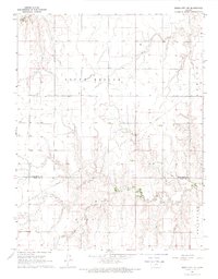
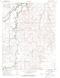
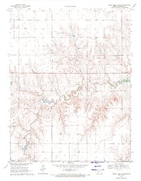
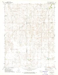
 1969 Jetmore1971 Print · USGSHodgeman County, Kansas, was a quiet agricultural hub in the late sixties, centered on the terminus of the A T & S F railroad. Researchers can trace local landmarks like Fairmount Cemetery, the High Sch, and the winding path of Buckner Creek.
 - 1970 Map of Jetmore SE, 1971 Print
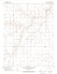
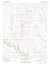
 1970 Jetmore SE1971 Print · USGSWestern Kansas ranching and energy production intersect in the 1970s along the Buckner Creek valley. Researchers can trace the Atchison Topeka and Santa Fe rail line or locate specific historical sites like the Lippoldt Oil Field and Hodgeman County State Park.
 - 1970 Map of Hanston, 1971 Print
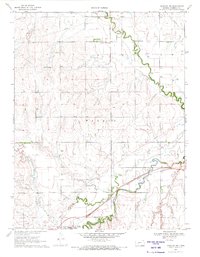
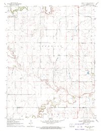
 1970 Hanston1971 Print · USGSHodgeman County's agricultural and energy landscape comes into focus around 1970, centered on the community of Hanston. Researchers can trace early infrastructure and family landmarks through features like St Anthony Cem, the Orwell settlement, and several active oil fields.
 - 1970 Map of Hanston NW, 1971 Print
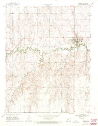
 1970 Hanston NW1971 Print · USGSWestern Kansas at the start of the 1970s shows a landscape shaped by its waterways and the steel of the Atchison Topeka and Santa Fe. Genealogists and local historians can locate the Hanston Cem, the Hodgeman Community Ch, and Dungans Crossing.
 - 1970 Map of Jetmore NE, 1971 Print
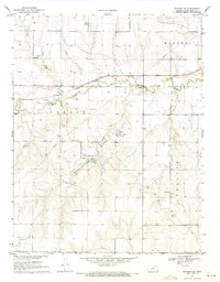
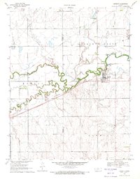
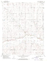
 1970 Jetmore NE1971 Print · USGSWestern Hodgeman County at the start of the 1970s shows a landscape shaped by the petroleum industry and rural settlement. Researchers can trace the development of the Hanston - Oppy Oil Field or locate the local Mennonite Ch and Cem.
 - 1970 Map of Jetmore NW, 1971 Print
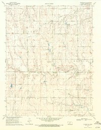
 1970 Jetmore NW1971 Print · USGSHodgeman County in the early seventies shows a landscape where prairie agriculture meets the petroleum boom. Researchers can trace the development of energy infrastructure through the Goebel East Oil Field, the Pawnee River valley, and several localized Drill Holes.
 - 1970 Map of Burdett, 1971 Print
 1970 Burdett1971 Print · USGSThe rural landscape around the Pawnee River is captured here during the 1970s, showing the intersection of rail, water, and local aviation. Researchers can locate the Browns Grove Cem and trace the Atchison Topeka and Santa Fe line through Burdett.
 - 1970 Map of Horse Thief Canyon, 1971 Print
 1970 Horse Thief Canyon1971 Print · USGSHigh plains topography and remote townships define this Hodgeman County landscape in the early seventies. Researchers can trace the drainage of Buckner Creek or locate local landmarks like the Caliche Pit and Horse Thief Canyon across the townships of Hallet and Benton.
 - 1970 Map of Bazine SE, 1972 Print
 1970 Bazine SE1972 Print · USGSPawnee and Ness Counties are captured here during a peak era of petroleum production in the early seventies. Genealogists and local historians can trace the specific locations of the Schadel Oil Field, Steffen Oil Field, and landmarks like High Point.
 - 1970 Map of Ness City SW, 1972 Print
 1970 Ness City SW1972 Print · USGSNess and Hodgeman counties are captured here in the early seventies, showing a rural landscape where the energy economy meets traditional prairie life. Researchers can trace the Petersilie Oil Field and find family-history landmarks like Kunze Cem and the settlement of Harold.
 - 1970 Map of Bazine SW, 1972 Print
 1970 Bazine SW1972 Print · USGSNess and Hodgeman Counties are captured here at the height of the regional petroleum boom in the early seventies. Local researchers can trace the winding Pawnee River near Marena and locate family history at St John the Baptist Cem or Crandall Cem.
 - 1970 Map of Ness City SE, 1972 Print
 1970 Ness City SE1972 Print · USGSThe Kansas plains north of the Hodgeman county line are captured here in 1970, showing a landscape defined by the Pawnee River and the Riverside Oil Field. Researchers can locate Riverside Cem and the settlement of Riverside, while tracing local industry via several Sandpits.
 - 1972 Map of Hanston SE, 1974 Print
 1972 Hanston SE1974 Print · USGSWestern Kansas townships and drainage basins are captured here in the early seventies, showing a landscape defined by large-scale ranching and early energy development. Genealogists and researchers can trace the rural boundaries of Marena and Sterling or locate early industrial sites like the Caliche Pit and Gas Well.
Showing maps 1-25 of 38
Top cities of Hodgeman County
Frequently asked questions
- What are the different types of historical maps available for Hodgeman County?
- What is the oldest map of Hodgeman County?
- Where can I purchase historical maps of Hodgeman County for my home or office?
- Where can I download high-res historical maps of Hodgeman County?
- Are there historical topographic maps available for Hodgeman County?
- Is there historical aerial imagery available for Hodgeman County?
- Where are historical maps of Hodgeman County sourced from?