1970s Maps of Jewell County, Kansas
Explore 9 historic maps of Jewell County from the 1970s. These maps offer a rare glimpse into what life looked like during the 1970s — showing old roads, neighborhoods, homes, and landmarks that have changed or disappeared over time.
Whether you're researching your family's past, planning a metal detecting trip, or studying how Jewell County's landscape evolved across the 1970s, these high-resolution maps are a powerful tool for exploring the history of this region.
- Focus on a specific era: All maps on this page are from the 1970s, giving you a focused view of this time period.
- See what’s changed: Compare century-old streets, trails, and buildings to today's modern landscape using overlays and satellite layers.
- Research with precision: Use these maps for genealogy, historical research, land use analysis, or educational projects.
- View, download, or print: Maps are fully viewable online in high resolution, and can be downloaded or printed for your own records.
Start exploring Jewell County's history through authentic maps from the 1970s. This is your window into the past.
Jewell County, KS maps
(9)- 1973 Map of Portis NE, 1975 Print
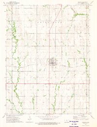
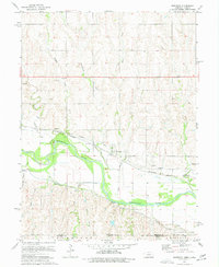
 1973 Portis NE1975 Print · USGSSmith County, Kansas, in the early seventies shows a landscape of upland plateaus and intricate creek valleys before modern consolidation. Genealogists and local historians can locate the Townhall, Oak Creek Ch, and family burial sites like North Oak Creek Cem.
 - 1973 Map of Mc Cracken Branch, 1975 Print
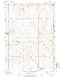 1973 Mc Cracken Branch1975 Print · USGSNorth-central Kansas farmland near the Nebraska border is captured here in the early seventies, showcasing a classic grid of rural townships. Genealogists can trace family footprints through sites like Oriole Cem, Mt Hope Ch, and the local Townhall.
 - 1973 Map of Lebanon, 1975 Print
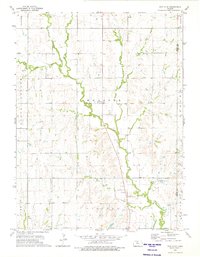
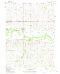
 1973 Lebanon1975 Print · USGSLebanon and the surrounding Smith County countryside are captured here in the early seventies as a thriving rail-and-ranching landscape. Genealogists can locate family landmarks like Sweet Home Cem and Price Cem, or trace the tracks of the Chicago and Pacific Rock Island railroad.
 - 1974 Map of Amboy, 1977 Print
 1974 Amboy1977 Print · USGSThe Nebraska-Kansas border region comes into focus during the mid-seventies as the Republican River winds past Amboy. Genealogists and historians can trace rail history at Lester Junction or locate family plots at Pleasant Hill Cem and Wagoner Cem.
 - 1974 Map of Guide Rock, 1977 Print
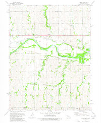
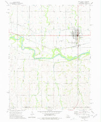
 1974 Guide Rock1977 Print · USGSThe Nebraska-Kansas border comes alive in the mid-1970s, centered on the historic river crossing at Guide Rock. Local historians can trace the paths of the Courtland Canal, find early burial sites like Columbia Cem, and locate The Guide Rock (Pa Hur) south of the river.
 - 1974 Map of Red Cloud, 1977 Print
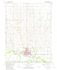
 1974 Red Cloud1977 Print · USGSRed Cloud and the surrounding valley along the Nebraska-Kansas border are captured here during the mid-seventies. Genealogists and local historians can trace rural burial grounds like Murphy Cem and Gust Cem, or locate the curious Indian Oven Ruins near the river.
 - 1974 Map of Superior, 1977 Print
 1974 Superior1977 Print · USGSThe Nebraska-Kansas border comes alive in this mid-seventies survey of Nuckolls and Jewell counties. Genealogists can trace local roots at Ladies Evergreen Cemetery or locate rural landmarks like Beaver-Ville School and the remote outpost of Smyrna.2 unique versions available
 - 1974 Map of Hardy, 1977 Print
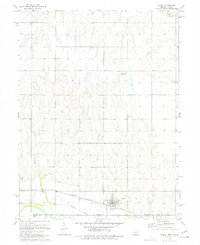 1974 Hardy1977 Print · USGSHardy and the surrounding tri-county borderlands are captured in the mid-1970s, showcasing a landscape shaped by rail and irrigation. Researchers can trace the convergence of the Burlington Northern and Missouri Pacific railroads and the path of the Superior Canal.
 - 1974 Map of Bostwick, 1977 Print
 1974 Bostwick1977 Print · USGSThe Republican River valley along the Nebraska-Kansas border shows a landscape of rail-side settlements and irrigation canals in the 1970s. Researchers can locate the 2-R School, trace the Burlington Northern line through Bostwick, and follow the Courtland Canal.
End of results
Showing maps 1-9 of 9
Top cities of Jewell County
- Mankato historical maps
- Jewell historical maps
- Burr Oak historical maps
- Formoso historical maps
- Esbon historical maps
- Ionia historical maps
See more
Frequently asked questions
- What are the different types of historical maps available for Jewell County?
- What is the oldest map of Jewell County?
- Where can I purchase historical maps of Jewell County for my home or office?
- Where can I download high-res historical maps of Jewell County?
- Are there historical topographic maps available for Jewell County?
- Is there historical aerial imagery available for Jewell County?
- Where are historical maps of Jewell County sourced from?