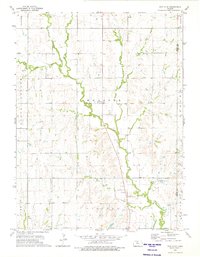
1973 Map of Portis NE
USGS Topo · Published 1975About this map
Crystal Plains characterizes this northern Kansas landscape, where the headwaters of the Oak Creek system carve into the upland plateau. The geography is defined by the convergence of West Oak Creek, Middle Oak Creek, and East Oak Creek, which join to form the main stem of Oak Creek as it flows south toward the Lincoln township boundary. This mid-1970s survey captures a rural landscape organized by section lines and small-scale industry, featuring scattered quarries and sandpits used for local road and building materials.
Find a feature on this map
19 named features on this map. Tap any name to fly to it.
Don’t see what you’re looking for? This feature index may not catch every label — zoom into the map to look around manually.
Map Details
Editions of this 1973 Portis NE Map
This is the sole edition of this map. No revisions or reprints were ever made.
Other maps of this area

1893 · Smith Center
USGS Topo · 1:125,000

1894 · Mankato
USGS Topo · 1:125,000

1955 · Beloit
USGS Topo · 1:250,000

1959 · Beloit
USGS Topo · 1:250,000

1960 · Downs North
USGS Topo · 1:24,000

1961 · Portis
USGS Topo · 1:24,000

1962 · Cawker City
USGS Topo · 1:24,000
1969 · Cawker City NW
USGS Topo · 1:24,000
1969 · Esbon
USGS Topo · 1:24,000
1973 · Lebanon
USGS Topo · 1:24,000