Old Maps of Jewell County, Kansas for Genealogy
Trace your family roots with 197 historic maps of Jewell County. These high-res maps reveal old neighborhoods, homesites, landmarks, and streets — helping you uncover where your ancestors lived and how the area evolved over time.
- Explore historic neighborhoods: Identify where your relatives may have lived in the 1800s or 1900s.
- Compare maps over time: Trace the changes in streets, buildings, and landmarks for multi-generational research.
- Perfect for genealogy & ancestry research: Used by family historians and researchers to map out lineage and migration.
These maps are an incredible resource for exploring your personal connection to Jewell County's past.
Jewell County, KS maps
(197)- 1892 Map of Concordia
 1892 Concordia1892 Print · USGSNorth-central Kansas thrives as a railroad and river corridor in the early 1890s, where the Republican River meets a dense web of competing iron rails. Genealogists and researchers can pinpoint early homesteads near Concordia, Belleville, and vanished rural stops like Seapo or Lake Sibley.4 unique versions available
 - 1893 Map of Smith Center
 1893 Smith Center1893 Print · USGSNorth-central Kansas emerges in the early 1890s as a landscape of grid-patterned townships and growing rail towns. Researchers can trace the early footprints of Smith Center and Lebanon or locate vanished points like Jacksonburg and Womer.3 unique versions available
 - 1894 Map of Mankato
 1894 Mankato1894 Print · USGSJewell and Mitchell Counties come into focus during the late nineteenth-century expansion of the Kansas rail network. Genealogists and historians can trace the early development of Mankato, Burr Oak, and Cawker along the vital lines of the Missouri Pacific Railway.4 unique versions available
 - 1897 Map of Red Cloud
 1897 Red Cloud1897 Print · USGSSouthern Nebraska and the Kansas borderlands were being transformed by heavy rail expansion in the 1890s. Genealogists can trace family farmsteads near Red Cloud and Minden, or follow the Republican River to see the early layouts of Riverton and Franklin.4 unique versions available
 - 1898 Map of Superior
 1898 Superior1898 Print · USGSSouthern Nebraska and northern Kansas were dominated by a growing rail network in the late nineteenth century. Genealogists can trace family roots through early settlements like Superior, Nelson, and Guide Rock, or locate vanished tracks of the Kansas City and Omaha R. R.3 unique versions available
 - 1898 Map of Hebron
 1898 Hebron1898 Print · USGSThayer County and the surrounding Nebraska-Kansas borderlands come alive in the 1890s as a vital hub of the prairie rail network. Researchers can trace the development of early settlements like Hebron and Friedensau or follow the path of the Little Blue River.2 unique versions available
 - 1940 Map of Red Cloud, 1954 Print
 1940 Red Cloud1954 Print · USGSSouthern Nebraska at the end of the Great Depression is characterized by its close-knit rural school districts and river-valley rail lines. Genealogists can trace family roots through numerous landmarks like Catherton Cem, St Stevens Ch, and the Poor Farm Sch.2 unique versions available
 - 1942 Map of Red Cloud
 1942 Red Cloud1942 Print · USGSRed Cloud and the surrounding Republican River valley are shown here just before the mid-century, when the rural school system remained remarkably intact. Researchers can trace family roots through numerous sites like New Virginia Cem, Poor Farm Sch, and Inavale.
 - 1955 Map of Manhattan, 1964 Print
 1955 Manhattan1964 Print · USGSNorth Central Kansas is captured here in the mid-fifties, just as major flood control projects began reshaping the river valleys. Genealogists can locate family sites near St. Joseph Church, Sunset Cemetery, or along the busy tracks of the Rock Island RR.4 unique versions available
 - 1955 Map of Lincoln, 1967 Print
 1955 Lincoln1967 Print · USGSSoutheast Nebraska in the mid-fifties presents a landscape of thriving railroad towns and the expanding footprint of the capital city. Researchers can trace the legacy of the pioneer era at the Homestead National Monument of America or locate mid-century military infrastructure like Lincoln Air Force Base.5 unique versions available
 - 1955 Map of Grand Island, 1967 Print
 1955 Grand Island1967 Print · USGSCentral Nebraska is seen here during a period of industrial and agricultural growth, centered on the vital Platte River corridor. Researchers can trace the mid-century footprints of the U S Naval Ammunition Depot and the Cornhusker Ordnance Plant.3 unique versions available
 - 1955 Map of Beloit, 1971 Print
 1955 Beloit1971 Print · USGSNorth Central Kansas in the mid-fifties shows a landscape of river-valley agriculture and expanding water infrastructure. Genealogists can trace the rail lines of the Union Pacific through towns like Nicodemus, Cawker City, and the State Sanatorium.3 unique versions available
 - 1956 Map of Manhattan
 1956 Manhattan1956 Print · USGSNorth-central Kansas in the mid-fifties reveals a landscape defined by the convergence of the Republican River and Smoky Hill River. Historians can trace the rail corridors of the Union Pacific RR and Missouri Pacific RR through towns like Manhattan and Clay Center.
 - 1957 Map of Manhattan
 1957 Manhattan1957 Print · USGSNortheast Kansas in the mid-1950s reveals a landscape of expanding military installations and new water projects. Genealogists and historians can trace the rail-to-river economy through the Union Pacific RR and old settlements like Clay Center or Marysville.
 - 1957 Map of Lincoln
 1957 Lincoln1957 Print · USGSSoutheastern Nebraska at mid-century shows a landscape of thriving rail towns and expanding infrastructure centered on Lincoln. Researchers can trace the path of the Chicago Burlington and Quincy railroad through communities like Weeping Water, Fairmont, and Seward.
 - 1957 Map of Grand Island
 1957 Grand Island1957 Print · USGSCentral Nebraska and Northern Kansas are shown here during a period of massive hydraulic and military expansion in the mid-fifties. Researchers can trace the development of the Harlan County Reservoir and the massive wartime legacy of the Cornhusker Ordnance Plant.
 - 1958 Map of Grand Island
 1958 Grand Island1958 Print · USGSSouth-central Nebraska thrived as a rail and industrial hub during the late fifties, shaped by the braided Platte River. Genealogists and historians can trace rail lines like the Union Pacific RR through towns such as Kearney or locate the sprawling Cornhusker Ordnance Plant.
 - 1958 Map of Lincoln
 1958 Lincoln1958 Print · USGSSoutheast Nebraska at the end of the 1950s shows a region defined by agricultural trade and the expansion of the state capital. Genealogists can trace family footprints across the Blue Valley and locate landmarks like the Lincoln AFB or the U.S. Veterans Hospital.
 - 1959 Map of Beloit
 1959 Beloit1959 Print · USGSNorth Central Kansas at mid-century reveals a landscape shaped by river valleys and the expansion of massive water reservoirs. Genealogists and historians can trace the rail-town connections of Beloit and Norton or locate the site of the new Webster Dam.3 unique versions available
 - 1960 Map of Downs North, 1962 Print
 1960 Downs North1962 Print · USGSThe Smith and Osborne County borderlands come to life in the early 1960s at the junction of the Solomon River forks. Researchers can locate vanished rural landmarks like Pleasant Ridge Sch, the settlement of Dispatch, and Rose Valley Ch.2 unique versions available
 - 1962 Map of Jewell SE, 1963 Print
 1962 Jewell SE1963 Print · USGSJewell and Mitchell counties meet along this quiet stretch of Kansas prairie in the early sixties. Researchers can trace the path of the Missouri Pacific railroad or locate family sites near Pleasant Prairie Cem and Plum Creek.
 - 1962 Map of Cawker City, 1963 Print
 1962 Cawker City1963 Print · USGSCawker City thrived as a rail and river hub during the early sixties, anchoring a landscape of small family farms and rural townships. Researchers can trace ancestral roots through several local burial grounds like Prairie Grove Cem and locate the historic Chandler Sch.3 unique versions available
 - 1962 Map of Glen Elder North, 1963 Print
 1962 Glen Elder North1963 Print · USGSJewell and Mitchell counties are captured in the early sixties, centered on the rural hub of Glen Elder and the Athens township. Genealogists and historians can trace the foundations of this farming community through the Athens Sch, Glenwood Cem, and the Missouri Pacific rail corridor.2 unique versions available
 - 1962 Map of Jewell SW, 1963 Print
 1962 Jewell SW1963 Print · USGSThe rural borderlands of Jewell and Mitchell Counties come into focus in the early sixties, showing a landscape of high prairie and winding creek bottoms. Genealogists can locate family landmarks like Mayview Ch, Pleasant Plain Sch, and Star Cem.
 - 1966 Map of Scottsville, 1967 Print
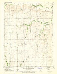 1966 Scottsville1967 Print · USGSIn the mid-sixties, the prairie landscape around the Mitchell and Jewell County border was a quiet network of railroad sidings and rural townships. Researchers can trace the path of the Missouri Pacific through Scottsville or locate family plots at St Marys Cem and Lutheran Cem.
Showing maps 1-25 of 197
Top cities of Jewell County
- Mankato historical maps
- Jewell historical maps
- Burr Oak historical maps
- Formoso historical maps
- Esbon historical maps
- Ionia historical maps
See more
Frequently asked questions
- What are the different types of historical maps available for Jewell County?
- What is the oldest map of Jewell County?
- Where can I purchase historical maps of Jewell County for my home or office?
- Where can I download high-res historical maps of Jewell County?
- Are there historical topographic maps available for Jewell County?
- Is there historical aerial imagery available for Jewell County?
- Where are historical maps of Jewell County sourced from?