1900s (20th Century) Maps of Edgerton, Kansas
Explore 11 historic maps of Edgerton from the 1900s (20th Century). These maps offer a rare glimpse into what life looked like during the 1900s — showing old roads, neighborhoods, homes, and landmarks that have changed or disappeared over time.
Whether you're researching your family's past, planning a metal detecting trip, or studying how Edgerton's landscape evolved across the 1900s, these high-resolution maps are a powerful tool for exploring the history of this region.
- Focus on a specific era: All maps on this page are from the 1900s, giving you a focused view of this time period.
- See what’s changed: Compare century-old streets, trails, and buildings to today's modern landscape using overlays and satellite layers.
- Research with precision: Use these maps for genealogy, historical research, land use analysis, or educational projects.
- View, download, or print: Maps are fully viewable online in high resolution, and can be downloaded or printed for your own records.
Start exploring Edgerton's history through authentic maps from the 1900s. This is your window into the past.
Edgerton, KS maps
(11)- 1947 Map of Lawrence, 1954 Print
 1947 Lawrence1954 Print · USGSEastern Kansas and western Missouri thrive in the late 1940s, showing a landscape defined by major river valleys and a dense railway network. Genealogists can trace family settlements from Lawrence to Greenwood and locate landmarks like Olathe Navy and Lake Lotawana.
 - 1950 Map of Lawrence
 1950 Lawrence1950 Print · USGSMid-century Kansas and Missouri come alive in this map of the river-valley corridors just as the interstate era was beginning. Researchers can trace the legacy of major rail lines like the Union Pacific RR and locate ancestral roots in towns from Lawrence to Harrisonville.
 - 1956 Map of Wellsville, 1957 Print
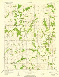
 1956 Wellsville1957 Print · USGSWellsville was a thriving railroad and agricultural hub in the mid-1950s, centered on the Santa Fe and Topeka Atchison line. Genealogists and historians can trace rural family roots through the Rock Creek Sch and cemeteries like Walnut Creek Cem.2 unique versions available
 - 1956 Map of Edgerton, 1958 Print
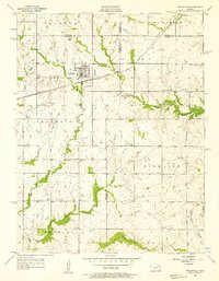
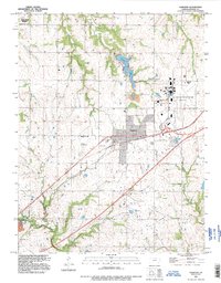
 1956 Edgerton1958 Print · USGSThe Douglas and Johnson County line was a landscape of small farm settlements and rail hubs during the mid-fifties. Researchers can locate family landmarks like Round Oak Sch, the Pleasant Valley Cem, and the industry at Edgerton.3 unique versions available
 - 1956 Map of Lawrence, 1967 Print
 1956 Lawrence1967 Print · USGSEastern Kansas and the Missouri border country are captured here during the mid-century transition to the interstate era. Genealogists and local historians can trace family-named terrain like Summers Mound and the footprint of Sunflower Ordnance Works near Baldwin City.4 unique versions available
 - 1957 Map of Antioch, 1958 Print
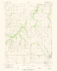
 1957 Antioch1958 Print · USGSNortheast Kansas rural life is captured here in the late fifties, where the border of Johnson and Miami counties meets. Genealogists and local historians can trace the locations of several country schoolhouses and churches, including North Windy Sch, Scott Valley Sch, and the Home Holding Cem.2 unique versions available
 - 1957 Map of Gardner, 1958 Print
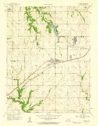 1957 Gardner1958 Print · USGSJohnson County was transitioning into a strategic military and aviation corridor during the late fifties. Researchers can locate the US Naval Air Station, trace the Atchison Topeka and Santa Fe rail line, and find local landmarks like Lanesfield Sch.3 unique versions available
 - 1961 Map of Lawrence
 1961 Lawrence1961 Print · USGSThe Kansas-Missouri borderland shows its mid-century transition from a rail-dependent agricultural region to a suburbanizing landscape. Genealogists can trace family footprints through numerous Cem sites and distinctive terrain landmarks like Graves Mound and Summers Mound.
 - 1983 Map of Olathe, 1984 Print
 1983 Olathe1984 Print · USGSThe Kansas-Missouri borderlands hum with suburban growth and historic transit routes in the early eighties. Researchers can trace the Santa Fe Trail across a landscape featuring Richards-Gebaur Air Force Base and Hillsdale Lake.
 - 1983 Map of Lawrence, 1984 Print
 1983 Lawrence1984 Print · USGSEastern Kansas in the early eighties shows a landscape of growing reservoirs and historic rail towns. Genealogists and historians can trace routes through Topeka and Ottawa, or locate smaller sites like Highland Cem and the settlement of Vassar.
 - 1991 Map of Gardner, 1996 Print
 1991 Gardner1996 Print · USGSGardner and the surrounding townships are captured during a period of significant military and civic evolution. Researchers can trace the layout of the US Naval Air Station (Inactive) and find family sites at St Columbia Cem or Fuller Cem.
End of results
Showing maps 1-11 of 11
Top cities near Edgerton
- Olathe historical maps
- Lawrence historical maps
- Shawnee historical maps
- Lenexa historical maps
- Gardner historical maps
- Ottawa historical maps
See more
Frequently asked questions
- What are the different types of historical maps available for Edgerton?
- What is the oldest map of Edgerton?
- Where can I purchase historical maps of Edgerton for my home or office?
- Where can I download high-res historical maps of Edgerton?
- Are there historical topographic maps available for Edgerton?
- Is there historical aerial imagery available for Edgerton?
- Where are historical maps of Edgerton sourced from?