2020s Maps of Shawnee, Kansas
Explore 6 historic maps of Shawnee from the 2020s. These maps offer a rare glimpse into what life looked like during the 2020s — showing old roads, neighborhoods, homes, and landmarks that have changed or disappeared over time.
Whether you're researching your family's past, planning a metal detecting trip, or studying how Shawnee's landscape evolved across the 2020s, these high-resolution maps are a powerful tool for exploring the history of this region.
- Focus on a specific era: All maps on this page are from the 2020s, giving you a focused view of this time period.
- See what’s changed: Compare century-old streets, trails, and buildings to today's modern landscape using overlays and satellite layers.
- Research with precision: Use these maps for genealogy, historical research, land use analysis, or educational projects.
- View, download, or print: Maps are fully viewable online in high resolution, and can be downloaded or printed for your own records.
Start exploring Shawnee's history through authentic maps from the 2020s. This is your window into the past.
Shawnee, KS maps
(6)- 2022 Map of Shawnee, 2022 Print
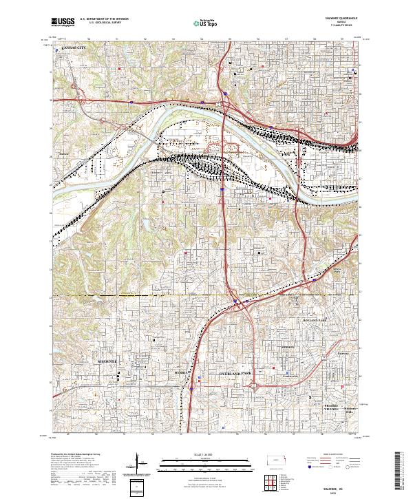 2022 Shawnee2022 Print · USGSThe Kansas City suburbs and riverfront come into focus in the early 2020s, showing a landscape defined by industrial rail corridors and historic burial grounds. Researchers can trace deep local roots at the Huron Indian Cem, Tensquatawa Burial Ground, and the Wyandotte County Courthouse.
 - 2022 Map of Edwardsville, 2022 Print
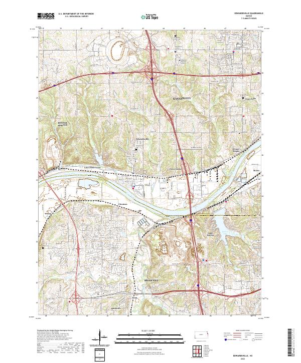 2022 Edwardsville2022 Print · USGSThe Kansas River borderlands between Wyandotte and Johnson counties come into focus here during a period of modern suburban growth. Genealogists can trace local roots through numerous sites like Wyandotte County Cem, Boles Cem, and Saint Patrick Catholic Church.
 - 2022 Map of Bonner Springs, 2022 Print
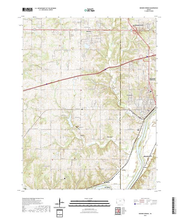 2022 Bonner Springs2022 Print · USGSThe Kansas River valley west of Kansas City appears here in its modern configuration, showing the intersection of growing suburbs and aviation history. Genealogists can trace family connections through Lenape Cem and Elm Grove Cem, or locate landmarks like Ingels Aerodrome.
 - 2022 Map of Lenexa, 2022 Print
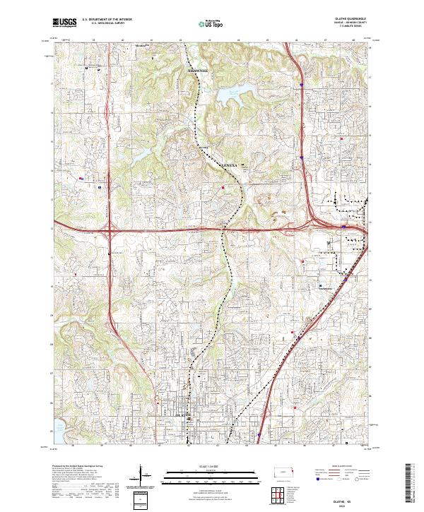
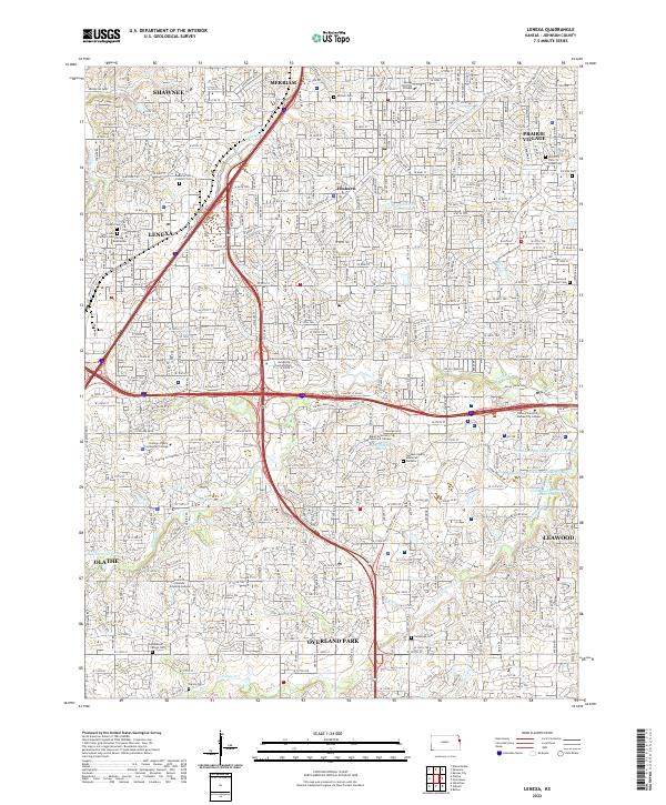 2022 Lenexa2022 Print · USGSJohnson County is shown here during a period of significant suburban maturity and institutional growth. Researchers can trace local history through several legacy sites, including the Strang Mausoleum, Antioch Cem, and the old settlement of Elmhurst.
 - 2022 Map of De Soto, 2022 Print
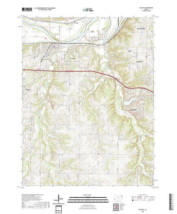 2022 De Soto2022 Print · USGSWestern Johnson County comes into focus as the suburban reach of Kansas City meets the Kansas River valley. Researchers can trace local lineage through De Soto Cem and Murphy Cem while exploring the evolving landscapes of De Soto and Lenexa.
 - 2022 Map of Olathe, 2022 Print
 2022 Olathe2022 Print · USGSJohnson County is shown during its modern suburban era, where a dense network of residential streets and expressways has integrated older settlements. Genealogists and local historians can trace family sites at Maupin Family Cem, locate the Johnson County Courthouse, or follow the historic route of Santa Fe Trail Dr.
End of results
Showing maps 1-6 of 6
Top cities near Shawnee
- Kansas City historical maps
- Overland Park historical maps
- Kansas City historical maps
- Olathe historical maps
- Lenexa historical maps
- Leavenworth historical maps
See more
Top neighborhoods of Shawnee
- Zarah historical maps
- Holliday historical maps
- Monticello historical maps
- Wilder historical maps
- Chouteau historical maps
- Frisbie historical maps
See more
Frequently asked questions
- What are the different types of historical maps available for Shawnee?
- What is the oldest map of Shawnee?
- Where can I purchase historical maps of Shawnee for my home or office?
- Where can I download high-res historical maps of Shawnee?
- Are there historical topographic maps available for Shawnee?
- Is there historical aerial imagery available for Shawnee?
- Where are historical maps of Shawnee sourced from?