Old Maps of Prairie Village, Kansas
Explore 56 old maps of Prairie Village, spanning from 1887 to today. These high-resolution historic maps reveal how streets, neighborhoods, landmarks, and natural features evolved over time — perfect for genealogy, metal detecting, research, and local history exploration.
What you can do with these maps:
- See how Prairie Village changed over time: Compare historical maps to modern-day views to trace roads, homesites, rail lines & more.
- View detailed metadata: Each map includes creators, publishers, year, scale, and archive source.
- Overlay maps with satellite & LiDAR: Visualize the past alongside modern tools to explore terrain & human change.
- Trusted historical sources: Maps sourced from the USGS, Library of Congress, and other archives.
- Access maps your way: View online, download high-res files, or order prints for personal or research use.
Start exploring old maps of Prairie Village to uncover forgotten places, hidden landmarks, and the deep history beneath your feet.
Prairie Village, KS maps
(56)- 1887 Map of Olathe
 1887 Olathe1887 Print · USGSEastern Kansas and the Missouri borderlands were being transformed by rail during the 1880s. Genealogists and historians can trace early town sites and railroad corridors like the Kansas City Clinton and Springfield Railroad and settlements from Lenexa to Osawatomie.
 - 1890 Map of Kansas City
 1890 Kansas City1890 Print · USGSThe Missouri River valley at the turn of the decade shows a booming rail-and-river economy centered on KANSAS CITY. Researchers can trace the early footprints of settlements like White Church, Lansing, and Smithville before modern expansion.2 unique versions available
 - 1893 Map of Olathe
 1893 Olathe1893 Print · USGSThe Kansas-Missouri border thrived during the late nineteenth century as a hub for expanding railroads and prairie commerce. Genealogists and historians can trace the early rail networks and locate frontier settlements like New Santa Fe, Olathe, and Paola.6 unique versions available
 - 1894 Map of Kansas City
 1894 Kansas City1894 Print · USGSThe Missouri River valley at the close of the nineteenth century was a bustling intersection of military life and frontier commerce. Genealogists can trace family roots through river towns like Weston and Parkville or locate early railroad hubs at Settles Station and Beverly Junction.14 unique versions available
 - 1934 Map of Grandview
 1934 Grandview1934 Print · USGSThe Missouri-Kansas borderlands were transforming in the mid-1930s as residential growth met established rail and river networks. Researchers can trace historic routes like the Santa Fe Trail or locate family sites near Hickmans Mill and Blue Ridge Cem.3 unique versions available
 - 1934 Map of Shawnee
 1934 Shawnee1934 Print · USGSThe Kansas River valley and the developing suburbs of Johnson County are shown in detail during the early 1930s. Researchers can trace historic neighborhoods and transit lines including Merriam, Argentine High Sch, and the Kansas and Missouri Interurban.3 unique versions available
 - 1935 Map of Kansas City
 1935 Kansas City1935 Print · USGSKansas City and its surrounding Missouri and Kansas neighborhoods are captured here during a period of significant civic expansion in the mid-1930s. Researchers can trace the layout of early aviation at the Municipal Landing Field or locate family history through many landmarks like Elmwood Cem and Wyandotte High Sch.2 unique versions available
 - 1935 Map of Lenexa
 1935 Lenexa1935 Print · USGSJohnson County during the mid-thirties reveals a landscape of expanding suburbs and rural school districts connected by the St Louis and San Francisco RR. Trace early neighborhood growth around Lenexa and Overland Park, or locate landmarks like the Mission Valley Hunt Club.2 unique versions available
 - 1939 Map of Grandview
 1939 Grandview1939 Print · USGSSoutheastern Jackson County is captured here in the late 1930s as a landscape of rural townships and growing rail hubs. You can trace early family connections through landmarks like Ruskin High Sch, the Mt Moriah Cemetery, and the village of Hickman Mills.2 unique versions available
 - 1940 Map of Kansas City
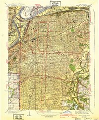 1940 Kansas City1940 Print · USGSKansas City's urban landscape is shown in remarkable detail just before the war, highlighting its massive rail yards and industrial riverfront. Genealogists and historians can trace neighborhood schools like Longfellow Sch, Central High Schools, and the resting places at Calvary Cemetery.3 unique versions available
 - 1943 Map of Lenexa
 1943 Lenexa1943 Print · USGSJohnson County was transitioning from a rural rail corridor to a suburban landscape in the years surrounding the Second World War. Researchers can trace early family-named school districts like Walnut Grove Sch and the grounds of the Mission Valley Hunt Club.2 unique versions available
 - 1943 Map of Shawnee
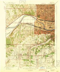 1943 Shawnee1943 Print · USGSGreater Kansas City and Johnson County are captured during a period of wartime transition, showing the dense rail yards and burgeoning suburbs of the early 1940s. Genealogists and local researchers can trace family roots through landmarks like St Johns Cem, Hickory Grove Sch, and the neighborhoods of South Park or Cunningham Highlands.2 unique versions available
 - 1947 Map of Lawrence, 1954 Print
 1947 Lawrence1954 Print · USGSEastern Kansas and western Missouri thrive in the late 1940s, showing a landscape defined by major river valleys and a dense railway network. Genealogists can trace family settlements from Lawrence to Greenwood and locate landmarks like Olathe Navy and Lake Lotawana.
 - 1950 Map of Kansas City
 1950 Kansas City1950 Print · USGSMid-century Kansas and Missouri are captured here during a period of industrial growth and shifting transportation. Genealogists and historians can trace rail lines like the Wabash RR or locate ancestral homes near the Potawatomi Indian Reservation and Horton.
 - 1950 Map of Lawrence
 1950 Lawrence1950 Print · USGSMid-century Kansas and Missouri come alive in this map of the river-valley corridors just as the interstate era was beginning. Researchers can trace the legacy of major rail lines like the Union Pacific RR and locate ancestral roots in towns from Lawrence to Harrisonville.
 - 1954 Map of Kansas City
 1954 Kansas City1954 Print · USGSThe Missouri-Kansas borderlands flourished in the post-war era as river commerce and rail networks converged at the Missouri River. Genealogists and historians can trace the foundations of Kansas City and smaller rural hubs like Hiawatha or Sabetha.
 - 1956 Map of Kansas City, 1967 Print
 1956 Kansas City1967 Print · USGSThe Kansas-Missouri border region thrived during the mid-fifties, centered on the growing metropolitan cores and the busy river valleys. Researchers can trace the layout of significant government sites like Fort Leavenworth and the Lake City Army Ammunition Plant.4 unique versions available
 - 1956 Map of Lawrence, 1967 Print
 1956 Lawrence1967 Print · USGSEastern Kansas and the Missouri border country are captured here during the mid-century transition to the interstate era. Genealogists and local historians can trace family-named terrain like Summers Mound and the footprint of Sunflower Ordnance Works near Baldwin City.4 unique versions available
 - 1957 Map of Grandview, 1958 Print
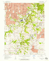 1957 Grandview1958 Print · USGSThe Missouri-Kansas borderlands were undergoing a period of intense suburban growth when this survey was conducted. Researchers can trace the mid-century development of Hickman Mills, the U S Naval Reservation, and the grounds of Swope Park.
 - 1957 Map of Lenexa, 1958 Print
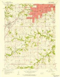 1957 Lenexa1958 Print · USGSMid-century Johnson County comes to life as Overland Park and Prairie Village begin to expand into the surrounding townships. Genealogists can trace family landmarks and schools like St Anns Sch or locate the historic Santa Fe Trail alignment.
 - 1957 Map of Shawnee, 1958 Print
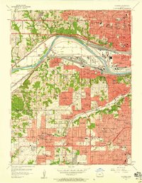 1957 Shawnee1958 Print · USGSNortheastern Kansas is captured here during a decade of rapid suburban growth between the river and the county line. Genealogists and local historians can trace family-named landmarks and early schools like Hocker Grove Jr High Sch, Crestline Cemetery, and the expansive Argentine rail district.
 - 1957 Map of Kansas City, 1958 Print
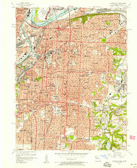 1957 Kansas City1958 Print · USGSKansas City at the dawn of the space age shows a bustling metropolitan hub still centered on its grand river crossings and rail terminals. Trace the city's mid-century footprint from the iconic Liberty Memorial and Union Station to the legendary Municipal Stadium and Swope Park.
 - 1960 Map of Kansas City
 1960 Kansas City1960 Print · USGSMid-century Kansas and Missouri meet at the river forks, showing a sprawling rail-and-river economy during the 1950s growth era. Genealogists and researchers can trace tribal lands like the Kickapoo Indian Reservation or follow the early interstate corridors through Saint Joseph and Independence.3 unique versions available
 - 1961 Map of Lawrence
 1961 Lawrence1961 Print · USGSThe Kansas-Missouri borderland shows its mid-century transition from a rail-dependent agricultural region to a suburbanizing landscape. Genealogists can trace family footprints through numerous Cem sites and distinctive terrain landmarks like Graves Mound and Summers Mound.
 - 1963 Map of Lenexa, 1964 Print
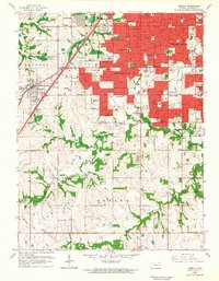 1963 Lenexa1964 Print · USGSSuburban Johnson County is caught in a moment of significant growth during the early sixties as residential developments spread south of Overland Park. Researchers can trace the expansion of local schools like Countryside Sch and locate early landmarks such as the Drive-in Theater and Resurrection Cemetery.3 unique versions available
Showing maps 1-25 of 56
Top cities near Prairie Village
- Kansas City historical maps
- Overland Park historical maps
- Kansas City historical maps
- Olathe historical maps
- Independence historical maps
- Lee's Summit historical maps
See more
Frequently asked questions
- What are the different types of historical maps available for Prairie Village?
- What is the oldest map of Prairie Village?
- Where can I purchase historical maps of Prairie Village for my home or office?
- Where can I download high-res historical maps of Prairie Village?
- Are there historical topographic maps available for Prairie Village?
- Is there historical aerial imagery available for Prairie Village?
- Where are historical maps of Prairie Village sourced from?