1960s Maps of Prairie Village, Kansas
Explore 6 historic maps of Prairie Village from the 1960s. These maps offer a rare glimpse into what life looked like during the 1960s — showing old roads, neighborhoods, homes, and landmarks that have changed or disappeared over time.
Whether you're researching your family's past, planning a metal detecting trip, or studying how Prairie Village's landscape evolved across the 1960s, these high-resolution maps are a powerful tool for exploring the history of this region.
- Focus on a specific era: All maps on this page are from the 1960s, giving you a focused view of this time period.
- See what’s changed: Compare century-old streets, trails, and buildings to today's modern landscape using overlays and satellite layers.
- Research with precision: Use these maps for genealogy, historical research, land use analysis, or educational projects.
- View, download, or print: Maps are fully viewable online in high resolution, and can be downloaded or printed for your own records.
Start exploring Prairie Village's history through authentic maps from the 1960s. This is your window into the past.
Prairie Village, KS maps
(6)- 1960 Map of Kansas City
 1960 Kansas City1960 Print · USGSMid-century Kansas and Missouri meet at the river forks, showing a sprawling rail-and-river economy during the 1950s growth era. Genealogists and researchers can trace tribal lands like the Kickapoo Indian Reservation or follow the early interstate corridors through Saint Joseph and Independence.3 unique versions available
 - 1961 Map of Lawrence
 1961 Lawrence1961 Print · USGSThe Kansas-Missouri borderland shows its mid-century transition from a rail-dependent agricultural region to a suburbanizing landscape. Genealogists can trace family footprints through numerous Cem sites and distinctive terrain landmarks like Graves Mound and Summers Mound.
 - 1963 Map of Lenexa, 1964 Print
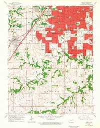 1963 Lenexa1964 Print · USGSSuburban Johnson County is caught in a moment of significant growth during the early sixties as residential developments spread south of Overland Park. Researchers can trace the expansion of local schools like Countryside Sch and locate early landmarks such as the Drive-in Theater and Resurrection Cemetery.3 unique versions available
 - 1964 Map of Kansas City, 1965 Print
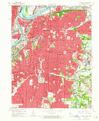 1964 Kansas City1965 Print · USGSKansas City in the mid-1960s reveals a bustling metropolitan hub where the Missouri and Kansas rivers meet. Researchers can trace the city's growth through its many neighborhood institutions and transit landmarks, including Union Station, Elmwood Cemetery, and the iconic Liberty Memorial.3 unique versions available
 - 1964 Map of Grandview, 1965 Print
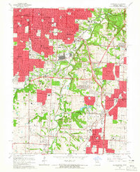 1964 Grandview1965 Print · USGSGreater Kansas City's southward expansion is in full view during the mid-sixties as suburban developments bridge the state line. Genealogists and local historians can trace family roots through numerous institutional landmarks like Mt Moriah Cemetery, Avila College, and the US Naval Reservation.4 unique versions available
 - 1964 Map of Shawnee, 1966 Print
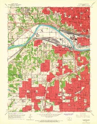 1964 Shawnee1966 Print · USGSThe Kansas River valley was a hub of rail and industrial activity in the mid-sixties, as suburban growth reshaped Wyandotte and Johnson counties. Genealogists and historians can trace neighborhood development and find local landmarks like Maple Hill Cemetery, Turner Memorial Bridge, and St Joseph High Sch Ch.4 unique versions available
End of results
Showing maps 1-6 of 6
Top cities near Prairie Village
- Kansas City historical maps
- Overland Park historical maps
- Kansas City historical maps
- Olathe historical maps
- Independence historical maps
- Lee's Summit historical maps
See more
Frequently asked questions
- What are the different types of historical maps available for Prairie Village?
- What is the oldest map of Prairie Village?
- Where can I purchase historical maps of Prairie Village for my home or office?
- Where can I download high-res historical maps of Prairie Village?
- Are there historical topographic maps available for Prairie Village?
- Is there historical aerial imagery available for Prairie Village?
- Where are historical maps of Prairie Village sourced from?