1980s Maps of Kingman County, Kansas
Explore 4 historic maps of Kingman County from the 1980s. These maps offer a rare glimpse into what life looked like during the 1980s — showing old roads, neighborhoods, homes, and landmarks that have changed or disappeared over time.
Whether you're researching your family's past, planning a metal detecting trip, or studying how Kingman County's landscape evolved across the 1980s, these high-resolution maps are a powerful tool for exploring the history of this region.
- Focus on a specific era: All maps on this page are from the 1980s, giving you a focused view of this time period.
- See what’s changed: Compare century-old streets, trails, and buildings to today's modern landscape using overlays and satellite layers.
- Research with precision: Use these maps for genealogy, historical research, land use analysis, or educational projects.
- View, download, or print: Maps are fully viewable online in high resolution, and can be downloaded or printed for your own records.
Start exploring Kingman County's history through authentic maps from the 1980s. This is your window into the past.
Kingman County, KS maps
(4)- 1985 Map of Pratt
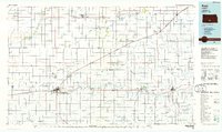 1985 Pratt1985 Print · USGSMid-1980s South Central Kansas is captured here as a landscape of rail-connected farming towns and energy fields. Researchers can trace the Old Indian Treaty Boundary or locate local landmarks like Walnut Hill Cemetery and the State Fish Hatchery.2 unique versions available
 - 1985 Map of Wichita
 1985 Wichita1985 Print · USGSThe mid-1980s landscape of the Wichita metro area is captured here during a peak era for the local aviation industry. Researchers can trace the sprawling rail network of the Santa Fe and Frisco or locate family landmarks at White Chapel Cem and Cheney Reservoir.
 - 1985 Map of Medicine Lodge
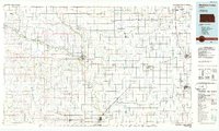 1985 Medicine Lodge1985 Print · USGSThe Kansas prairie of the mid-eighties shows a landscape of deep-rooted rail towns and historic land divisions. Genealogists and researchers can trace the Old Indian Treaty Boundary and locate family sites near Riverview Cem or the town of Anthony.2 unique versions available
 - 1985 Map of Wellington
 1985 Wellington1985 Print · USGSSouthern Kansas in the mid-eighties reveals a landscape shaped by historical lines and rail commerce, from Wellington to the Arkansas River. Researchers can trace the Old Indian Treaty Boundary and locate family sites near Prairie Lawn Cem or Bluff City.2 unique versions available
End of results
Showing maps 1-4 of 4
Top cities of Kingman County
- Kingman historical maps
- Norwich historical maps
- Cunningham historical maps
- Zenda historical maps
- Nashville historical maps
- Belmont historical maps
See more
Frequently asked questions
- What are the different types of historical maps available for Kingman County?
- What is the oldest map of Kingman County?
- Where can I purchase historical maps of Kingman County for my home or office?
- Where can I download high-res historical maps of Kingman County?
- Are there historical topographic maps available for Kingman County?
- Is there historical aerial imagery available for Kingman County?
- Where are historical maps of Kingman County sourced from?