1900s (20th Century) Maps of Kingman County, Kansas
Explore 28 historic maps of Kingman County from the 1900s (20th Century). These maps offer a rare glimpse into what life looked like during the 1900s — showing old roads, neighborhoods, homes, and landmarks that have changed or disappeared over time.
Whether you're researching your family's past, planning a metal detecting trip, or studying how Kingman County's landscape evolved across the 1900s, these high-resolution maps are a powerful tool for exploring the history of this region.
- Focus on a specific era: All maps on this page are from the 1900s, giving you a focused view of this time period.
- See what’s changed: Compare century-old streets, trails, and buildings to today's modern landscape using overlays and satellite layers.
- Research with precision: Use these maps for genealogy, historical research, land use analysis, or educational projects.
- View, download, or print: Maps are fully viewable online in high resolution, and can be downloaded or printed for your own records.
Start exploring Kingman County's history through authentic maps from the 1900s. This is your window into the past.
Kingman County, KS maps
(28)- 1901 Map of Cheney, 1910 Print
 1901 Cheney1910 Print · USGSSouth Central Kansas was a landscape of budding rail towns and rural post offices at the turn of the century. Genealogists can trace family roots through now-vanished locales like Stella P.O. and Mona P.O. or early hubs like Cheney and Mt. Hope.2 unique versions available
 - 1955 Map of Wichita, 1959 Print
 1955 Wichita1959 Print · USGSSouth-central Kansas comes alive in the mid-1950s as Wichita grows into its role as a regional industrial and military powerhouse. Trace the rail-and-river network connecting El Dorado and Arkansas City through the Atchison Topeka and Santa Fe lines.3 unique versions available
 - 1955 Map of Pratt, 1968 Print
 1955 Pratt1968 Print · USGSSouth-central Kansas during the mid-fifties presents a landscape of sprawling oil fields and critical rail junctions. Researchers can trace the paths of the Atchison Topeka and Santa Fe railroad or locate local landmarks like the Blue Ridge Community House and Camp Carlisle.3 unique versions available
 - 1958 Map of Wichita
 1958 Wichita1958 Print · USGSSouth Central Kansas in the late fifties was a landscape of aviation industry, oil exploration, and expanding turnpikes. Researchers can trace mid-century growth through McConnell Air Force Base, major facilities for Cessna Aircraft Company, and the active El Dorado Oil Field.
 - 1959 Map of Pratt
 1959 Pratt1959 Print · USGSSouth-central Kansas thrived as a rail and agricultural hub in the late fifties, where the Arkansas River meets a vast grid of section roads. Researchers can trace the path of the Missouri Pacific railroad through settlements like Turon and Stafford, or locate family landmarks like the Prairie Oak School.2 unique versions available
 - 1964 Map of Cheney, 1966 Print
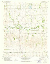
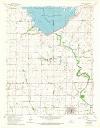 1964 Cheney1966 Print · USGSCheney and the surrounding Kansas plains appear here just as the landscape was being reshaped by the waters of the Cheney Reservoir. Researchers can trace the legacy of the Atchison Topeka and Santa Fe railroad or locate family roots at the Mt Vernon Cem and Cheney Cem.2 unique versions available
 - 1965 Map of Cheney SE, 1966 Print
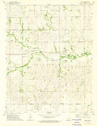
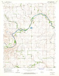 1965 Cheney SE1966 Print · USGSThe rural prairie of Kingman County is captured here in the mid-1960s as the river economy and oil industry shaped local life. Genealogists can locate family ties at Vinita Cem or Mt Pleasant Cem, and trace the rail line through Lansdowne.
 - 1965 Map of Waterloo, 1966 Print
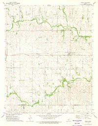
 1965 Waterloo1966 Print · USGSThe rural agricultural landscape of Kingman and Reno Counties is captured here in the mid-1960s. Genealogists and local historians can trace the foundations of the Waterloo and Midway communities, locating family plots at Waterloo Cem and St Louis Cem.2 unique versions available
 - 1965 Map of Murdock, 1966 Print
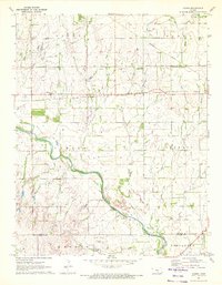
 1965 Murdock1966 Print · USGSKingman County's agricultural and energy landscape is captured here in the mid-1960s, centered on the South Fork Winnescah River. Researchers can trace rail-side history in Murdock and Belmont or locate family plots at Murdock Cem and Greenwood Cem.
 - 1966 Map of Cunningham, 1968 Print
 1966 Cunningham1968 Print · USGSMid-century Kingman County centers on the thriving town of Cunningham and the river-fed agricultural lands of the Cunningham Valley. Researchers can trace the Atchison Topeka and Santa Fe rail line and locate old community landmarks like Skellyville and Dresden Cem.
 - 1966 Map of St Leo, 1968 Print
 1966 St Leo1968 Print · USGSThe rural landscapes of Kingman County come into focus during the mid-1960s, showing the agricultural heartland at the confluence of the Chikaskia River and its North Fork. Genealogists and researchers can pinpoint the St Leo settlement, the West Point Cem, and scattered Gravel Pits marking the local industry of the day.
 - 1967 Map of Kingman NW, 1968 Print
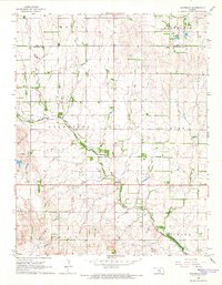
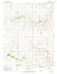
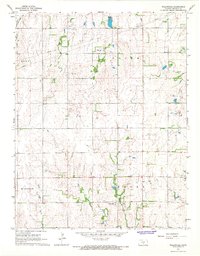
 1967 Kingman NW1968 Print · USGSKingman and the surrounding Kansas prairie are captured in the late sixties as the region's rail and river systems shaped its growth. Genealogists and local historians can locate the Hoosier Cem, trace the Missouri Pacific line through Browns Spur, and identify early aviation and utility sites.
 - 1967 Map of Alameda, 1968 Print
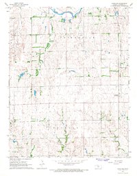
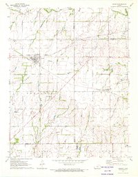
 1967 Alameda1968 Print · USGSKingman County's prairie landscape was shaped by a combination of rail transport and energy extraction in the late 1960s. Researchers can trace the Atchison Topeka and Santa Fe Pacific railroad past Alameda and find local landmarks like Bethany Cem and the Basil Oil and Gas Field.
 - 1967 Map of Cleveland, 1968 Print
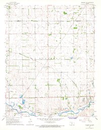
 1967 Cleveland1968 Print · USGSKingman County, Kansas, is captured here in the mid-1960s as a landscape of prairie agriculture and energy development. Researchers can locate the settlement of Cleveland (Carvel Sta) and trace its cemetery, the Belmont Gas Field, and the Atchison Topeka and Santa Fe rail line.
 - 1967 Map of Kingman, 1968 Print
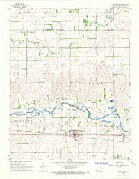
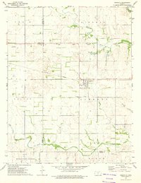
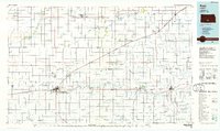
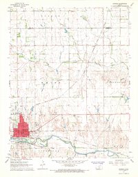 1967 Kingman1968 Print · USGSKingman and the surrounding Kansas prairie are documented here in the late sixties as the region balanced its rail heritage with modern aviation. Genealogists and local historians can locate Schooley Cemetery, trace the Atchison Topeka and Santa Fe line, or find the old Drive-in Theater.2 unique versions available
 - 1967 Map of Willowdale, 1968 Print
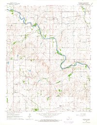
 1967 Willowdale1968 Print · USGSKingman County agricultural life is captured here in the mid-1960s, showing the intersection of rural townships and water-carved terrain. Genealogists can locate the settlement of Willowdale and trace land use near the Oil Well or along Peters Creek.
 - 1967 Map of Penalosa, 1968 Print
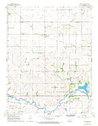 1967 Penalosa1968 Print · USGSKingman County's agricultural and rail landscapes are preserved here from the late sixties, where two major railroads define the local topography. Genealogists and historians can trace the small settlements of Penalosa and Calista alongside the South Fork Ninnescah River.
 - 1971 Map of Norwich, 1972 Print
 1971 Norwich1972 Print · USGSThe rural landscape around Norwich and Milton is shown here in the early 1970s, where two major rail lines intersect among the Kansas townships. Genealogists and historians can trace the Old Indian Treaty Boundary and locate family markers at Upchurch Cem or Stitch Cem.
 - 1971 Map of Adams, 1972 Print
 1971 Adams1972 Print · USGSKingman County and the surrounding townships are captured in the early 1970s, showing a landscape defined by prairie rivers and energy infrastructure. Researchers can trace the Old Indian Treaty Boundary and locate specific sites like the Adams settlement and the Oil Field wells.
 - 1973 Map of Spivey, 1975 Print
 1973 Spivey1975 Print · USGSThe rural landscape around Spivey in the mid-1970s is defined by its energy industry and rail connections. Researchers can trace the Old Indian Treaty Boundary and locate family landmarks like Nichols Cem and the Dick Landing Strip.
 - 1973 Map of Rago, 1975 Print
 1973 Rago1975 Print · USGSKingman County and Harper County landscapes are revealed in the early 1970s, showing a prairie economy transitioning into energy production. Local researchers can trace the Atchison Topeka and Santa Fe rail line through Rago and Duquoin or locate the historic Indian Treaty Boundary.
 - 1973 Map of Zenda, 1975 Print
 1973 Zenda1975 Print · USGSThe rural landscape around Zenda was a hub of energy and rail transit in the early 1970s. Researchers can trace the Old Indian Treaty Boundary and locate family history sites like St Johns Cem or the Pleasant Hill Cem.
 - 1973 Map of Nashville, 1975 Print
 1973 Nashville1975 Print · USGSNashville and the surrounding prairie were deeply connected to the rail and river systems in the early 1970s. Genealogists can trace family roots at Nashville Cem and St John Cem, or follow the historic Old Indian Treaty Boundary across the landscape.
 - 1985 Map of Pratt
 1985 Pratt1985 Print · USGSMid-1980s South Central Kansas is captured here as a landscape of rail-connected farming towns and energy fields. Researchers can trace the Old Indian Treaty Boundary or locate local landmarks like Walnut Hill Cemetery and the State Fish Hatchery.2 unique versions available
 - 1985 Map of Wichita
 1985 Wichita1985 Print · USGSThe mid-1980s landscape of the Wichita metro area is captured here during a peak era for the local aviation industry. Researchers can trace the sprawling rail network of the Santa Fe and Frisco or locate family landmarks at White Chapel Cem and Cheney Reservoir.
Showing maps 1-25 of 28
Top cities of Kingman County
- Kingman historical maps
- Norwich historical maps
- Cunningham historical maps
- Zenda historical maps
- Nashville historical maps
- Belmont historical maps
See more
Frequently asked questions
- What are the different types of historical maps available for Kingman County?
- What is the oldest map of Kingman County?
- Where can I purchase historical maps of Kingman County for my home or office?
- Where can I download high-res historical maps of Kingman County?
- Are there historical topographic maps available for Kingman County?
- Is there historical aerial imagery available for Kingman County?
- Where are historical maps of Kingman County sourced from?