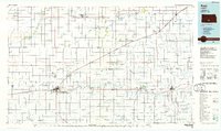
1985 Map of Pratt
USGS Topo · Published 1985About this map
Pratt and Kingman anchor this central Kansas landscape, where the agricultural grid is bisected by the diagonal Old Indian Treaty Boundary. The region's economy and social structure are defined by a dense network of rail lines, including the Missouri Pacific and Atchison Topeka and Santa Fe, which connect dozens of smaller grain-stop settlements like Iuka, Arlington, and Cunningham. Industrial activity is evident in the western Oil and Gas Field, while the educational and conservation infrastructure is represented by the Community Junior College and the State Fish Hatchery.
Find a feature on this map
90 named features on this map. Tap any name to fly to it.
Don’t see what you’re looking for? This feature index may not catch every label — zoom into the map to look around manually.
Map Details
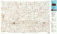
Editions of this 1985 Pratt Map
2 editions found
Other maps of this area

1889 · Anthony
USGS Topo · 1:125,000

1889 · Cheney
USGS Topo · 1:125,000

1889 · Larned
USGS Topo · 1:125,000

1889 · Caldwell
USGS Topo · 1:125,000

1889 · Kinsley
USGS Topo · 1:125,000

1891 · Great Bend
USGS Topo · 1:125,000

1891 · Medicine Lodge
USGS Topo · 1:125,000

1891 · Larned
USGS Topo · 1:125,000

1891 · Hutchinson
USGS Topo · 1:125,000

1891 · Cheney
USGS Topo · 1:125,000