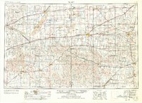
1955 Map of Pratt
USGS Topo · Published 1978About this map
The Arkansas River and Cimarron River carve across this expansive stretch of the High Plains during the late 1960s, a landscape defined by its grid of section lines and early oil exploration. Large clusters of Oil Field symbols indicate the petroleum economy of the era, particularly near Pratt, while the region's agricultural roots are anchored by central gathering points like the Blue Ridge Community House.
Find a feature on this map
119 named features on this map. Tap any name to fly to it.
Don’t see what you’re looking for? This feature index may not catch every label — zoom into the map to look around manually.
Map Details
Editions of this 1955 Pratt Map
3 editions found

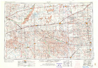
Other maps of this area

1889 · Anthony
USGS Topo · 1:125,000

1889 · Cheney
USGS Topo · 1:125,000

1889 · Larned
USGS Topo · 1:125,000

1889 · Caldwell
USGS Topo · 1:125,000

1889 · Kinsley
USGS Topo · 1:125,000

1891 · Great Bend
USGS Topo · 1:125,000

1891 · Medicine Lodge
USGS Topo · 1:125,000

1891 · Larned
USGS Topo · 1:125,000

1891 · Hutchinson
USGS Topo · 1:125,000

1891 · Cheney
USGS Topo · 1:125,000