2020s Maps of Miami County, Kansas
Explore 15 historic maps of Miami County from the 2020s. These maps offer a rare glimpse into what life looked like during the 2020s — showing old roads, neighborhoods, homes, and landmarks that have changed or disappeared over time.
Whether you're researching your family's past, planning a metal detecting trip, or studying how Miami County's landscape evolved across the 2020s, these high-resolution maps are a powerful tool for exploring the history of this region.
- Focus on a specific era: All maps on this page are from the 2020s, giving you a focused view of this time period.
- See what’s changed: Compare century-old streets, trails, and buildings to today's modern landscape using overlays and satellite layers.
- Research with precision: Use these maps for genealogy, historical research, land use analysis, or educational projects.
- View, download, or print: Maps are fully viewable online in high resolution, and can be downloaded or printed for your own records.
Start exploring Miami County's history through authentic maps from the 2020s. This is your window into the past.
Miami County, KS maps
(15)- 2021 Map of West Line, 2021 Print
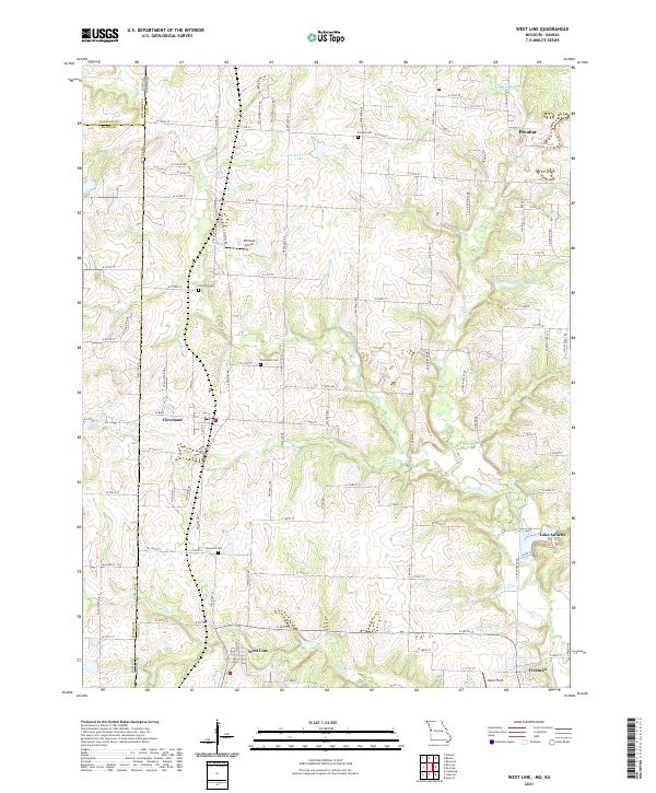 2021 West Line2021 Print · USGSThe Missouri-Kansas borderlands in Cass County come into focus in this recent survey of the rural landscape south of Kansas City. Researchers can trace local lineage through Cleveland Cem and Glenwild Cem, or locate family sites near West Line and Lake Annette.
 - 2021 Map of Freeman, 2021 Print
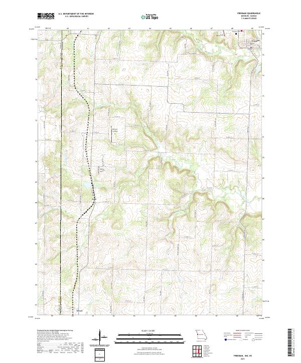 2021 Freeman2021 Print · USGSThe Kansas and Missouri borderlands come into focus in the early 2020s, showing a landscape of rural airfields and creekside settlements. Trace local history through Freeman, Lisle, and landmarks like Bishop's Landing or Veach Field.
 - 2021 Map of Drexel, 2021 Print
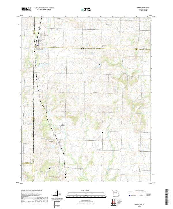 2021 Drexel2021 Print · USGSThe borderlands of Cass and Bates counties come into focus here in the early twenty-first century, showing the enduring grid of the Missouri-Kansas line. Genealogists and local researchers can locate Sharon Cem, Edgewood Cem, and the small settlement of Merwin.
 - 2022 Map of Fontana, 2022 Print
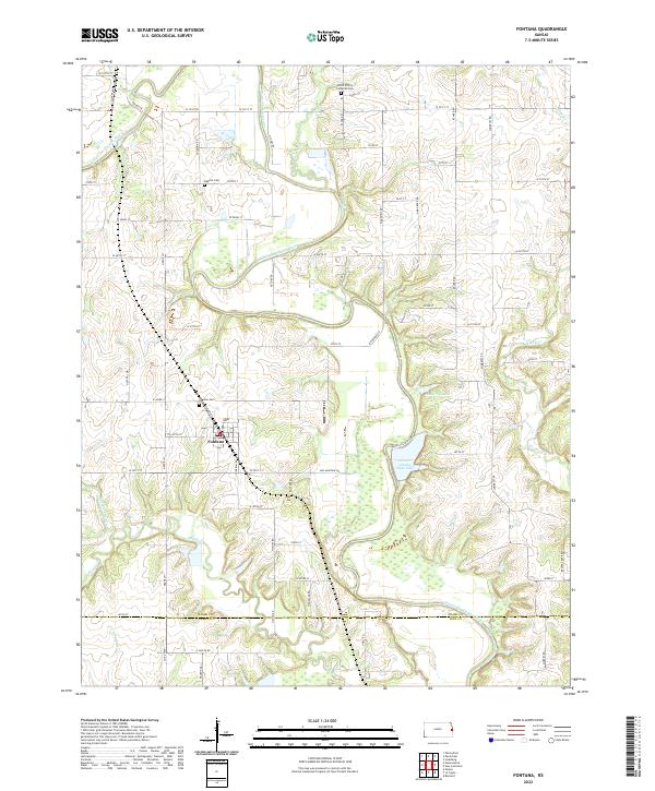 2022 Fontana2022 Print · USGSMiami County at the start of the 2020s shows a landscape of river valleys and rural settlements. Researchers can locate family sites at Fontana Cem and Block Trinity Lutheran Cem or trace the Marais des Cygnes River.
 - 2022 Map of Paola West, 2022 Print
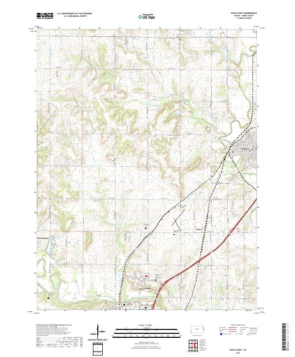 2022 Paola West2022 Print · USGSMiami County at the start of the 2020s shows the enduring relationship between the Marais des Cygnes River and its historic towns. Genealogists can trace family records at the Indianapolis Cem, Oakwood Cem, or the Osawatomie State Hospital Cem.
 - 2022 Map of Lane, 2022 Print
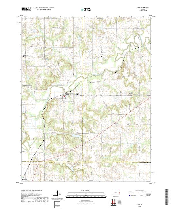 2022 Lane2022 Print · USGSThe borderlands of Franklin and Miami counties come into focus in the early 2020s, showing a landscape shaped by the winding Pottawatomie Creek. Family historians can locate several rural burial grounds, including the Spring Grove Quaker Cem and Lane Cem.
 - 2022 Map of Rantoul, 2022 Print
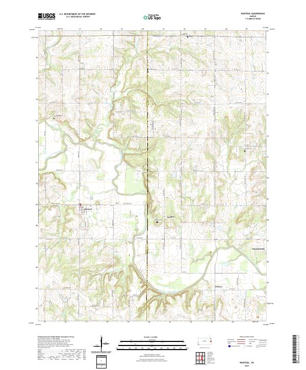 2022 Rantoul2022 Print · USGSEastern Kansas rural life and river geography are captured here in the early twenty-first century. Genealogists and historians can trace family locations through established sites like Stanton, Howard Cem, and the reaches of the Marais des Cygnes River.
 - 2022 Map of Osawatomie, 2022 Print
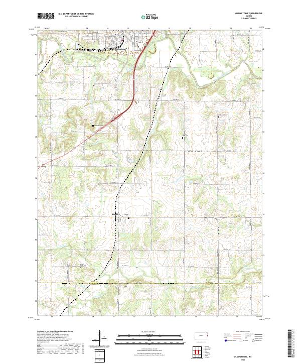 2022 Osawatomie2022 Print · USGSOsawatomie and the surrounding Miami County farmstead country are documented here in the early twenty-first century. Family researchers can locate numerous rural burial sites like Mount Nebo Cem and Beagle Cem while tracing the winding path of Pottawatomie Creek.
 - 2022 Map of Paola East, 2022 Print
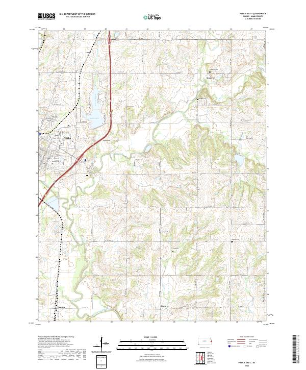 2022 Paola East2022 Print · USGSMiami County's eastern prairie and the outskirts of Paola are shown here in the early twenty-first century, capturing a dense landscape of rural settlements and family burial grounds. Local researchers can trace family roots through sites like Somerset, Block, and Highland Cemetery.
 - 2022 Map of Bucyrus, 2022 Print
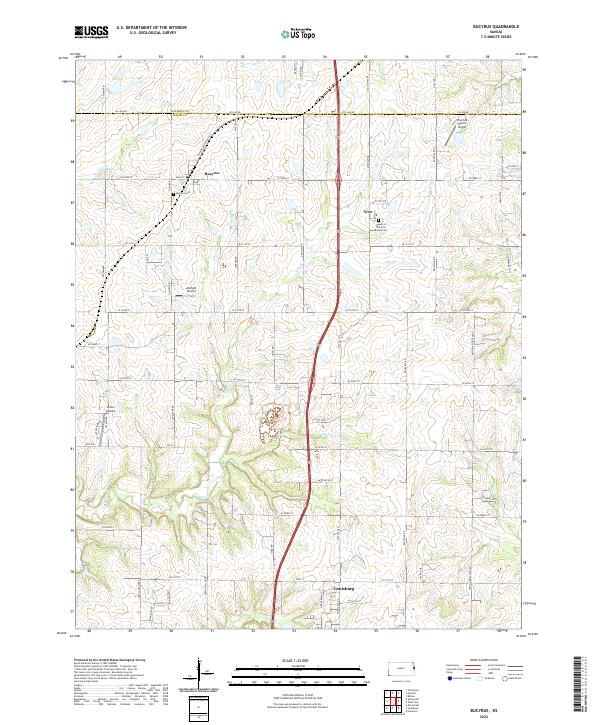 2022 Bucyrus2022 Print · USGSBucyrus and the Miami County borderlands appear in the early twenty-first century as a landscape of prairie farms and small airfields. Researchers can trace family sites at Bucyrus Cem or explore the rural hubs of Wea and Bucyrus.
 - 2022 Map of Wellsville, 2022 Print
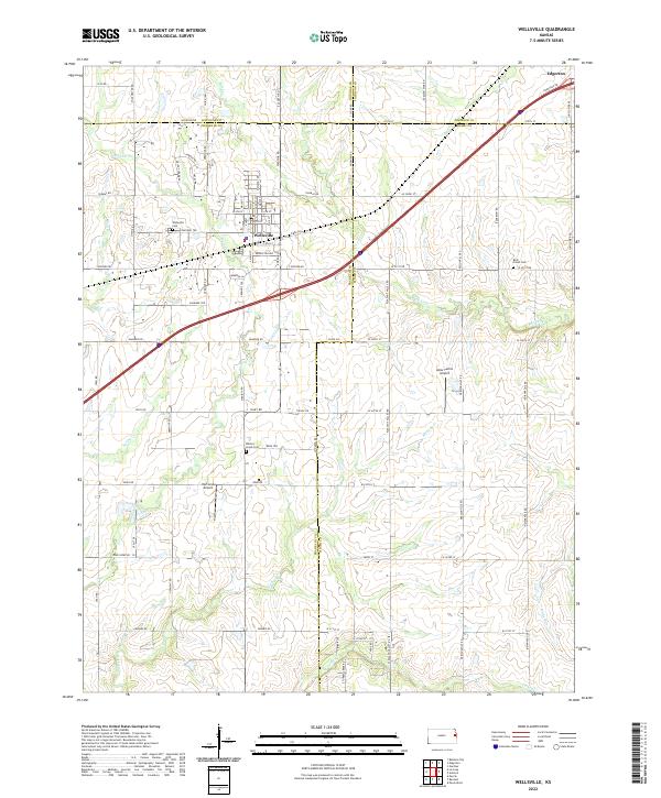 2022 Wellsville2022 Print · USGSThe agricultural heartland where Franklin and Johnson counties meet is documented here in the early twenty-first century. Genealogists and local historians can trace family locations and rural landmarks like Walnut Creek Cem and Amar Farms Airport.
 - 2022 Map of Louisburg, 2022 Print
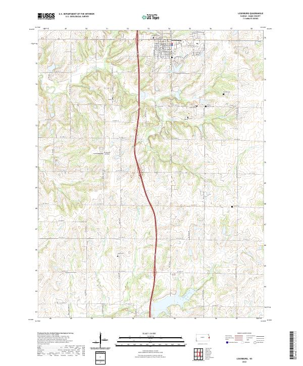 2022 Louisburg2022 Print · USGSLouisburg and the surrounding Miami County countryside are shown in this modern era, where traditional township grids meet branching prairie streams. Genealogists can locate numerous historic burial sites like Dagenett Cem and Reed Cem, or trace the winding course of Middle Creek.
 - 2022 Map of Spring Hill, 2022 Print
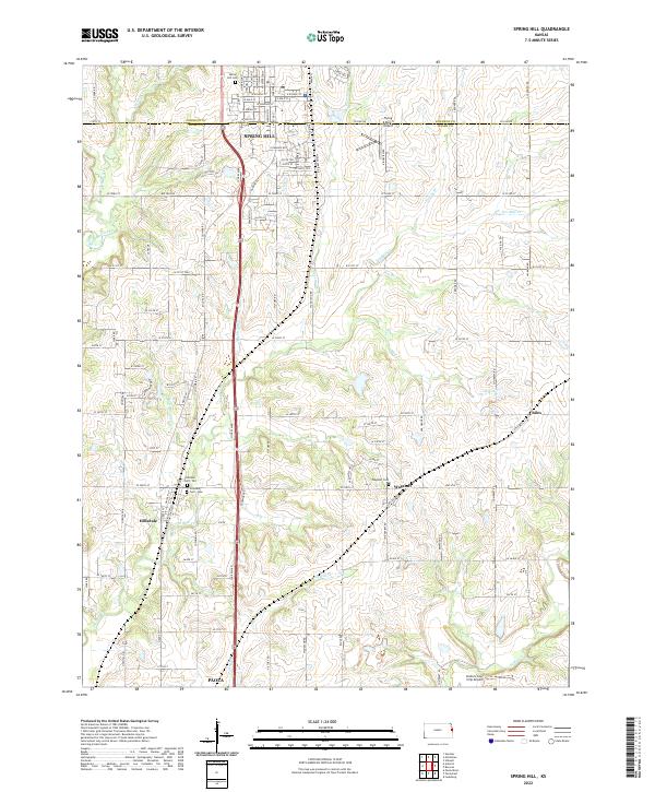 2022 Spring Hill2022 Print · USGSThe borderlands of Johnson and Miami counties come into focus in this modern era, centered on the growing community of Spring Hill. Family historians can trace local roots at the Hillsdale Cem - Old or find rural aviation sites like the Linders Cow-Chip Airport.
 - 2022 Map of New Lancaster, 2022 Print
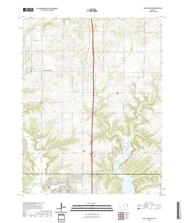 2022 New Lancaster2022 Print · USGSMiami and Linn counties appear in this modern survey of the Kansas borderlands, where traditional agriculture meets newer residential growth. Genealogists can locate family sites near New Lancaster, Linn Valley, and the rural New Lancaster Cem.
 - 2022 Map of Antioch, 2022 Print
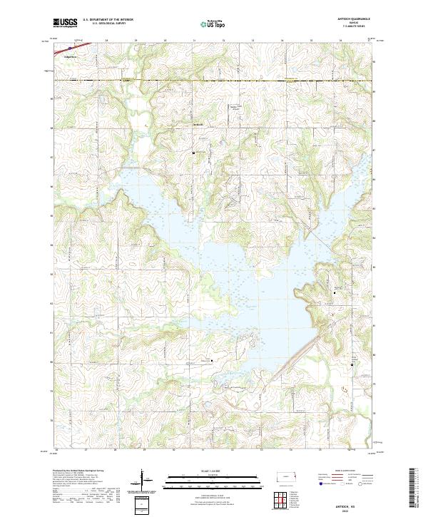 2022 Antioch2022 Print · USGSThe Johnson and Miami county line comes alive in the early twenty-first century, centered on the expansion of Hillsdale Lake. Genealogists and local historians can trace family ties at the Marysville Cem - Old, Antioch Cem, and the rural airfield at Hayden Farm Airport.
End of results
Showing maps 1-15 of 15
Top cities of Miami County
- Paola historical maps
- Osawatomie historical maps
- Louisburg historical maps
- Wea historical maps
- Stanton historical maps
- Fontana historical maps
Frequently asked questions
- What are the different types of historical maps available for Miami County?
- What is the oldest map of Miami County?
- Where can I purchase historical maps of Miami County for my home or office?
- Where can I download high-res historical maps of Miami County?
- Are there historical topographic maps available for Miami County?
- Is there historical aerial imagery available for Miami County?
- Where are historical maps of Miami County sourced from?