Old Maps of Miami County, Kansas for Academic Research
Study the evolution of Miami County with 107 high-resolution historic maps. Whether you're teaching, researching, or modeling changes in land use, these maps provide essential visual documentation of urban, environmental, and geographic change.
- Analyze long-term change: Track patterns in development, transportation, and natural features.
- Ideal for environmental or urban studies: Support academic projects with primary historical map data.
- Use in the classroom or lab: Educators and researchers rely on these maps to bring historical context to life.
These maps are a powerful tool for teaching, research, and visualizing how Miami County has changed over the decades.
Miami County, KS maps
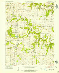
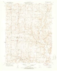
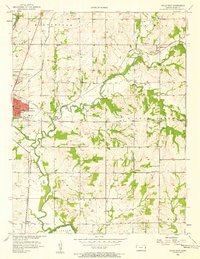
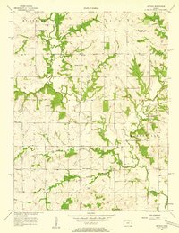
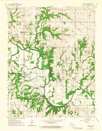
(107)- 1885 Map of Garnett
 1885 Garnett1885 Print · USGSAnderson County during the late nineteenth-century rail boom shows a landscape of emerging towns and heavy steam-engine influence. Genealogists can trace family roots in early settlements like Garnett, Central City, and Elizabethtown before the modern highway era.
 - 1885 Map of Lawrence, 1957 Print
 1885 Lawrence1957 Print · USGSEastern Kansas thrived during the mid-1880s as a vital corridor of rail-driven commerce and river valley agriculture. Genealogists and historians can trace old homesteads near the Kansas River and identify early township centers like Ottawa, Eudora, and Vinland.
 - 1887 Map of Olathe
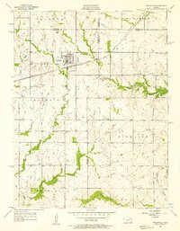
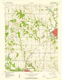
 1887 Olathe1887 Print · USGSEastern Kansas and the Missouri borderlands were being transformed by rail during the 1880s. Genealogists and historians can trace early town sites and railroad corridors like the Kansas City Clinton and Springfield Railroad and settlements from Lenexa to Osawatomie.
 - 1887 Map of Mound City
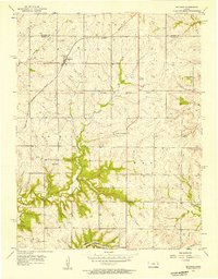
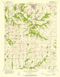
 1887 Mound City1887 Print · USGSLinn and Miami counties are captured here in the 1880s, showcasing a landscape of river-valley agriculture and rapid railroad growth. Researchers can trace the path of the Kansas City Fort Scott and Gulf Railroad through Pleasanton or locate early settlements like Trading Post and Wall Street.
 - 1889 Map of Lawrence
 1889 Lawrence1889 Print · USGSEastern Kansas thrived as a rail-and-river hub in the late nineteenth century, as documented in this detailed survey. Genealogists can trace family roots through early settlements like Clinton, Vinland, and Eudora or locate land near the Marais Des Cygnes River.6 unique versions available
 - 1893 Map of Mound City
 1893 Mound City1893 Print · USGSEastern Kansas at the close of the nineteenth century is defined here by its rail-and-river network and early township boundaries. Genealogists and historians can trace the early growth of Mound City, Pleasanton, and La Cygne along the Kansas City Osage and Gulf Railroad.4 unique versions available
 - 1893 Map of Olathe
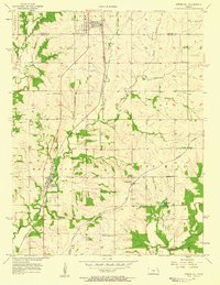
 1893 Olathe1893 Print · USGSThe Kansas-Missouri border thrived during the late nineteenth century as a hub for expanding railroads and prairie commerce. Genealogists and historians can trace the early rail networks and locate frontier settlements like New Santa Fe, Olathe, and Paola.6 unique versions available
 - 1894 Map of Garnett
 1894 Garnett1894 Print · USGSAnderson County and its neighbors flourished during this Victorian-era railroad boom. Genealogists and historians can trace the exact routes of the Missouri Pacific Railroad and locate early settlements like Elizabethtown, Central City, and Mont Ida.5 unique versions available
 - 1947 Map of Lawrence, 1954 Print
 1947 Lawrence1954 Print · USGSEastern Kansas and western Missouri thrive in the late 1940s, showing a landscape defined by major river valleys and a dense railway network. Genealogists can trace family settlements from Lawrence to Greenwood and locate landmarks like Olathe Navy and Lake Lotawana.
 - 1950 Map of Lawrence
 1950 Lawrence1950 Print · USGSMid-century Kansas and Missouri come alive in this map of the river-valley corridors just as the interstate era was beginning. Researchers can trace the legacy of major rail lines like the Union Pacific RR and locate ancestral roots in towns from Lawrence to Harrisonville.
 - 1953 Map of Freeman, 1954 Print
 1953 Freeman1954 Print · USGSThe Missouri-Kansas borderlands in the early fifties are captured here as a landscape of rural schoolhouses and rail-side settlements. Genealogists can trace family roots through local landmarks like Dodge Point Sch, Shiloh Chapel, and the Freeman Cem.4 unique versions available
 - 1953 Map of West Line, 1954 Print
 1953 West Line1954 Print · USGSAlong the Kansas-Missouri border in the early fifties, this area shows a landscape of small rail-side towns and rural school districts. Researchers can find many family landmarks, from Glenwild Cem and Corinth Cem to the tracks of the Kansas City Southern.4 unique versions available
 - 1956 Map of Wellsville, 1957 Print
 1956 Wellsville1957 Print · USGSWellsville was a thriving railroad and agricultural hub in the mid-1950s, centered on the Santa Fe and Topeka Atchison line. Genealogists and historians can trace rural family roots through the Rock Creek Sch and cemeteries like Walnut Creek Cem.2 unique versions available
 - 1956 Map of Bucyrus, 1957 Print
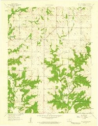
 1956 Bucyrus1957 Print · USGSBucyrus and rural Miami County are shown here in the mid-fifties, still defined by a landscape of family farms and small rail stops. Researchers can trace historic school sites like Wea Sch and Snake Den Sch, or follow the path of the Missouri Pacific railroad.2 unique versions available
 - 1956 Map of Paola East, 1958 Print
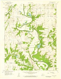
 1956 Paola East1958 Print · USGSMid-century Miami County reveals a landscape of thriving rural school districts and growing energy infrastructure near Paola. Genealogists and historians can trace family locations near Somerset, Block, and several country cemeteries like Holy Cross Cem.2 unique versions available
 - 1956 Map of Lawrence, 1967 Print
 1956 Lawrence1967 Print · USGSEastern Kansas and the Missouri border country are captured here during the mid-century transition to the interstate era. Genealogists and local historians can trace family-named terrain like Summers Mound and the footprint of Sunflower Ordnance Works near Baldwin City.4 unique versions available
 - 1957 Map of Paola West, 1958 Print
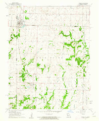
 1957 Paola West1958 Print · USGSMiami County at the end of the fifties reveals a landscape shaped by three major railroads and the early oil industry. Genealogists can trace family footprints through numerous country schools like Lone Star Sch and cemeteries including Elmdale Cem.2 unique versions available
 - 1957 Map of Spring Hill, 1958 Print
 1957 Spring Hill1958 Print · USGSThe Johnson and Miami County line comes alive in the late fifties, showing a rural landscape defined by two major rail lines. Researchers can trace family ties at the Glendale Sch, explore the village of Hillsdale, and follow the banks of Sweetwater Creek.2 unique versions available
 - 1957 Map of Louisburg, 1958 Print
 1957 Louisburg1958 Print · USGSLouisburg and the eastern Kansas plains are captured in the late fifties as a landscape of small school districts and early oil exploration. Researchers can trace rural landmarks like Miami Ch, the Bellview Sch Cem, and the Missouri Kansas Texas rail line.
 - 1957 Map of Antioch, 1958 Print
 1957 Antioch1958 Print · USGSNortheast Kansas rural life is captured here in the late fifties, where the border of Johnson and Miami counties meets. Genealogists and local historians can trace the locations of several country schoolhouses and churches, including North Windy Sch, Scott Valley Sch, and the Home Holding Cem.2 unique versions available
 - 1957 Map of New Lancaster, 1959 Print
 1957 New Lancaster1959 Print · USGSMiami and Linn counties appear here in the late fifties, showcasing a rural landscape defined by creek drainage and small crossroads. Researchers can trace family sites near New Lancaster, Drexel Corner, and the Rockville Cem.2 unique versions available
 - 1958 Map of Fontana, 1959 Print
 1958 Fontana1959 Print · USGSEastern Kansas at the close of the 1950s reveals a landscape defined by the winding Marais Des Cygnes River and the rural town of Fontana. Genealogists can trace family names through the Debrick Cem or locate historic school sites such as Trinity Sch and Hawkeye Sch.2 unique versions available
 - 1961 Map of Lawrence
 1961 Lawrence1961 Print · USGSThe Kansas-Missouri borderland shows its mid-century transition from a rail-dependent agricultural region to a suburbanizing landscape. Genealogists can trace family footprints through numerous Cem sites and distinctive terrain landmarks like Graves Mound and Summers Mound.
 - 1961 Map of Drexel, 1962 Print
 1961 Drexel1962 Print · USGSThe Kansas-Missouri border comes alive in the early sixties as rural townships thrive along the rail lines. Genealogists and historians can trace family land between Drexel and the creeks of Morman Fork, or locate resting places at Sharon Cem and West Point Cem.2 unique versions available
 - 1963 Map of Rantoul, 1964 Print
 1963 Rantoul1964 Print · USGSEastern Kansas agriculture and river life are preserved here in the early sixties, centered on the village of Rantoul. Researchers can trace the path of the Missouri Pacific railroad and locate rural landmarks like New Hope Ch and Howard Cem.2 unique versions available
Showing maps 1-25 of 107
Top cities of Miami County
- Paola historical maps
- Osawatomie historical maps
- Louisburg historical maps
- Wea historical maps
- Stanton historical maps
- Fontana historical maps
Frequently asked questions
- What are the different types of historical maps available for Miami County?
- What is the oldest map of Miami County?
- Where can I purchase historical maps of Miami County for my home or office?
- Where can I download high-res historical maps of Miami County?
- Are there historical topographic maps available for Miami County?
- Is there historical aerial imagery available for Miami County?
- Where are historical maps of Miami County sourced from?