1960s Maps of Miami County, Kansas
Explore 5 historic maps of Miami County from the 1960s. These maps offer a rare glimpse into what life looked like during the 1960s — showing old roads, neighborhoods, homes, and landmarks that have changed or disappeared over time.
Whether you're researching your family's past, planning a metal detecting trip, or studying how Miami County's landscape evolved across the 1960s, these high-resolution maps are a powerful tool for exploring the history of this region.
- Focus on a specific era: All maps on this page are from the 1960s, giving you a focused view of this time period.
- See what’s changed: Compare century-old streets, trails, and buildings to today's modern landscape using overlays and satellite layers.
- Research with precision: Use these maps for genealogy, historical research, land use analysis, or educational projects.
- View, download, or print: Maps are fully viewable online in high resolution, and can be downloaded or printed for your own records.
Start exploring Miami County's history through authentic maps from the 1960s. This is your window into the past.
Miami County, KS maps
(5)- 1961 Map of Lawrence
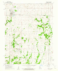
 1961 Lawrence1961 Print · USGSThe Kansas-Missouri borderland shows its mid-century transition from a rail-dependent agricultural region to a suburbanizing landscape. Genealogists can trace family footprints through numerous Cem sites and distinctive terrain landmarks like Graves Mound and Summers Mound.
 - 1961 Map of Drexel, 1962 Print
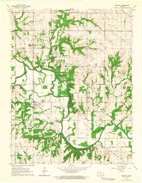
 1961 Drexel1962 Print · USGSThe Kansas-Missouri border comes alive in the early sixties as rural townships thrive along the rail lines. Genealogists and historians can trace family land between Drexel and the creeks of Morman Fork, or locate resting places at Sharon Cem and West Point Cem.2 unique versions available
 - 1963 Map of Rantoul, 1964 Print
 1963 Rantoul1964 Print · USGSEastern Kansas agriculture and river life are preserved here in the early sixties, centered on the village of Rantoul. Researchers can trace the path of the Missouri Pacific railroad and locate rural landmarks like New Hope Ch and Howard Cem.2 unique versions available
 - 1963 Map of Osawatomie, 1964 Print
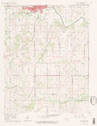 1963 Osawatomie1964 Print · USGSOsawatomie and the surrounding Miami County townships are captured here in the early 1960s at the junction of two major railroads. Genealogists and local historians can trace rural school districts like Union Valley Sch and find family-named sites such as Whiteford Cem or the settlement of Bangor.2 unique versions available
 - 1966 Map of Lane, 1967 Print
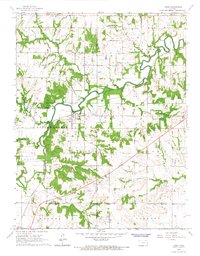 1966 Lane1967 Print · USGSThe rural borderlands of Franklin and Miami counties are captured in the mid-1960s, centered on the winding Pottawatomie Creek. Researchers can trace local lineage through Needham Cem and find vanished rural schools like Fairview Sch and Indianapolis Sch.2 unique versions available
End of results
Showing maps 1-5 of 5
Top cities of Miami County
- Paola historical maps
- Osawatomie historical maps
- Louisburg historical maps
- Wea historical maps
- Stanton historical maps
- Fontana historical maps
Frequently asked questions
- What are the different types of historical maps available for Miami County?
- What is the oldest map of Miami County?
- Where can I purchase historical maps of Miami County for my home or office?
- Where can I download high-res historical maps of Miami County?
- Are there historical topographic maps available for Miami County?
- Is there historical aerial imagery available for Miami County?
- Where are historical maps of Miami County sourced from?