2020s Maps of Morton County, Kansas
Explore 25 historic maps of Morton County from the 2020s. These maps offer a rare glimpse into what life looked like during the 2020s — showing old roads, neighborhoods, homes, and landmarks that have changed or disappeared over time.
Whether you're researching your family's past, planning a metal detecting trip, or studying how Morton County's landscape evolved across the 2020s, these high-resolution maps are a powerful tool for exploring the history of this region.
- Focus on a specific era: All maps on this page are from the 2020s, giving you a focused view of this time period.
- See what’s changed: Compare century-old streets, trails, and buildings to today's modern landscape using overlays and satellite layers.
- Research with precision: Use these maps for genealogy, historical research, land use analysis, or educational projects.
- View, download, or print: Maps are fully viewable online in high resolution, and can be downloaded or printed for your own records.
Start exploring Morton County's history through authentic maps from the 2020s. This is your window into the past.
Morton County, KS maps
(25)- 2022 Map of Stonington SE, 2022 Print
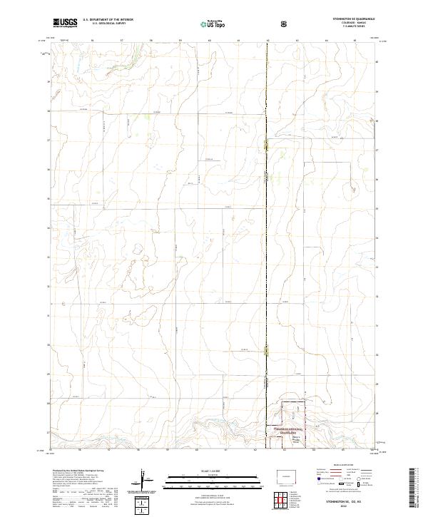 2022 Stonington SE2022 Print · USGSThis early twenty-first-century survey captures the high-plains borderlands where Colorado meets Kansas at the edge of the Cimarron National Grassland. Genealogists and local historians can trace the section-line road network and the seasonal course of the N Fork Cimarron River and Sand Arroyo Cr.
 - 2022 Map of Midway SE, 2022 Print
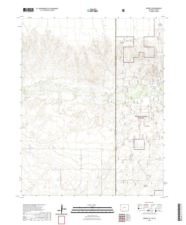 2022 Midway SE2022 Print · USGSThe Colorado-Kansas borderlands are documented here in 2022, centering on the open rangelands of the Cimarron National Grassland. Researchers can trace the legacy of western migration along the Santa Fe National Historic Trl and across the Cimarron River.
 - 2022 Map of Midway NE, 2022 Print
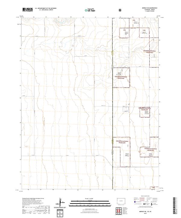 2022 Midway NE2022 Print · USGSThe Colorado-Kansas borderlands in the early 2020s are defined by the intersection of state lines and ranching heritage. Trace the boundaries of the Cimarron National Grassland and management units like Pasture Number Eighteen near the N Fork Cimarron River.
 - 2022 Map of Shore Airport NE, 2022 Print
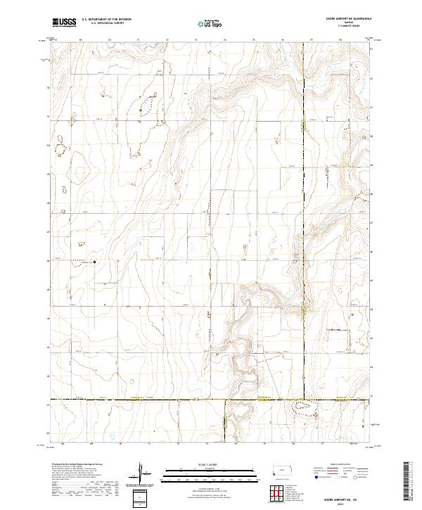 2022 Shore Airport NE2022 Print · USGSWestern Kansas at the intersection of Stanton, Morton, Grant, and Stevens counties shows a landscape defined by section lines and river valleys. Genealogists and local historians can locate the Liverpool Cem or trace the winding path of the N Fork Cimarron River.
 - 2022 Map of Elkhart North, 2022 Print
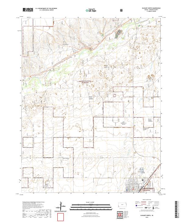 2022 Elkhart North2022 Print · USGSMorton County's high plains and river breaks appear here in the early twenty-first century, centered on the protected Cimarron National Grassland. Researchers can trace historic routes along the Santa Fe National Historic Trl and locate local landmarks like Point of Rocks and the Elkhart Cem.
 - 2022 Map of Shore Airport SW, 2022 Print
 2022 Shore Airport SW2022 Print · USGSSouthwest Kansas ranching and farm country is captured here during the early twenty-first century. Researchers can locate the Richfield Cem and trace the course of the N Fork Cimarron River through the sectioned plains.
 - 2022 Map of Saunders, 2022 Print
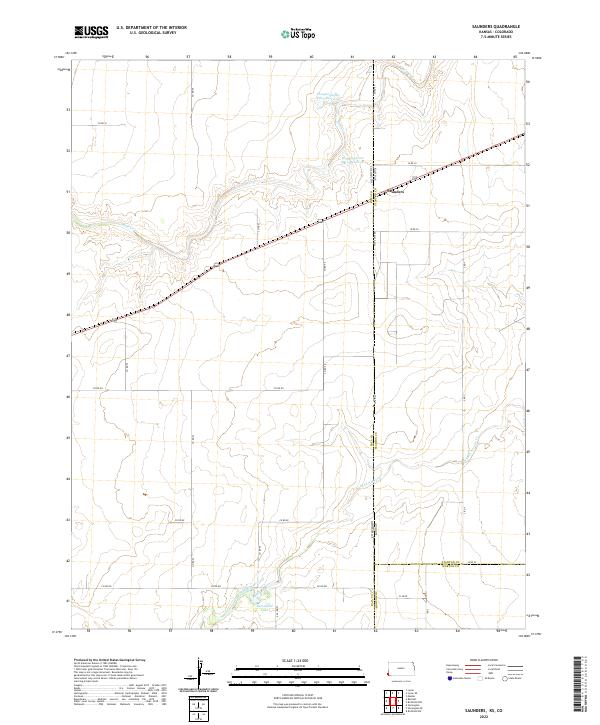 2022 Saunders2022 Print · USGSThe Kansas-Colorado borderlands are documented here in the early twenty-first century, centered on the small community of Saunders. Researchers can trace the drainage of Bear Creek and locate water features like Hoopengarner SW-4 Reservoir and Burchfield Lake.
 - 2022 Map of Richfield, 2022 Print
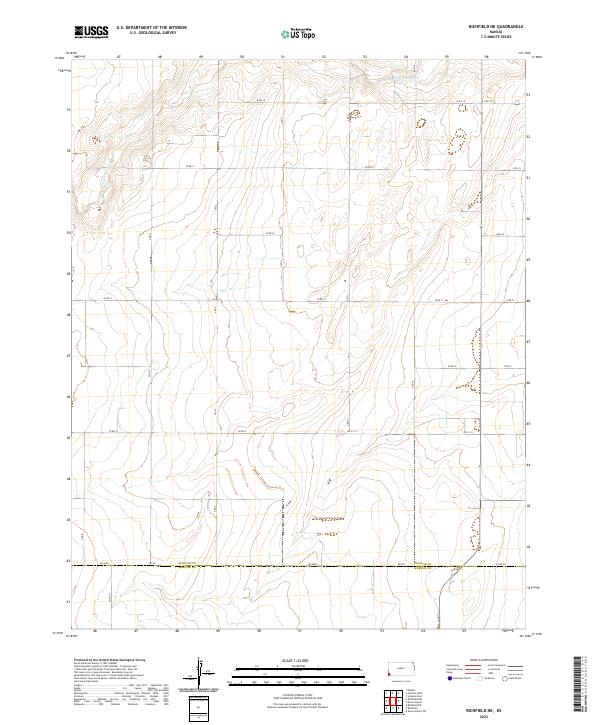
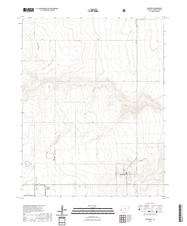 2022 Richfield2022 Print · USGSMorton County, Kansas, is documented here in recent years, centered on the historic prairie community of Richfield. Researchers can trace the local street grid near the N Fork Cimarron River and locate regional landmarks like New Pasture Number Thirteen.
 - 2022 Map of Rolla NW, 2022 Print
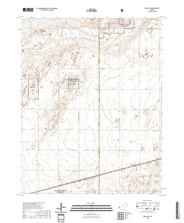
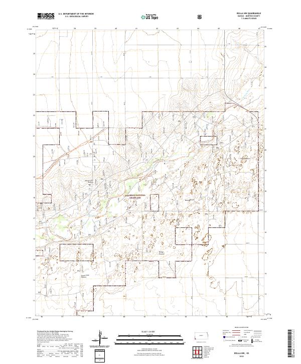 2022 Rolla NW2022 Print · USGSMorton County's high plains are shown here in the early 2020s, where federal conservation land meets the deep tracks of the American West. Researchers can trace the legendary Santa Fe National Historic Trl as it winds past the Cimarron River and through the North Lowe Pasture.
 - 2022 Map of Richfield NE, 2022 Print
 2022 Richfield NE2022 Print · USGSStanton County and Morton County are captured here during the early 2020s, showing the intersection of rural Kansas section lines. You can trace the path of Sand Arroyo Cr across the plains and follow the boundary roads like DD Blvd and Rd DD.
 - 2022 Map of Richfield SW, 2022 Print
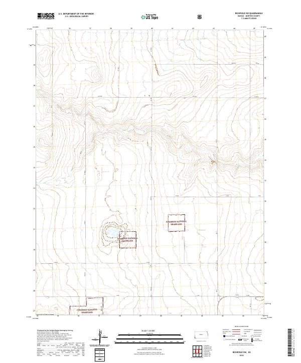 2022 Richfield SW2022 Print · USGSThe southwestern plains of Morton County are defined by the expansive Cimarron National Grassland in this modern survey. Researchers can trace the section-line roads and remote prairie access points along Co Rd 7, Aa Blvd, and V Blvd.
 - 2022 Map of Richfield NW, 2022 Print
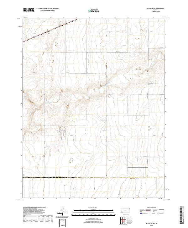 2022 Richfield NW2022 Print · USGSThe High Plains of southwest Kansas are captured here during a period of modern agricultural stability near the Oklahoma border. Researchers can trace the winding course of Sand Arroyo Cr and the precise county line dividing Stanton Co from Morton Co along DD Blvd.
 - 2022 Map of Shore Airport, 2022 Print
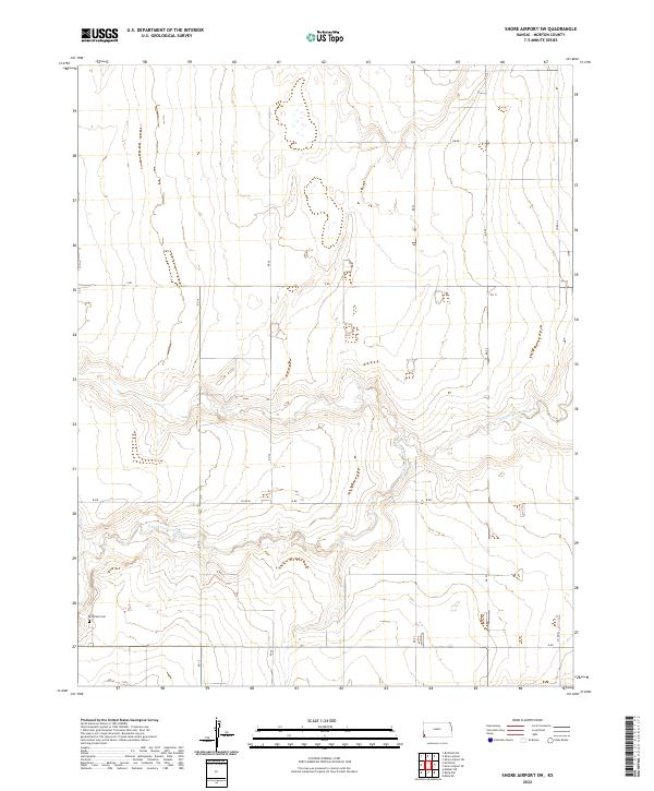
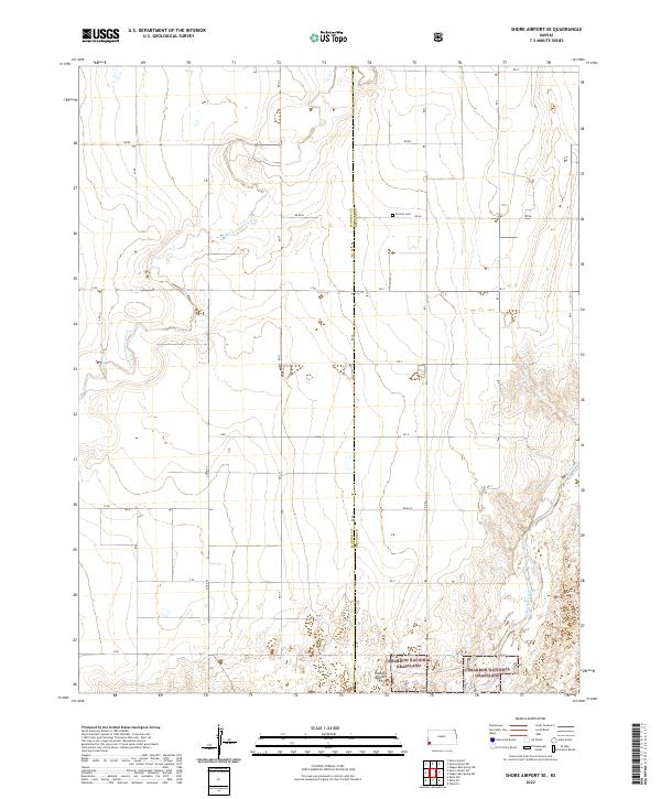
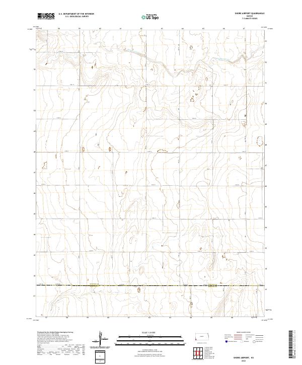 2022 Shore Airport2022 Print · USGSThe high plains of southwestern Kansas appear here as a strictly ordered landscape of section lines and prairie drainage. Genealogists and researchers can trace property boundaries along the Stanton Co line or follow the path of Sand Arroyo Cr.
 - 2022 Map of Elkhart South, 2022 Print
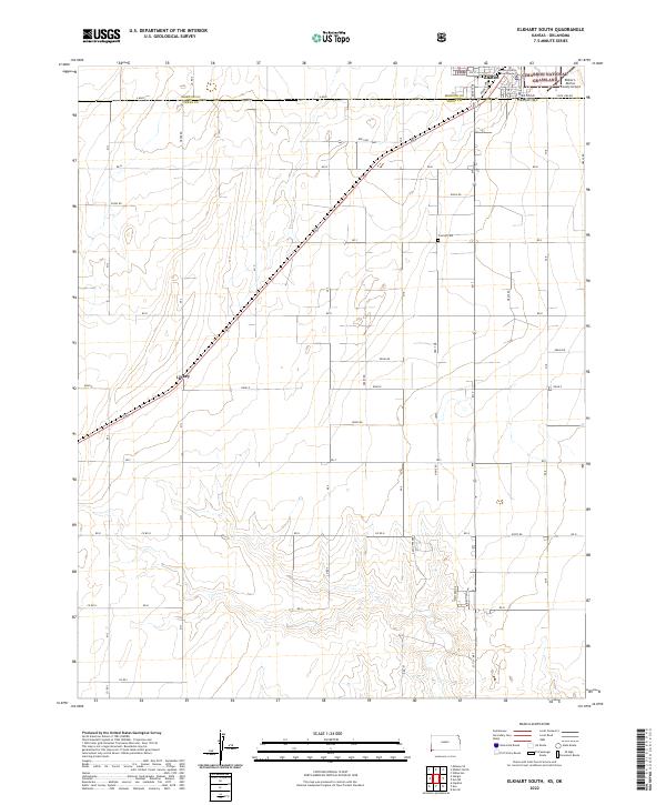 2022 Elkhart South2022 Print · USGSThe Kansas-Oklahoma border comes alive in this survey of the high plains south of Elkhart. Genealogists and local researchers can trace early family plots at Cosmos Cem or locate the former rail stop at Libbey along the section lines.
 - 2022 Map of Wilburton, 2022 Print
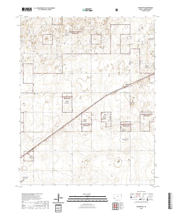 2022 Wilburton2022 Print · USGSThe High Plains of Morton County appear here in the early twenty-first century, showing a landscape of organized ranching and public land. Local researchers can locate the Prairie Flower Cem and trace the boundaries of the Cimarron National Grassland.
 - 2022 Map of Rolla NE, 2022 Print
 2022 Rolla NE2022 Print · USGSThe southwest Kansas High Plains and the Cimarron River corridor are documented here in the early 2020s. Researchers can trace the management of public lands across Morton Co and Stevens Co, locating numbered grazing areas like CNG Pasture Number Twentythree.
 - 2022 Map of Rolla SE, 2022 Print
 2022 Rolla SE2022 Print · USGSThe high plains of the Kansas-Oklahoma borderlands are captured here in the early twenty-first century, showing the managed prairies of the Cimarron National Grassland. Researchers can trace the divisions of South East Rollo Pasture and County Line Pasture along the Morton and Stevens county line.
 - 2022 Map of Elkhart NE, 2022 Print
 2022 Elkhart NE2022 Print · USGSMorton County, Kansas, is seen here in the early twenty-first century, centered on the protected shortgrass prairie and river bottoms. You can trace the path of the Santa Fe National Historic Trl and locate local landmarks like Yoder Pasture and Wilburton Pond.
 - 2022 Map of Rolla, 2022 Print
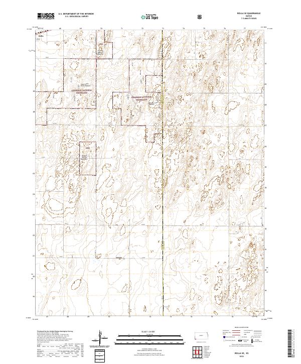
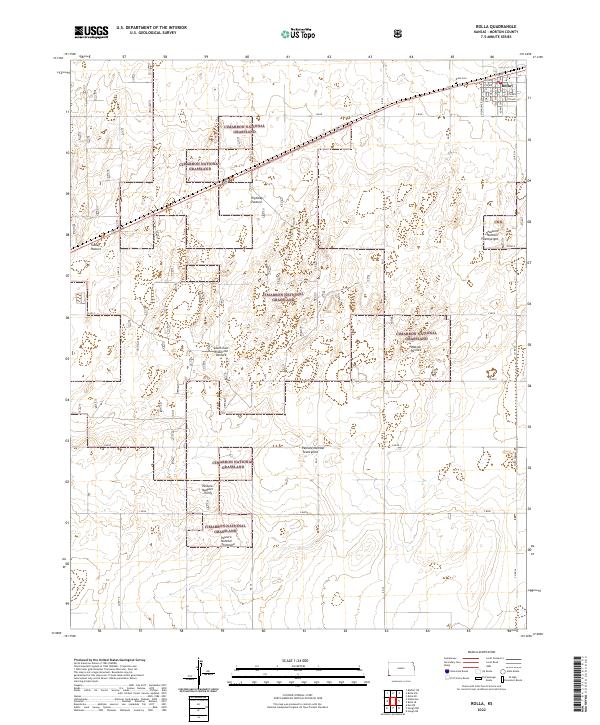 2022 Rolla2022 Print · USGSRolla and the surrounding Morton County plains appear here in the early 2020s, dominated by the managed landscapes of the Cimarron National Grassland. Researchers can trace local heritage at Rolla Cem or locate family grazing interests at Watson Pasture and Tucker Pasture.
 - 2022 Map of Elkhart NW, 2022 Print
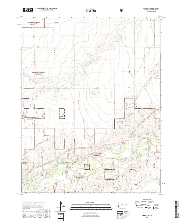
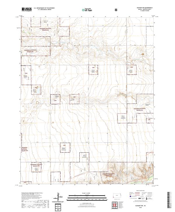 2022 Elkhart NW2022 Print · USGSMorton County, Kansas, is presented here in the early 2020s, showcasing the open prairie management of the Cimarron National Grassland. You can trace the path of the Santa Fe National Historic Trl as it crosses the North Fork Cimarron River.
 - 2022 Map of Shore Airport SE, 2022 Print
 2022 Shore Airport SE2022 Print · USGSThe high plains of southwest Kansas are captured here in 2022 at the intersection of Morton and Stevens counties. Researchers can trace the winding N Fork Cimarron River, locate the Dermot Cem, and explore the managed boundaries of the Cimarron National Grassland.
 - 2022 Map of Eva NE, 2022 Print
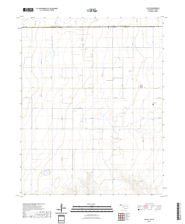 2022 Eva NE2022 Print · USGSThe Kansas-Oklahoma border comes into focus in this recent survey of the High Plains, where the grid of State Line Rd separates the two states. Researchers can locate the Kuhn Cem and trace the winding course of Cow Cr through several rural townships.
 - 2022 Map of Sturgis, 2022 Print
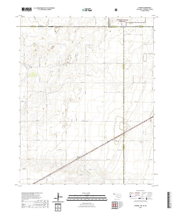 2022 Sturgis2022 Print · USGSThe tri-state border region of the Oklahoma Panhandle comes into focus in this modern survey of the high plains. Researchers can trace the remote settlement of Sturgis, follow the course of Goff Cr, and map the boundaries of the Cimarron National Grassland.
 - 2022 Map of Hough NW, 2022 Print
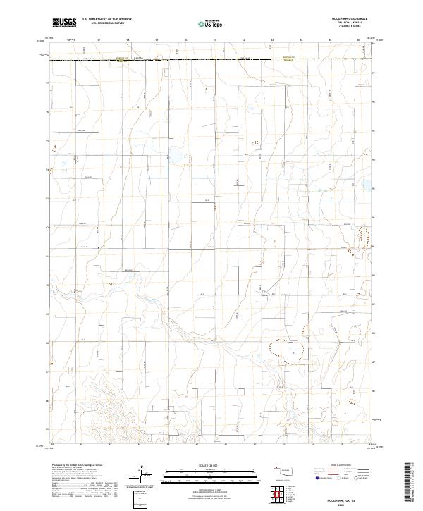 2022 Hough NW2022 Print · USGSThe Oklahoma Panhandle border comes into sharp focus in this modern survey of the high plains. Researchers can trace the agricultural grid and water sources like Cow Cr along the intersection of State Line Rd and N0735 Rd.
 - 2022 Map of Hough NE, 2022 Print
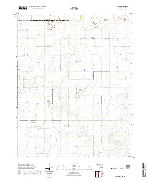 2022 Hough NE2022 Print · USGSThe Oklahoma-Kansas borderlands are shown in modern detail across this high plains region. Genealogists and local historians can trace family locations near Barden Memorial Cem, Camp Cem, and the waters of Pony Cr.
End of results
Showing maps 1-25 of 25
Top cities of Morton County
Frequently asked questions
- What are the different types of historical maps available for Morton County?
- What is the oldest map of Morton County?
- Where can I purchase historical maps of Morton County for my home or office?
- Where can I download high-res historical maps of Morton County?
- Are there historical topographic maps available for Morton County?
- Is there historical aerial imagery available for Morton County?
- Where are historical maps of Morton County sourced from?