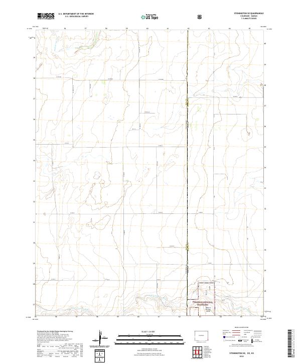
2022 Map of Stonington SE
USGS Topo · Published 2022About this map
Cimarron National Grassland dominates the southeastern portion of this landscape at the high-plains border of Colorado and Kansas. Within this protected expanse, Pasture Number Three is defined by the winding course of the N Fork Cimarron River, which cuts across the southern sections. The map reveals a strictly regulated grid of local transit, with routes like Co Rd 88, Co Rd Z, and Co Rd V carving the terrain into precise sections characteristic of the Public Land Survey System. In the northwest, Sand Arroyo Cr drains toward the plains, illustrating the subtle hydrology of this semi-arid region. The transition from Baca Co, Colorado, into Morton Co, Kansas, is marked only by a straight political line and a shift in road designations such as AA Blvd and W Blvd.
Find a feature on this map
26 named features on this map. Tap any name to fly to it.
Don’t see what you’re looking for? This feature index may not catch every label — zoom into the map to look around manually.
Map Details
Editions of this 2022 Stonington SE Map
This is the sole edition of this map. No revisions or reprints were ever made.
Other maps of this area

1892 · Vilas
USGS Topo · 1:125,000

1955 · La Junta
USGS Topo · 1:250,000

1955 · Dodge City
USGS Topo · 1:250,000

1958 · La Junta
USGS Topo · 1:250,000

1958 · Dodge City
USGS Topo · 1:250,000

1959 · Dodge City
USGS Topo · 1:250,000

1968 · La Junta
USGS Topo · 1:250,000

1973 · Richfield NW
USGS Topo · 1:24,000
1973 · Richfield SW
USGS Topo · 1:24,000
1973 · Elkhart NW
USGS Topo · 1:24,000