1960s Maps of Nemaha County, Kansas
Explore 21 historic maps of Nemaha County from the 1960s. These maps offer a rare glimpse into what life looked like during the 1960s — showing old roads, neighborhoods, homes, and landmarks that have changed or disappeared over time.
Whether you're researching your family's past, planning a metal detecting trip, or studying how Nemaha County's landscape evolved across the 1960s, these high-resolution maps are a powerful tool for exploring the history of this region.
- Focus on a specific era: All maps on this page are from the 1960s, giving you a focused view of this time period.
- See what’s changed: Compare century-old streets, trails, and buildings to today's modern landscape using overlays and satellite layers.
- Research with precision: Use these maps for genealogy, historical research, land use analysis, or educational projects.
- View, download, or print: Maps are fully viewable online in high resolution, and can be downloaded or printed for your own records.
Start exploring Nemaha County's history through authentic maps from the 1960s. This is your window into the past.
Nemaha County, KS maps
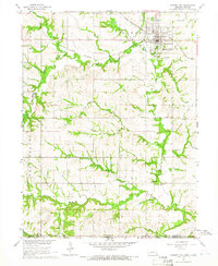
(21)- 1960 Map of Kansas City
 1960 Kansas City1960 Print · USGSMid-century Kansas and Missouri meet at the river forks, showing a sprawling rail-and-river economy during the 1950s growth era. Genealogists and researchers can trace tribal lands like the Kickapoo Indian Reservation or follow the early interstate corridors through Saint Joseph and Independence.3 unique versions available
 - 1960 Map of Bern, 1961 Print
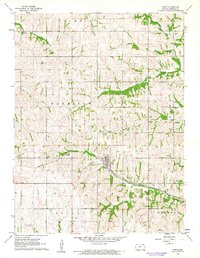
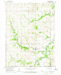
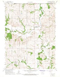
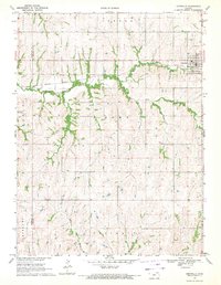
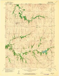 1960 Bern1961 Print · USGSThe northern Kansas prairie comes into focus at the dawn of the 1960s, centered on the railroad town of Bern. Researchers can trace old rural schoolhouses like Union Sch and Excelsior Sch or locate family burial plots at Strahm Cem and Williams Cem.
 - 1960 Map of Sabetha, 1961 Print
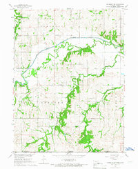
 1960 Sabetha1961 Print · USGSSabetha sits at the crossroads of two major rail lines during the early sixties, anchoring a landscape of small Kansas townships and creek-fed valleys. Genealogists and historians can trace old landmarks like the Albany Cemetery, Berwick School, and the Sabetha Municipal Landing Field.
 - 1961 Map of Circleville, 1962 Print
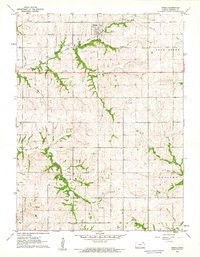
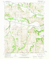
 1961 Circleville1962 Print · USGSCircleville and the surrounding townships are captured in the early 1960s as the rural economy revolved around the rail and creek networks. Genealogists and historians can locate Circleville Cem, the Grange Hall, and the Missouri Pacific line.
 - 1961 Map of Wetmore, 1962 Print
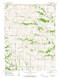
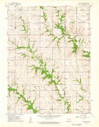
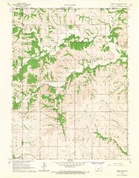
 1961 Wetmore1962 Print · USGSWetmore and the surrounding townships are captured in the early sixties as a thriving rail and agricultural corridor. Genealogists and local historians can trace the foundations of this rural community through the Granada Cem, the Powhattan Cem, and the path of the Missouri Pacific line.
 - 1961 Map of Goff, 1962 Print
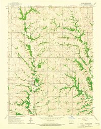
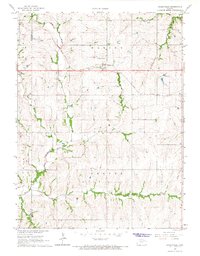
 1961 Goff1962 Print · USGSGoff and the surrounding townships of Nemaha County are captured here in the early sixties, centered on the Missouri Pacific rail corridor. Genealogists can locate family sites at St Bedes Cem, Fairview Cem, and Barnes Cem across this rural landscape.
 - 1961 Map of Oneida, 1962 Print
 1961 Oneida1962 Print · USGSOneida and the surrounding townships of Nemaha County are captured here in the early sixties, centered on the Union Pacific rail corridor. Family historians can locate the Ford Cem and trace the winding paths of Harris Creek and Tennessee Creek.
 - 1961 Map of Woodlawn, 1962 Print
 1961 Woodlawn1962 Print · USGSNortheastern Kansas is shown here in the early sixties, split by the Nemaha and Brown county lines. Genealogists and historians can trace family locations near Woodlawn, Capioma, and Fidelity, or locate the Woodlawn Cem and local Quarries.
 - 1964 Map of Soldier, 1965 Print
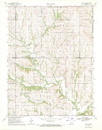
 1964 Soldier1965 Print · USGSNortheast Kansas in the mid-1960s reveals a transition from rail to road as local communities adapted to changing times. Researchers can trace the Old Railroad Grade near Soldier and locate rural landmarks like the High Sch and Bancroft.
 - 1965 Map of Pawnee City, 1966 Print
 1965 Pawnee City1966 Print · USGSSoutheast Nebraska in the mid-sixties reveals a landscape of rural schoolhouses and busy rail junctions centered on Pawnee City. Researchers can trace old property lines and family landmarks like Barker School, Evergreen Cemetery, and the Rock Island Railroad.
 - 1965 Map of Du Bois, 1966 Print
 1965 Du Bois1966 Print · USGSSoutheastern Pawnee County comes to life in the mid-1960s as a bustling agricultural landscape centered on the village of Du Bois. Genealogists can trace family roots through numerous country landmarks including Sheridan Sch, St Johns Ch, and Cincinnati Cem.
 - 1965 Map of Humboldt SW, 1967 Print
 1965 Humboldt SW1967 Print · USGSSoutheastern Nebraska was still a landscape defined by small rural school districts and community churches in the mid-1960s. Researchers can trace the legacy of local education at Rose Dale Sch and Athens Sch, or locate family sites near Bohemian Cem.2 unique versions available
 - 1965 Map of Humboldt SE, 1967 Print
 1965 Humboldt SE1967 Print · USGSThe Nebraska-Kansas border comes alive in the mid-sixties as the Big Nemaha River branches across Richardson County farmland. Researchers can locate the Miles Ranch, trace the rail lines of the Chicago Burlington and Quincy, and find family sites like Wild Rose Cem.
 - 1966 Map of St Benedict, 1967 Print
 1966 St Benedict1967 Print · USGSNorthern Kansas farmland meets the Nebraska border in the late sixties, a landscape defined by rolling prairie and meandering streams. Genealogists can locate St Benedict, trace roots at St Marys Cem, or follow the Chicago Rock Island and Pacific railroad line.
 - 1966 Map of Seneca NW, 1967 Print
 1966 Seneca NW1967 Print · USGSNortheast Kansas in the mid-1960s was a landscape of deeply etched creek valleys and tidy township squares. Genealogists and local historians can trace family land in St Bridget or Marion and locate the historic Madden Cem tucked away near the county line.
 - 1966 Map of Baileyville, 1967 Print
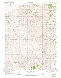
 1966 Baileyville1967 Print · USGSNortheast Kansas in the mid-1960s shows a landscape of steady agricultural life along the Union Pacific corridor. Researchers can trace land use through detailed fence lines and locate local landmarks like Sacred Heart Cem and the small hub of Baileyville.
 - 1966 Map of Seneca, 1967 Print
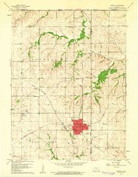
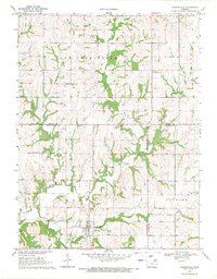
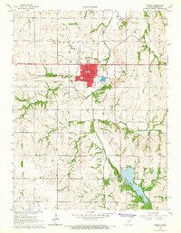 1966 Seneca1967 Print · USGSSeneca and the surrounding Nemaha County townships thrive during the mid-sixties as a center for rail transport and civic life. Researchers can trace family roots at SS Peter and Paul Cem, locate the old County Home, or explore the riparian landscape of Nemaha County State Park.
 - 1969 Map of Centralia, 1971 Print
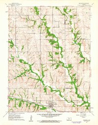
 1969 Centralia1971 Print · USGSCentralia sits at a rail-and-river crossroads in the late sixties, where the Missouri Pacific line meets the winding Black Vermillion River. Researchers can trace the layout of the town and its outlying rural townships, including locations like Centralia Cem and Mulberry Cem.
 - 1969 Map of Havensville, 1971 Print
 1969 Havensville1971 Print · USGSHavensville and the surrounding townships in the late sixties reveal a rural landscape defined by creek valleys and evolving infrastructure. Genealogists and local historians can trace the Old Railroad Grade and locate family burial sites at Havensville or America City Cemeteries.
 - 1969 Map of Corning, 1971 Print
 1969 Corning1971 Print · USGSSouthern Nemaha County comes into focus in the late 1960s, showing the agricultural heartland of Kansas and its vital railroad corridors. Researchers can trace historic family burial sites at St Patrick Cem and Roots Cem or follow the Missouri Pacific line through Corning.
 - 1969 Map of Duluth, 1971 Print
 1969 Duluth1971 Print · USGSPottawatomie and Nemaha Counties come to life in the late sixties as the prairie landscape transitions between small rail towns and rural parishes. Genealogists and historians can trace family ties at St Patricks Ch, find old burial sites like Home Cem, and follow the Union Pacific rail line.
End of results
Showing maps 1-21 of 21
Top cities of Nemaha County
- Seneca historical maps
- Centralia historical maps
- Berwick historical maps
- Wetmore historical maps
- Bern historical maps
- Goff historical maps
See more
Frequently asked questions
- What are the different types of historical maps available for Nemaha County?
- What is the oldest map of Nemaha County?
- Where can I purchase historical maps of Nemaha County for my home or office?
- Where can I download high-res historical maps of Nemaha County?
- Are there historical topographic maps available for Nemaha County?
- Is there historical aerial imagery available for Nemaha County?
- Where are historical maps of Nemaha County sourced from?