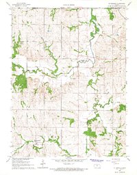
1966 Map of St Benedict
USGS Topo · Published 1967About this map
St Benedict and the surrounding farmland of Richmond township define the landscape of this mid-1960s Kansas survey. The settlement is anchored by St Marys Ch and its accompanying St Marys Cem, reflecting the deep-rooted community ties common in Nemaha County. The terrain is marked by a complex network of waterways, including the winding South Fork Big Nemaha River, Wildcat Creek, and Turkey Creek, which carve through the prairie and support the region's agricultural productivity.
Find a feature on this map
26 named features on this map. Tap any name to fly to it.
Don’t see what you’re looking for? This feature index may not catch every label — zoom into the map to look around manually.
Map Details
Editions of this 1966 St Benedict Map
This is the sole edition of this map. No revisions or reprints were ever made.
Other maps of this area

1888 · Hiawatha
USGS Topo · 1:125,000

1889 · Seneca
USGS Topo · 1:125,000

1894 · Seneca
USGS Topo · 1:125,000

1894 · Hiawatha
USGS Topo · 1:125,000

1916 · Humboldt
USGS Topo · 1:62,500

1950 · Kansas City
USGS Topo · 1:250,000

1954 · Kansas City
USGS Topo · 1:250,000

1955 · Manhattan
USGS Topo · 1:250,000

1955 · Nebraska City
USGS Topo · 1:250,000

1955 · Lincoln
USGS Topo · 1:250,000