Old Maps of Nemaha County, Kansas for Metal Detecting
Plan your next treasure hunt with 139 historic maps of Nemaha County. Find old homesites, ghost towns, trails, and gathering spots that may be lost to time — perfect for identifying promising metal detecting locations.
- Locate forgotten sites: Uncover places like long-lost settlements, abandoned rail lines, or gathering spots.
- Plan better hunts: Use map overlays combined with LiDAR or satellite views to narrow in on historically rich areas.
- Made for detectorists: Thousands of hobbyists use these maps to discover relics, coins, and hidden history.
Use these historic maps to boost your research and find new opportunities beneath the surface of Nemaha County.
Nemaha County, KS maps
(139)- 1888 Map of Hiawatha
 1888 Hiawatha1888 Print · USGSNortheast Kansas in the late 1880s was a bustling corridor of competing rail lines and established tribal lands. Researchers can trace the path of the Kansas Central Railroad and locate early settlements like Powhattan, Baker, and Wetmore.
 - 1889 Map of Seneca
 1889 Seneca1889 Print · USGSNortheast Kansas was a bustling intersection of frontier rail lines in the late nineteenth century. Genealogists and local historians can trace the early development of towns like Seneca and Centralia along the Missouri Pacific Railroad and other historic transit corridors.
 - 1894 Map of Seneca
 1894 Seneca1894 Print · USGSNortheastern Kansas is captured here in the late nineteenth century as a thriving rail and river corridor. You can trace early community sites like Guittard Station, Taylor Rapids, and America City along the Missouri Pacific Railroad.4 unique versions available
 - 1894 Map of Hiawatha
 1894 Hiawatha1894 Print · USGSNortheastern Kansas was a bustling intersection of tribal lands and iron rails in the late nineteenth century. Genealogists and historians can trace the early development of Hiawatha, the boundaries of the Kickapoo Indian Reservation, and rail stops like Netawaka or Berwick.4 unique versions available
 - 1916 Map of Humboldt
 1916 Humboldt1916 Print · USGSRichardson County was a landscape of river-valley farming and emerging drainage projects during the mid-1910s. Researchers can trace the development of rural education and transport through dozens of local landmarks like Windy Lonesome School, Miles Ranch, and the Missouri Pacific line.3 unique versions available
 - 1950 Map of Kansas City
 1950 Kansas City1950 Print · USGSMid-century Kansas and Missouri are captured here during a period of industrial growth and shifting transportation. Genealogists and historians can trace rail lines like the Wabash RR or locate ancestral homes near the Potawatomi Indian Reservation and Horton.
 - 1954 Map of Kansas City
 1954 Kansas City1954 Print · USGSThe Missouri-Kansas borderlands flourished in the post-war era as river commerce and rail networks converged at the Missouri River. Genealogists and historians can trace the foundations of Kansas City and smaller rural hubs like Hiawatha or Sabetha.
 - 1955 Map of Manhattan, 1964 Print
 1955 Manhattan1964 Print · USGSNorth Central Kansas is captured here in the mid-fifties, just as major flood control projects began reshaping the river valleys. Genealogists can locate family sites near St. Joseph Church, Sunset Cemetery, or along the busy tracks of the Rock Island RR.4 unique versions available
 - 1955 Map of Nebraska City, 1967 Print
 1955 Nebraska City1967 Print · USGSThe four-state region surrounding the Missouri River valley appears here in the mid-1950s, a landscape of rail-dependent market towns and rural school districts. Genealogists can locate family landmarks like the Rock Bluff School, St Oswald Church, and the Clarinda State Hospital.3 unique versions available
 - 1955 Map of Lincoln, 1967 Print
 1955 Lincoln1967 Print · USGSSoutheast Nebraska in the mid-fifties presents a landscape of thriving railroad towns and the expanding footprint of the capital city. Researchers can trace the legacy of the pioneer era at the Homestead National Monument of America or locate mid-century military infrastructure like Lincoln Air Force Base.5 unique versions available
 - 1956 Map of Manhattan
 1956 Manhattan1956 Print · USGSNorth-central Kansas in the mid-fifties reveals a landscape defined by the convergence of the Republican River and Smoky Hill River. Historians can trace the rail corridors of the Union Pacific RR and Missouri Pacific RR through towns like Manhattan and Clay Center.
 - 1956 Map of Kansas City, 1967 Print
 1956 Kansas City1967 Print · USGSThe Kansas-Missouri border region thrived during the mid-fifties, centered on the growing metropolitan cores and the busy river valleys. Researchers can trace the layout of significant government sites like Fort Leavenworth and the Lake City Army Ammunition Plant.4 unique versions available
 - 1957 Map of Nebraska City
 1957 Nebraska City1957 Print · USGSThe four-state junction of Nebraska, Iowa, Missouri, and Kansas comes alive in this mid-fifties survey of the Missouri River valley. Genealogists and historians can trace the rail-and-road networks connecting Nebraska City, Maryville, and the Squaw Creek National Wildlife Refuge.
 - 1957 Map of Manhattan
 1957 Manhattan1957 Print · USGSNortheast Kansas in the mid-1950s reveals a landscape of expanding military installations and new water projects. Genealogists and historians can trace the rail-to-river economy through the Union Pacific RR and old settlements like Clay Center or Marysville.
 - 1957 Map of Lincoln
 1957 Lincoln1957 Print · USGSSoutheastern Nebraska at mid-century shows a landscape of thriving rail towns and expanding infrastructure centered on Lincoln. Researchers can trace the path of the Chicago Burlington and Quincy railroad through communities like Weeping Water, Fairmont, and Seward.
 - 1958 Map of Lincoln
 1958 Lincoln1958 Print · USGSSoutheast Nebraska at the end of the 1950s shows a region defined by agricultural trade and the expansion of the state capital. Genealogists can trace family footprints across the Blue Valley and locate landmarks like the Lincoln AFB or the U.S. Veterans Hospital.
 - 1958 Map of Nebraska City
 1958 Nebraska City1958 Print · USGSThe Missouri River Valley and its fertile four-state borderlands are captured here during the mid-century expansion of the regional highway and rail networks. Genealogists can trace family roots through numerous rural landmarks like Moulton School, Shady Grove Church, and the Clarinda State Hospital.
 - 1960 Map of Kansas City
 1960 Kansas City1960 Print · USGSMid-century Kansas and Missouri meet at the river forks, showing a sprawling rail-and-river economy during the 1950s growth era. Genealogists and researchers can trace tribal lands like the Kickapoo Indian Reservation or follow the early interstate corridors through Saint Joseph and Independence.3 unique versions available
 - 1960 Map of Bern, 1961 Print
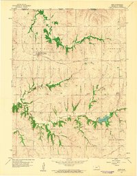 1960 Bern1961 Print · USGSThe northern Kansas prairie comes into focus at the dawn of the 1960s, centered on the railroad town of Bern. Researchers can trace old rural schoolhouses like Union Sch and Excelsior Sch or locate family burial plots at Strahm Cem and Williams Cem.
 - 1960 Map of Sabetha, 1961 Print
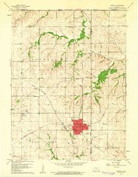 1960 Sabetha1961 Print · USGSSabetha sits at the crossroads of two major rail lines during the early sixties, anchoring a landscape of small Kansas townships and creek-fed valleys. Genealogists and historians can trace old landmarks like the Albany Cemetery, Berwick School, and the Sabetha Municipal Landing Field.
 - 1961 Map of Circleville, 1962 Print
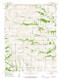 1961 Circleville1962 Print · USGSCircleville and the surrounding townships are captured in the early 1960s as the rural economy revolved around the rail and creek networks. Genealogists and historians can locate Circleville Cem, the Grange Hall, and the Missouri Pacific line.
 - 1961 Map of Wetmore, 1962 Print
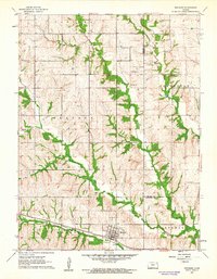 1961 Wetmore1962 Print · USGSWetmore and the surrounding townships are captured in the early sixties as a thriving rail and agricultural corridor. Genealogists and local historians can trace the foundations of this rural community through the Granada Cem, the Powhattan Cem, and the path of the Missouri Pacific line.
 - 1961 Map of Goff, 1962 Print
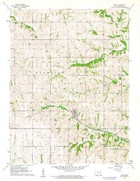 1961 Goff1962 Print · USGSGoff and the surrounding townships of Nemaha County are captured here in the early sixties, centered on the Missouri Pacific rail corridor. Genealogists can locate family sites at St Bedes Cem, Fairview Cem, and Barnes Cem across this rural landscape.
 - 1961 Map of Oneida, 1962 Print
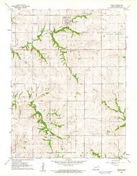 1961 Oneida1962 Print · USGSOneida and the surrounding townships of Nemaha County are captured here in the early sixties, centered on the Union Pacific rail corridor. Family historians can locate the Ford Cem and trace the winding paths of Harris Creek and Tennessee Creek.
 - 1961 Map of Woodlawn, 1962 Print
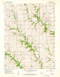 1961 Woodlawn1962 Print · USGSNortheastern Kansas is shown here in the early sixties, split by the Nemaha and Brown county lines. Genealogists and historians can trace family locations near Woodlawn, Capioma, and Fidelity, or locate the Woodlawn Cem and local Quarries.
Showing maps 1-25 of 139
Top cities of Nemaha County
- Seneca historical maps
- Centralia historical maps
- Berwick historical maps
- Wetmore historical maps
- Bern historical maps
- Goff historical maps
See more
Frequently asked questions
- What are the different types of historical maps available for Nemaha County?
- What is the oldest map of Nemaha County?
- Where can I purchase historical maps of Nemaha County for my home or office?
- Where can I download high-res historical maps of Nemaha County?
- Are there historical topographic maps available for Nemaha County?
- Is there historical aerial imagery available for Nemaha County?
- Where are historical maps of Nemaha County sourced from?