Old Maps of Vine Creek, Kansas for Metal Detecting
Plan your next treasure hunt with 11 historic maps of Vine Creek. Find old homesites, ghost towns, trails, and gathering spots that may be lost to time — perfect for identifying promising metal detecting locations.
- Locate forgotten sites: Uncover places like long-lost settlements, abandoned rail lines, or gathering spots.
- Plan better hunts: Use map overlays combined with LiDAR or satellite views to narrow in on historically rich areas.
- Made for detectorists: Thousands of hobbyists use these maps to discover relics, coins, and hidden history.
Use these historic maps to boost your research and find new opportunities beneath the surface of Vine Creek.
Vine Creek, KS maps
(11)- 1891 Map of Clay Center
 1891 Clay Center1891 Print · USGSClay County and northern Dickinson County were defined by competing rail lines in the early 1890s as the river valleys were first being settled. Genealogists and historians can trace the early foundations of towns like Clay Center, Wakefield, and Manchester alongside the Republican River.5 unique versions available
 - 1955 Map of Manhattan, 1964 Print
 1955 Manhattan1964 Print · USGSNorth Central Kansas is captured here in the mid-fifties, just as major flood control projects began reshaping the river valleys. Genealogists can locate family sites near St. Joseph Church, Sunset Cemetery, or along the busy tracks of the Rock Island RR.4 unique versions available
 - 1956 Map of Manhattan
 1956 Manhattan1956 Print · USGSNorth-central Kansas in the mid-fifties reveals a landscape defined by the convergence of the Republican River and Smoky Hill River. Historians can trace the rail corridors of the Union Pacific RR and Missouri Pacific RR through towns like Manhattan and Clay Center.
 - 1957 Map of Manhattan
 1957 Manhattan1957 Print · USGSNortheast Kansas in the mid-1950s reveals a landscape of expanding military installations and new water projects. Genealogists and historians can trace the rail-to-river economy through the Union Pacific RR and old settlements like Clay Center or Marysville.
 - 1965 Map of Vine Creek, 1966 Print
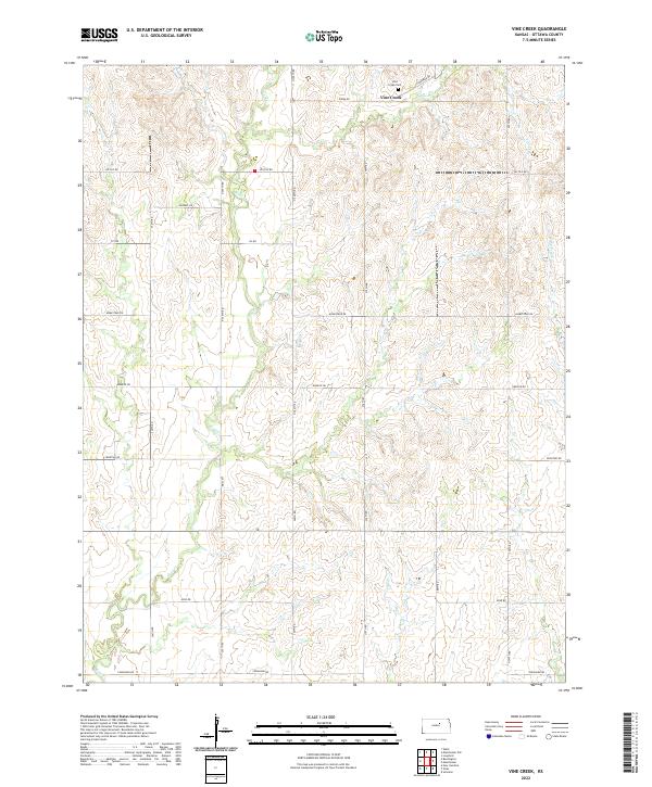
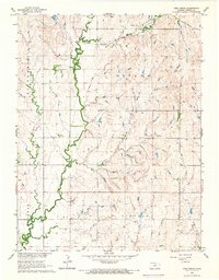 1965 Vine Creek1966 Print · USGSOttawa County, Kansas, is captured in the mid-1960s as a landscape of rural farmsteads and township grids. Genealogists can trace family roots near Vine Creek (Vilas), the Vine Creek Cem, and the path of the Atchison Topeka and Santa Fe rail line.
 - 1985 Map of Clay Center
 1985 Clay Center1985 Print · USGSThe river valleys of North Central Kansas appear here in the mid-eighties, showing the region's agricultural layout and the rise of Milford Lake. Researchers can trace old township connections through settlements like Delphos, Idana, and Summerville.2 unique versions available
 - 2009 Map of Vine Creek, 2009 Print
 2009 Vine Creek2009 Print · USGSCovers Vine Creek, including Ottawa County, United States, and other nearby areas
 - 2012 Map of Vine Creek, 2012 Print
 2012 Vine Creek2012 Print · USGSCovers Vine Creek, including Ottawa County, United States, and other nearby areas
 - 2015 Map of Vine Creek, 2015 Print
 2015 Vine Creek2015 Print · USGSCovers Vine Creek, including Ottawa County, United States, and other nearby areas
 - 2018 Map of Vine Creek, 2018 Print
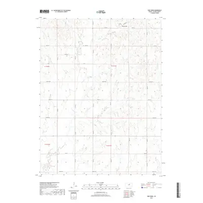 2018 Vine Creek2018 Print · USGSCovers Vine Creek, including Ottawa County, United States, and other nearby areas
 - 2022 Map of Vine Creek, 2022 Print
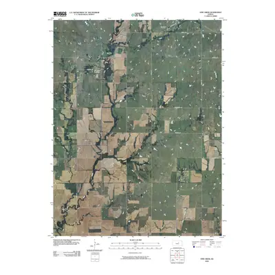
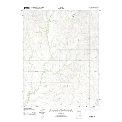
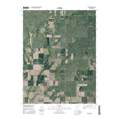
 2022 Vine Creek2022 Print · USGSOttawa County, Kansas, is shown here in its modern rural character, defined by a rigid grid of section-line roads and winding prairie streams. Researchers can locate the Vine Creek Cem and follow the paths of Coal Cr and Vine Cr across the landscape.
End of results
Showing maps 1-11 of 11
Top cities near Vine Creek
- Salina historical maps
- Abilene historical maps
- Bennington historical maps
- Miltonvale historical maps
- Manchester historical maps
- Longford historical maps
See more
Frequently asked questions
- What are the different types of historical maps available for Vine Creek?
- What is the oldest map of Vine Creek?
- Where can I purchase historical maps of Vine Creek for my home or office?
- Where can I download high-res historical maps of Vine Creek?
- Are there historical topographic maps available for Vine Creek?
- Is there historical aerial imagery available for Vine Creek?
- Where are historical maps of Vine Creek sourced from?