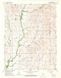
1965 Map of Vine Creek
USGS Topo · Published 1966About this map
Vine Creek (Vilas) sits along the northern reaches of this central Kansas landscape, where the Atchison Topeka and Santa Fe railroad cuts a diagonal line across the prairie. The settlement pattern here is defined by township boundaries such as Richland, Ottawa, Buckeye, and Lincoln, reflecting the grid-based organization of the Great Plains. Waterways like Coal Creek and Cole Creek meander through the terrain, creating the primary topographic breaks in an otherwise steady elevation.
Find a feature on this map
12 named features on this map. Tap any name to fly to it.
Don’t see what you’re looking for? This feature index may not catch every label — zoom into the map to look around manually.
Map Details
Editions of this 1965 Vine Creek Map
This is the sole edition of this map. No revisions or reprints were ever made.
Other maps of this area

1889 · Abilene
USGS Topo · 1:125,000

1891 · Clay Center
USGS Topo · 1:125,000

1892 · Salina
USGS Topo · 1:125,000

1892 · Minneapolis
USGS Topo · 1:125,000

1894 · Abilene
USGS Topo · 1:125,000

1942 · Salina
USGS Topo · 1:125,000

1955 · Niles
USGS Topo · 1:24,000

1955 · New Cambria
USGS Topo · 1:24,000

1955 · Manhattan
USGS Topo · 1:250,000

1955 · Hutchinson
USGS Topo · 1:250,000