
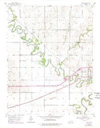
1955 Map of Niles
USGS Topo · Published 1956About this map
The meandering Solomon River dominates this mid-century landscape as it winds through Buckeye and Lincoln townships toward its confluence. This survey captures a rural environment defined by river-bottom agriculture and the vital Union Pacific rail corridor. Significant for local historians, the map shows the transition of education and community life through the Solomon Valley Sch and the Red Brick Sch (Abandoned). The settlement of Niles sits at a strategic bend in the river, while further east, the larger town of Solomon straddles the county lines. Complex water management is evident in the extensive Levee systems protecting the lowlands near the junction with the Smoky Hill River. Smaller landmarks like the Greenville Cem and the Mt Calvary Cem provide specific points of interest for genealogists tracing family ties to this fertile central Kansas region.
Find a feature on this map
20 named features on this map. Tap any name to fly to it.
Don’t see what you’re looking for? This feature index may not catch every label — zoom into the map to look around manually.
Map Details
Editions of this 1955 Niles Map
2 editions found
Other maps of this area

1889 · Abilene
USGS Topo · 1:125,000

1891 · Clay Center
USGS Topo · 1:125,000

1892 · Salina
USGS Topo · 1:125,000

1892 · Minneapolis
USGS Topo · 1:125,000

1894 · Abilene
USGS Topo · 1:125,000

1942 · Salina
USGS Topo · 1:125,000

1955 · Salina
USGS Topo · 1:24,000

1955 · New Cambria
USGS Topo · 1:24,000

1955 · Kipp
USGS Topo · 1:24,000

1955 · Manhattan
USGS Topo · 1:250,000