1960s Maps of Rawlins County, Kansas
Explore 8 historic maps of Rawlins County from the 1960s. These maps offer a rare glimpse into what life looked like during the 1960s — showing old roads, neighborhoods, homes, and landmarks that have changed or disappeared over time.
Whether you're researching your family's past, planning a metal detecting trip, or studying how Rawlins County's landscape evolved across the 1960s, these high-resolution maps are a powerful tool for exploring the history of this region.
- Focus on a specific era: All maps on this page are from the 1960s, giving you a focused view of this time period.
- See what’s changed: Compare century-old streets, trails, and buildings to today's modern landscape using overlays and satellite layers.
- Research with precision: Use these maps for genealogy, historical research, land use analysis, or educational projects.
- View, download, or print: Maps are fully viewable online in high resolution, and can be downloaded or printed for your own records.
Start exploring Rawlins County's history through authentic maps from the 1960s. This is your window into the past.
Rawlins County, KS maps
(8)- 1962 Map of Trenton SW, 1964 Print
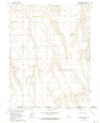 1962 Trenton SW1964 Print · USGSThe Nebraska-Kansas borderlands come into focus in the early sixties as new water management reshapes the plains. Genealogists can locate McCabe Cem and trace the rural townships of Freedom, Stratton, and Burntwood along the creek.
 - 1962 Map of Max SE, 1964 Print
 1962 Max SE1964 Print · USGSThe Nebraska-Kansas borderlands in the early sixties reveal a landscape of deep creek valleys and river-bottom rail lines. Genealogists and historians can trace local landmarks like West Union Cem and the Chicago Burlington and Quincy tracks.
 - 1962 Map of Culbertson SW, 1964 Print
 1962 Culbertson SW1964 Print · USGSThe Nebraska-Kansas borderlands in the early sixties reveal a landscape of deep canyons and rural schoolhouses. Researchers can trace the roots of the Cornell community at Cornell Ch and Cornell Cem, or locate landmarks like Hoagland and Fairplains Sch.
 - 1962 Map of Trenton SE, 1964 Print
 1962 Trenton SE1964 Print · USGSThe Nebraska-Kansas borderlands in the early sixties reveal a landscape of deep canyons and rural schoolhouses north of Rawlins County. Researchers can trace the Nebraska Kansas Base Line and locate historic community sites like School No 42 and Ford Sch.2 unique versions available
 - 1962 Map of Max, 1964 Print
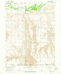
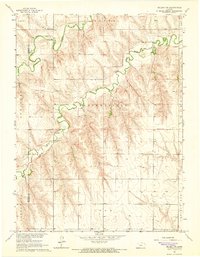
 1962 Max1964 Print · USGSThe Republican River valley in the early 1960s was a landscape defined by its deep canyons and the vital Chicago Burlington and railroad. You can trace family history at Max and the Max Cem, or locate remote landmarks like Bunning and Vogley Canyon.
 - 1965 Map of Oberlin SW, 1966 Print
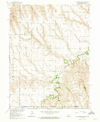
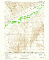
 1965 Oberlin SW1966 Print · USGSDecatur and Rawlins counties in the mid-sixties are shown here as a landscape of winding draws and high plains townships. Trace the paths of North Fork Sappa Creek, locate St Johns Cem, and find industrial markers like the Radio Tower (KOMC-TV) and local Oil Wells.
 - 1965 Map of Achilles, 1966 Print
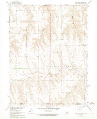
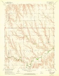
 1965 Achilles1966 Print · USGSRawlins County in the mid-sixties shows a rural landscape shaped by the branching forks of Sappa Creek. Genealogists and local historians can trace the small community of Achilles, find the Achilles Cem, and locate early industrial sites like a Gravel Pit or Oil Well.
 - 1965 Map of Selden NW, 1966 Print
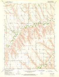
 1965 Selden NW1966 Print · USGSDecatur County's rural landscape is captured here in the mid-1960s, showing the convergence of the forks of Sappa Creek. Local researchers can locate the Bassettville Cem, the site of Plainview Sch, and several small riverside industrial sites like a Gravel Pit.
End of results
Showing maps 1-8 of 8
Top cities of Rawlins County
- Atwood historical maps
- McDonald historical maps
- Herndon historical maps
- Ludell historical maps
- Achilles historical maps
Frequently asked questions
- What are the different types of historical maps available for Rawlins County?
- What is the oldest map of Rawlins County?
- Where can I purchase historical maps of Rawlins County for my home or office?
- Where can I download high-res historical maps of Rawlins County?
- Are there historical topographic maps available for Rawlins County?
- Is there historical aerial imagery available for Rawlins County?
- Where are historical maps of Rawlins County sourced from?