Old Maps of Rawlins County, Kansas for Metal Detecting
Plan your next treasure hunt with 222 historic maps of Rawlins County. Find old homesites, ghost towns, trails, and gathering spots that may be lost to time — perfect for identifying promising metal detecting locations.
- Locate forgotten sites: Uncover places like long-lost settlements, abandoned rail lines, or gathering spots.
- Plan better hunts: Use map overlays combined with LiDAR or satellite views to narrow in on historically rich areas.
- Made for detectorists: Thousands of hobbyists use these maps to discover relics, coins, and hidden history.
Use these historic maps to boost your research and find new opportunities beneath the surface of Rawlins County.
Rawlins County, KS maps
(222)- 1950 Map of Mc Donald, 1966 Print
 1950 Mc Donald1966 Print · USGSThe rural landscape of Rawlins County, Kansas, is captured here at mid-century as a network of prairie schoolhouses and railroad-side townships. Genealogists can locate family-named landmarks and institutions like Grand Prairie School, Grace Cem, and the Lone Tree School.
 - 1951 Map of Mc Donald
 1951 Mc Donald1951 Print · USGSRawlins and Cheyenne counties appear here in the early fifties, centering on the rail town of McDonald. Researchers can trace old rural school districts like Prairie Dog Sch and North School No 38 or locate the Grace Cem.
 - 1951 Map of Selden, 1952 Print
 1951 Selden1952 Print · USGSNorthwestern Kansas farmland is depicted here in the early fifties, centered on the railroad hub of Selden. Genealogists can trace a remarkable number of rural landmarks, from Shibboleth Ch to schools like Welsh Sch and North Valley Sch.2 unique versions available
 - 1951 Map of Herndon, 1952 Print
 1951 Herndon1952 Print · USGSThe high plains of Rawlins County are mapped here in the early fifties, centering on the communities of Herndon and Ludell. Researchers can trace rural landmarks like Beaver Creek, Union Cem, and numerous country schools including Linda Sch and School No 208.
 - 1951 Map of Achilles, 1952 Print
 1951 Achilles1952 Print · USGSThe rural community of Achilles and the surrounding high plains of Rawlins County come into focus in the early 1950s. Genealogists and local historians can trace family roots through numerous country landmarks including St Patrick Ch, Achilles Cem, and Tully Sch.2 unique versions available
 - 1951 Map of Atwood, 1952 Print
 1951 Atwood1952 Print · USGSAtwood and the surrounding Rawlins County prairies are captured in the early fifties, showcasing a landscape of rail-connected agricultural settlements. Researchers can locate numerous rural schoolhouses and cemeteries, such as Red Top Sch and Blakeman Cem, along the Chicago rail line.2 unique versions available
 - 1951 Map of Oberlin, 1952 Print
 1951 Oberlin1952 Print · USGSDecatur County is captured here in the early fifties, centered on the rail hub of Oberlin and the winding Sappa Creek. Genealogists and local historians can trace rural landmarks like St Johns Cemetery, School No 11, and the settlement of Traer.2 unique versions available
 - 1951 Map of Chardon, 1952 Print
 1951 Chardon1952 Print · USGSNorthwest Kansas at the mid-century remains a landscape of isolated farmsteads and rural schoolhouses along the Sappa Creek drainages. Researchers can trace the social geography of the plains through landmarks like Chardon Cem, Harmony Sch, and Wesley Chapel.
 - 1951 Map of Dewey Ranch, 1952 Print
 1951 Dewey Ranch1952 Print · USGSNorthwest Kansas ranching country and the Missouri River Basin development are captured here in the early fifties. Genealogists can trace rural school districts and community centers like Prairie Gem Ch, Dewey Ranch, and Pleasant Valley Sch.
 - 1954 Map of McCook, 1966 Print
 1954 McCook1966 Print · USGSSouthwest Nebraska in the mid-fifties reveals a landscape shaped by major water projects and the Chicago Burlington and Quincy RR. Trace ancestral roots and defunct rail stops in McCook, Wauneta, and along the shores of Swanson Lake.2 unique versions available
 - 1954 Map of Goodland, 1976 Print
 1954 Goodland1976 Print · USGSNorthwest Kansas comes into focus during the mid-1950s, showing a landscape defined by its vital river forks and thriving rail towns. Researchers can trace the path of the Union Pacific through Colby or locate historic parks like Sheridan Co State Park.
 - 1956 Map of Goodland
 1956 Goodland1956 Print · USGSThe high plains of Northwest Kansas in the mid-fifties reveal a landscape of river-fed agriculture and expanding rail networks. Genealogists and historians can trace the development of county seats like Goodland and Atwood or locate landmarks such as the Arikaree Breaks.
 - 1957 Map of McCook
 1957 McCook1957 Print · USGSSouthwestern Nebraska in the mid-fifties is captured here during a period of significant water development and rail-based commerce. Researchers can trace the path of the Chicago Burlington and Quincy through Indianola and Bartley, or locate rural settlements like Chase Village and Ough near the Sand Hills.
 - 1957 Map of Goodland
 1957 Goodland1957 Print · USGSNorthwest Kansas in the mid-1950s shows a landscape of high plains agriculture and vital rail junctions. Researchers can trace the river-valley settlements from Goodland to Oberlin and follow the paths of the Union Pacific and Sappa Creek.2 unique versions available
 - 1957 Map of McCook SW, 1958 Print
 1957 McCook SW1958 Print · USGSThe Nebraska-Kansas borderlands are captured here in the mid-fifties, showing the rural landscape of Red Willow and Decatur counties. Researchers can locate the precisely plotted Banksville Sch, the well-named Devils Gap Sch, and the winding course of Driftwood Cr.2 unique versions available
 - 1958 Map of McCook
 1958 McCook1958 Print · USGSSouthwest Nebraska during the late fifties reveals a landscape of massive new reservoirs and established rail hubs like McCook. Genealogists can trace family footprints through rural centers like St Johns Church and the many grain elevators along the Union Pacific RR.2 unique versions available
 - 1962 Map of Trenton SW, 1964 Print
 1962 Trenton SW1964 Print · USGSThe Nebraska-Kansas borderlands come into focus in the early sixties as new water management reshapes the plains. Genealogists can locate McCabe Cem and trace the rural townships of Freedom, Stratton, and Burntwood along the creek.
 - 1962 Map of Max SE, 1964 Print
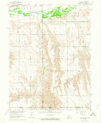 1962 Max SE1964 Print · USGSThe Nebraska-Kansas borderlands in the early sixties reveal a landscape of deep creek valleys and river-bottom rail lines. Genealogists and historians can trace local landmarks like West Union Cem and the Chicago Burlington and Quincy tracks.
 - 1962 Map of Culbertson SW, 1964 Print
 1962 Culbertson SW1964 Print · USGSThe Nebraska-Kansas borderlands in the early sixties reveal a landscape of deep canyons and rural schoolhouses. Researchers can trace the roots of the Cornell community at Cornell Ch and Cornell Cem, or locate landmarks like Hoagland and Fairplains Sch.
 - 1962 Map of Trenton SE, 1964 Print
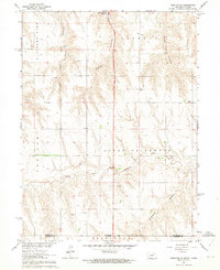 1962 Trenton SE1964 Print · USGSThe Nebraska-Kansas borderlands in the early sixties reveal a landscape of deep canyons and rural schoolhouses north of Rawlins County. Researchers can trace the Nebraska Kansas Base Line and locate historic community sites like School No 42 and Ford Sch.2 unique versions available
 - 1962 Map of Max, 1964 Print
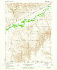 1962 Max1964 Print · USGSThe Republican River valley in the early 1960s was a landscape defined by its deep canyons and the vital Chicago Burlington and railroad. You can trace family history at Max and the Max Cem, or locate remote landmarks like Bunning and Vogley Canyon.
 - 1965 Map of Oberlin SW, 1966 Print
 1965 Oberlin SW1966 Print · USGSDecatur and Rawlins counties in the mid-sixties are shown here as a landscape of winding draws and high plains townships. Trace the paths of North Fork Sappa Creek, locate St Johns Cem, and find industrial markers like the Radio Tower (KOMC-TV) and local Oil Wells.
 - 1965 Map of Achilles, 1966 Print
 1965 Achilles1966 Print · USGSRawlins County in the mid-sixties shows a rural landscape shaped by the branching forks of Sappa Creek. Genealogists and local historians can trace the small community of Achilles, find the Achilles Cem, and locate early industrial sites like a Gravel Pit or Oil Well.
 - 1965 Map of Selden NW, 1966 Print
 1965 Selden NW1966 Print · USGSDecatur County's rural landscape is captured here in the mid-1960s, showing the convergence of the forks of Sappa Creek. Local researchers can locate the Bassettville Cem, the site of Plainview Sch, and several small riverside industrial sites like a Gravel Pit.
 - 1970 Map of Culbertson SE, 1972 Print
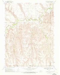 1970 Culbertson SE1972 Print · USGSThe Nebraska-Kansas borderlands in the early seventies reveal a landscape of deep canyons and meandering creeks. Genealogists and land researchers can trace the reaches of Driftwood Creek, locate the Grove Cem, and map the rugged Tipton Canyon.
Showing maps 1-25 of 222
Top cities of Rawlins County
- Atwood historical maps
- McDonald historical maps
- Herndon historical maps
- Ludell historical maps
- Achilles historical maps
Frequently asked questions
- What are the different types of historical maps available for Rawlins County?
- What is the oldest map of Rawlins County?
- Where can I purchase historical maps of Rawlins County for my home or office?
- Where can I download high-res historical maps of Rawlins County?
- Are there historical topographic maps available for Rawlins County?
- Is there historical aerial imagery available for Rawlins County?
- Where are historical maps of Rawlins County sourced from?