1960s Maps of Sedgwick County, Kansas
Explore 16 historic maps of Sedgwick County from the 1960s. These maps offer a rare glimpse into what life looked like during the 1960s — showing old roads, neighborhoods, homes, and landmarks that have changed or disappeared over time.
Whether you're researching your family's past, planning a metal detecting trip, or studying how Sedgwick County's landscape evolved across the 1960s, these high-resolution maps are a powerful tool for exploring the history of this region.
- Focus on a specific era: All maps on this page are from the 1960s, giving you a focused view of this time period.
- See what’s changed: Compare century-old streets, trails, and buildings to today's modern landscape using overlays and satellite layers.
- Research with precision: Use these maps for genealogy, historical research, land use analysis, or educational projects.
- View, download, or print: Maps are fully viewable online in high resolution, and can be downloaded or printed for your own records.
Start exploring Sedgwick County's history through authentic maps from the 1960s. This is your window into the past.
Sedgwick County, KS maps
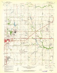
(16)- 1960 Map of Rose Hill, 1961 Print
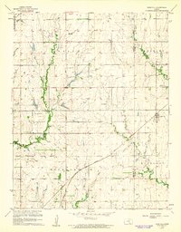 1960 Rose Hill1961 Print · USGSThe Kansas prairie south of Wichita comes alive in this mid-century survey as the region's agricultural and aviation sectors expanded. Researchers can trace the heritage of Rose Hill and its surrounding townships through local landmarks like Branson Cem, Hamilton Airport, and the Atchison Topeka and Santa Fe railroad line.2 unique versions available
 - 1960 Map of Greenwich, 1961 Print
 1960 Greenwich1961 Print · USGSIn the early sixties, the prairie surrounding Greenwich was a landscape of rail junctions, oil production, and deep-rooted farming communities. Genealogists can trace family connections at Greenwich Cem, Palmyra Ch, and along the historic Old Indian Boundary.3 unique versions available
 - 1960 Map of Derby, 1961 Print
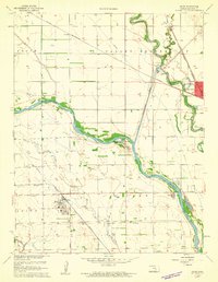
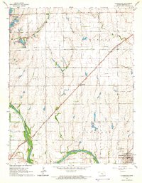
 1960 Derby1961 Print · USGSThe Arkansas River valley south of Wichita appears here in the early sixties as suburban growth begins to overtake rural townships. Researchers can trace family roots through several local landmarks like Waco Cem, St Marys Sch, and the riverside community of Derby.4 unique versions available
 - 1960 Map of Valley Center, 1961 Print
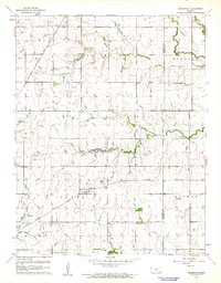
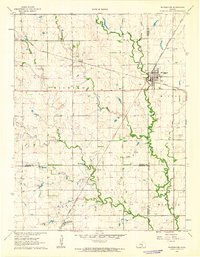
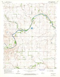
 1960 Valley Center1961 Print · USGSSedgwick County experiences significant mid-century growth and industrial development as oil fields and new suburbs expand across the prairie. Researchers can trace family roots through Marble Grove Cem or locate former landmarks like the Drive-in Theater and Hillside Grove Sch.4 unique versions available
 - 1961 Map of Wichita West
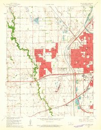 1961 Wichita West1961 Print · USGSWichita's western suburbs and industrial fringes take shape in the early sixties as new residential developments meet the prairie. Researchers can find numerous mid-century landmarks like the Wichita Municipal Airport, Sacred Heart College, and Westlink Village.5 unique versions available
 - 1961 Map of Maize
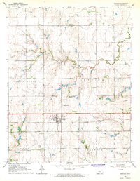
 1961 Maize1961 Print · USGSThe Sedgwick County plains are shown in the early sixties as a vital crossroads of rail lines and river floodways. Genealogists and local historians can trace the Old Indian Boundary and locate landmarks like Maize Cem and West Elementary Sch.4 unique versions available
 - 1961 Map of Bayneville
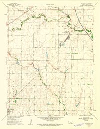 1961 Bayneville1961 Print · USGSThe Sedgwick County prairie in the early sixties shows a landscape of small agricultural towns and emerging energy infrastructure. Researchers can locate Greenwood Cem, trace the rail lines of the Missouri Pacific, and find the local Townhall and Oatville Sch.3 unique versions available
 - 1961 Map of Wichita East
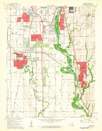
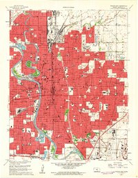 1961 Wichita East1961 Print · USGSWichita is seen here in a period of significant post-war expansion, with the city's residential grid pushing toward the suburban enclave of Eastborough. Genealogists and historians can trace numerous neighborhood landmarks, from the Masonic Home and VA Hospital to family names at White Chapel Cemetery.5 unique versions available
 - 1961 Map of Andover
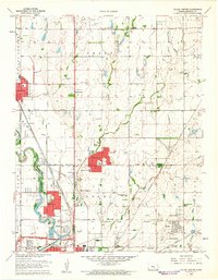
 1961 Andover1961 Print · USGSEast of Wichita in the early 1960s, the landscape is a mix of rapid suburban growth and significant aviation infrastructure. Researchers can trace mid-century developments like Beech Landing Field, Mc Connell Air Force Base, and local landmarks like Seltzer Church.4 unique versions available
 - 1962 Map of Whitewater, 1963 Print
 1962 Whitewater1963 Print · USGSButler and Harvey Counties thrive as a rail and agricultural crossroads in the early sixties, centered on the junction at Whitewater. Researchers can trace old property lines, local cemeteries like Swiss Cem, and the path of the Missouri Pacific railroad.2 unique versions available
 - 1964 Map of Cheney, 1966 Print
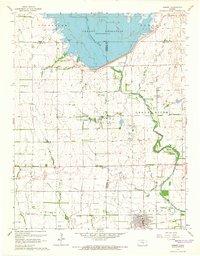 1964 Cheney1966 Print · USGSCheney and the surrounding Kansas plains appear here just as the landscape was being reshaped by the waters of the Cheney Reservoir. Researchers can trace the legacy of the Atchison Topeka and Santa Fe railroad or locate family roots at the Mt Vernon Cem and Cheney Cem.2 unique versions available
 - 1965 Map of Garden Plain, 1966 Print
 1965 Garden Plain1966 Print · USGSGarden Plain and the surrounding Sedgwick County countryside are captured here in the mid-1960s, showing a landscape defined by rail and river. Family historians can locate St Anthony Cem, St Pauls Ch, and the small settlements of St Joe and St Marys.2 unique versions available
 - 1965 Map of Cheney SE, 1966 Print
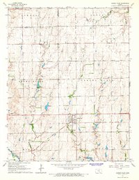
 1965 Cheney SE1966 Print · USGSThe rural prairie of Kingman County is captured here in the mid-1960s as the river economy and oil industry shaped local life. Genealogists can locate family ties at Vinita Cem or Mt Pleasant Cem, and trace the rail line through Lansdowne.
 - 1965 Map of Clearwater, 1966 Print
 1965 Clearwater1966 Print · USGSSouth of Wichita during the mid-sixties, this area shows a productive landscape of oil fields and river valley farms. You can trace the Atchison Topeka and Santa Fe rail line through Clonmel or locate family sites near St Johns Cem and Ruby Cem.2 unique versions available
 - 1965 Map of Goddard, 1966 Print
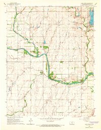
 1965 Goddard1966 Print · USGSGoddard and the surrounding Sedgwick County townships are shown here in the mid-sixties, dominated by agricultural tracts and the Atchison Topeka and Santa Fe rail line. Genealogists can locate family sites like Afton Cem and St Marks.2 unique versions available
 - 1965 Map of Lake Afton, 1966 Print
 1965 Lake Afton1966 Print · USGSWestern Sedgwick County in the mid-sixties reveals a landscape defined by the winding Ninnescah River and the emerging recreational hub at Lake Afton. Genealogists and local historians can trace the Peotone Cem and old institutional sites like the Lake Afton Boys Ranch and Camp Hyde.2 unique versions available
End of results
Showing maps 1-16 of 16
Top cities of Sedgwick County
- Wichita historical maps
- Derby historical maps
- Haysville historical maps
- Park City historical maps
- Bel Aire historical maps
- Valley Center historical maps
See more
Frequently asked questions
- What are the different types of historical maps available for Sedgwick County?
- What is the oldest map of Sedgwick County?
- Where can I purchase historical maps of Sedgwick County for my home or office?
- Where can I download high-res historical maps of Sedgwick County?
- Are there historical topographic maps available for Sedgwick County?
- Is there historical aerial imagery available for Sedgwick County?
- Where are historical maps of Sedgwick County sourced from?