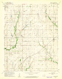
1960 Map of Rose Hill
USGS Topo · Published 1961About this map
Rose Hill and its surrounding agricultural landscape are defined here by a network of rural roads and the Atchison Topeka and Santa Fe railroad line cutting diagonally across the prairie. The convergence of Sedgwick and Butler Counties is clearly marked, showing how the boundaries influenced land division and settlement patterns between Gypsum, Pleasant, Rockford, and Richland townships. Local aviation is particularly prominent on this sheet, which features both Cook Airport and Hamilton Airport, as well as a corner of the Mc Connell Air Force Base. Genealogists will find significant value in the documentation of family-named landmarks like Branson Cem and Eastridge Cem, alongside the community hub at Rose Hill Ch. These features, nestled among the drainages of Spring Creek and Polecat Creek, reflect the steady development of south-central Kansas at the dawn of the 1960s.
Find a feature on this map
21 named features on this map. Tap any name to fly to it.
Don’t see what you’re looking for? This feature index may not catch every label — zoom into the map to look around manually.
Map Details
Editions of this 1960 Rose Hill Map
2 editions found
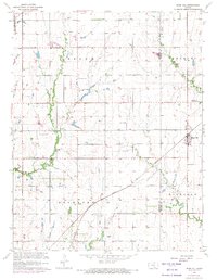
Other maps of this area

1889 · Wichita
USGS Topo · 1:125,000

1890 · Wellington
USGS Topo · 1:125,000

1894 · Wichita
USGS Topo · 1:125,000

1943 · Wichita East
USGS Topo · 1:31,680

1943 · Derby
USGS Topo · 1:31,680

1945 · Andover
USGS Topo · 1:31,680

1955 · Udall
USGS Topo · 1:24,000

1955 · Belle Plaine
USGS Topo · 1:24,000

1955 · Santa Fe Lake
USGS Topo · 1:24,000

1955 · Rose Hill
USGS Topo · 1:24,000