
1943 Map of Derby
USGS Topo · Published 1943About this map
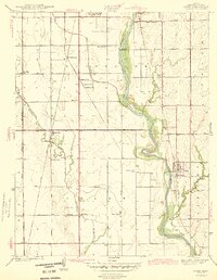
The Arkansas River meanders south through the center of this early 1940s landscape, providing a natural corridor for the major rail lines and nascent settlements of Sedgwick County. At this time, Derby and Haysville appear as small agricultural hubs, while the map preserves the distinct locations of both Old Waco and New Waco further south. The region is characterized by a dense network of local education and social centers, including Haysville Sch, Pleasant Valley Sch, and Waco Sch, which served the surrounding farming community before post-war suburbanization transformed the area. Transportation infrastructure is prominent, with the Midland Valley, Chicago Rock Island and Pacific, and Atchison Topeka and Santa Fe railroads crisscrossing the terrain. For genealogists, the inclusion of Waco Cem and Roll Cem provides precise locations for family research in this pre-expansion era.
Find a feature on this map
30 named features on this map. Tap any name to fly to it.
Don’t see what you’re looking for? This feature index may not catch every label — zoom into the map to look around manually.
Map Details
Editions of this 1943 Derby Map
2 editions found
Other maps of this area

1889 · Wichita
USGS Topo · 1:125,000

1890 · Wellington
USGS Topo · 1:125,000

1894 · Wichita
USGS Topo · 1:125,000

1943 · Wichita West
USGS Topo · 1:31,680

1943 · Wichita East
USGS Topo · 1:31,680

1943 · Bayneville
USGS Topo · 1:31,680

1945 · Andover
USGS Topo · 1:31,680

1950 · Bayneville
USGS Topo · 1:24,000

1955 · Belle Plaine
USGS Topo · 1:24,000
1955 · Zyba
USGS Topo · 1:24,000