1894 Map of Wichita
USGS Topo · Published 1894About this map
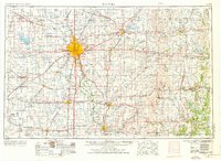
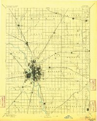
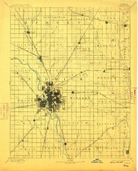
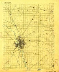
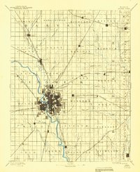
Wichita sits at the confluence of the Little Arkansas River and the Arkansas River, serving as a dense center of commerce and rail during the late nineteenth century. The town's grid expands outward from the river fork, surrounded by early settlements such as Valley Center, Maize, and Oatville. This 1894 edition, based on an 1888 survey, reveals a region defined by its rapid railway development, with lines like the St. Louis and San Francisco Railroad and the Chicago Kansas and Nebraska Railroad carving through the prairie to connect isolated stations like Furley and Green Station.
Find a feature on this map
78 named features on this map. Tap any name to fly to it.
Don’t see what you’re looking for? This feature index may not catch every label — zoom into the map to look around manually.
Map Details
Editions of this 1894 Wichita Map
5 editions found
Historical Maps of Wichita Through Time
6 maps found